MyTopo
Classic USGS Mason Louisiana 7.5'x7.5' Topo Map
Couldn't load pickup availability
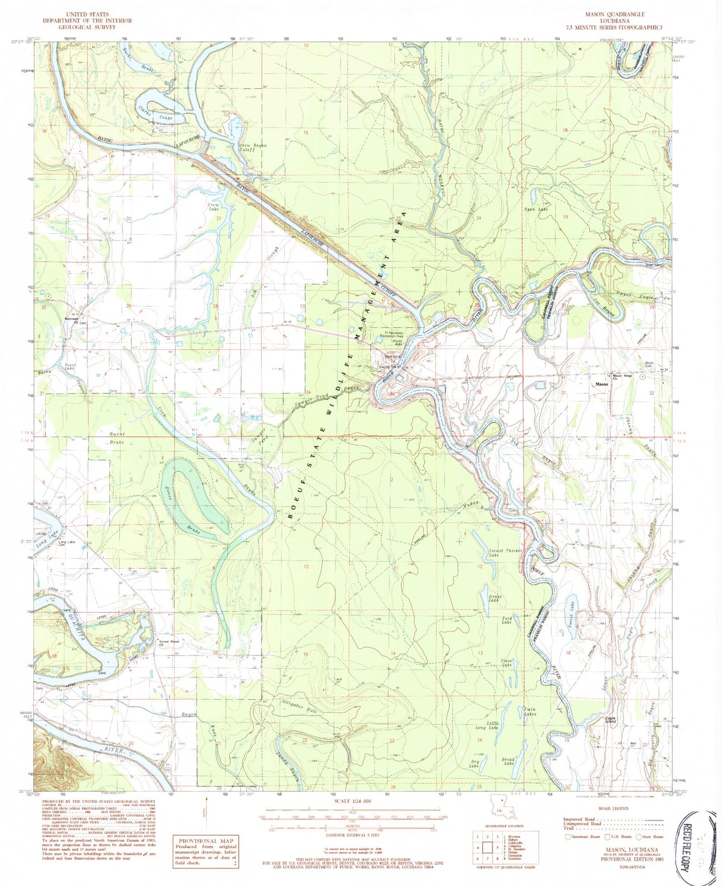
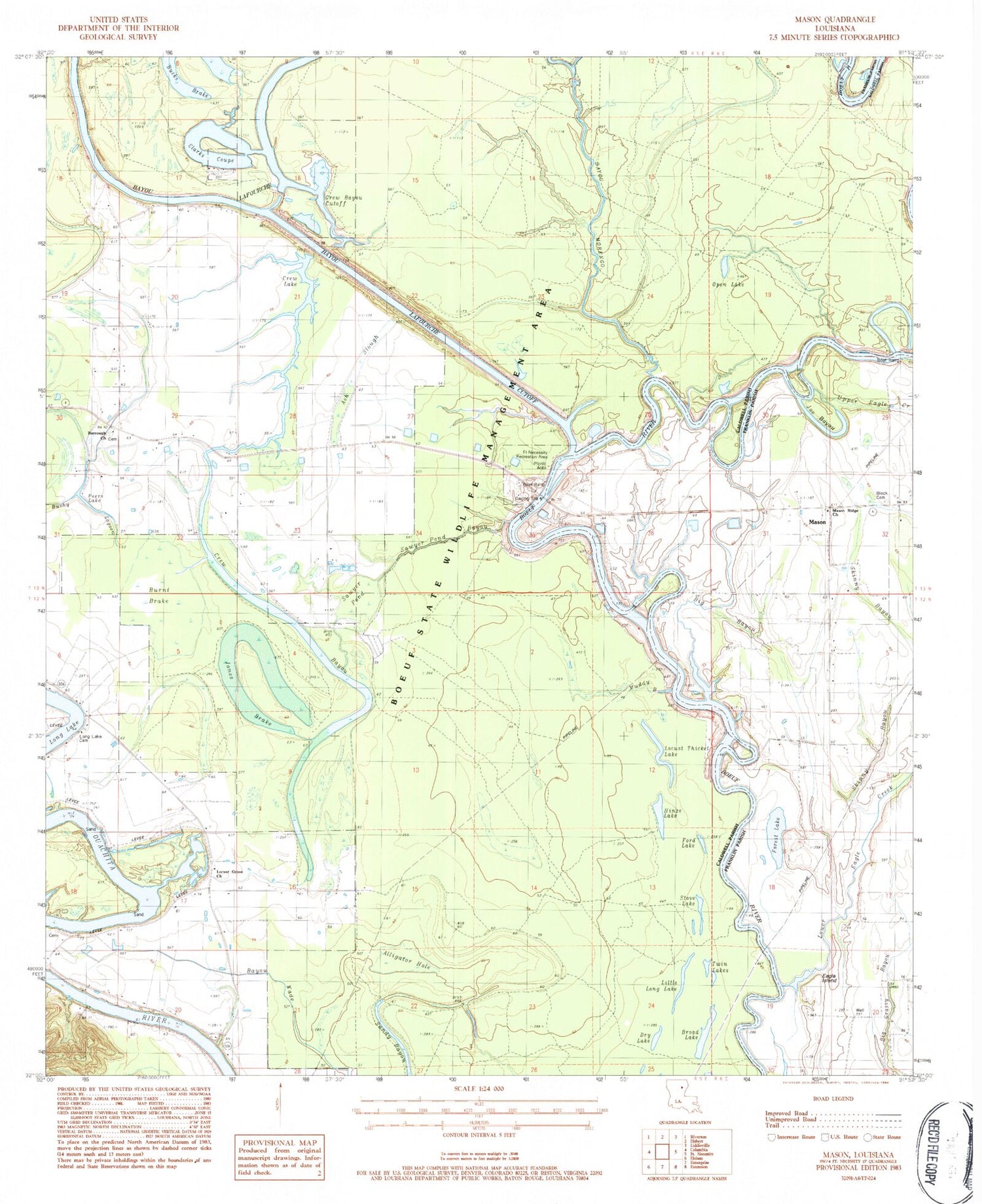
Historical USGS topographic quad map of Mason in the state of Louisiana. Map scale may vary for some years, but is generally around 1:24,000. Print size is approximately 24" x 27"
This quadrangle is in the following counties: Caldwell, Franklin.
The map contains contour lines, roads, rivers, towns, and lakes. Printed on high-quality waterproof paper with UV fade-resistant inks, and shipped rolled.
Contains the following named places: Alligator Hole, Ash Slough, Bayou Lafourche, Bayou Lafourche Cutoff, Bayou Morengo, Bayou Wade, Big Bayou, Block Cemetery, Boeuf State Wildlife Management Area, Booker T Washington School, Broad Lake, Brushy Lagoon, Burrough Church, Bushy Lagoon, Clarks Coupe, Crew Bayou, Crew Bayou Cutoff, Crew Lake, Doctor Cole Landing, Dry Lake, Eagle Island, Fig Tree Landing, Ford Lake, Forest Lake, Fort Necessity Recreation Area, Fredericksburg, Fredericksburg Landing, Grassy Bend Ford, Hinze Lake, Hudson Ferry, Joe Bayou Boeuf River, Jones Brake, Little Long Lake, Locust Grove Church, Locust Thicket Lake, Long Lake Cemetery, Long Lake Landing, Lower Eagle Creek, Marshall Landing, Mason, Mason Ridge Church, Muddy Bayou, Oak Bluff Landing, Open Lake, Ox Bow Bend, Parish Governing Authority District 2, Peers Lake, Sawyer Pond, Sawyer Pond Bayou, Skinny Bayou, Stove Lake, Twin Lakes, Upper Eagle Creek, Ward Six