MyTopo
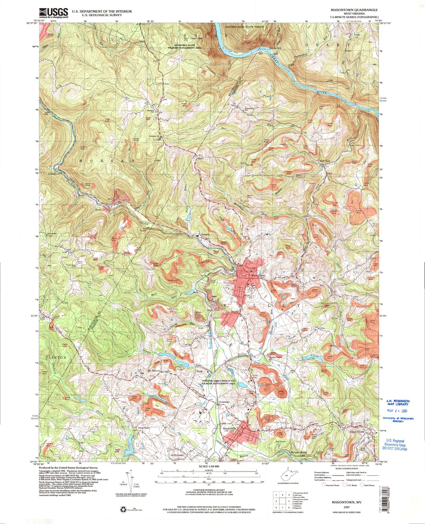
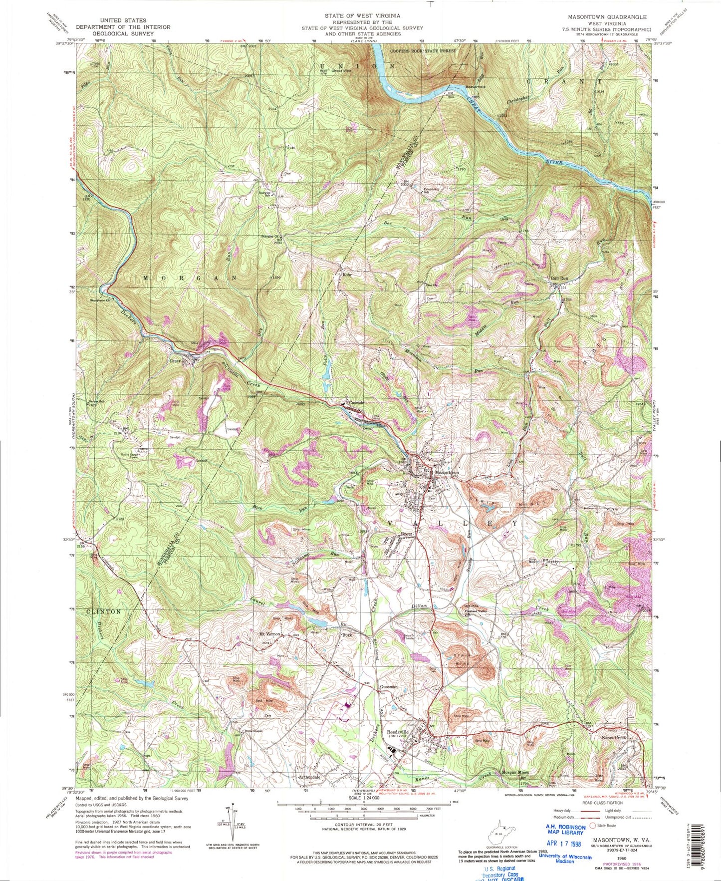
Classic USGS Masontown West Virginia 7.5'x7.5' Topo Map
Couldn't load pickup availability
Historical USGS topographic quad map of Masontown in the state of West Virginia. Typical map scale is 1:24,000, but may vary for certain years, if available. Print size: 24" x 27"
This quadrangle is in the following counties: Monongalia, Preston.
The map contains contour lines, roads, rivers, towns, and lakes. Printed on high-quality waterproof paper with UV fade-resistant inks, and shipped rolled.
Contains the following named places: Back Run, Beaverhole, Bee Run, Big Run, Bull Run, Bull Run, Cheat View, Christopher Run, Dillan Creek, Dry Run, Falls Run, Friendship School (historical), Glady Run, Kanes Creek, Laurel Run, Lick Run, Middle Run, Morgan Mines, Mountain Run, Pleasant Valley United Methodist Church, Reedsville, Sarver School (historical), Scott Run, Slabcamp Run, Sturgiss Church, Sturgiss School (historical), Sturgisson United Methodist Church (historical), Swamp Run, Zinn Chapel, Zion Church, Guseman, Bretz, Burk, Cascade, Greer, Kanes Creek, Masontown, Mount Vernon, Rohr, Bretz Post Office, Elkins Coal and Coke Company Historic District, Kanes Creek United Methodist Church, Masontown Post Office, Mount Vernon United Methodist Church, Reedsville Post Office, West Preston Middle School, Town of Masontown Water Supply Dam, Town of Masontown Water Supply D Lake, Upper Deckers Creek Structure Number One Dam, Upper Deckers Creek Structure Number Two Dam, Upper Deckers Creek Structure Number Three Dam, Upper Deckers Creek Structure Four Dam, Upper Deckers Creek Structure Number Five Dam, Upper Deckers Creek Structure Number Seven Dam, Preston County Light and Power Company Dam, Preston County Light and Power Company Lake Number Two Dam, Frank Corbin Spring, Maiden Spring, Mayfield Spring, Mayfield Spring, Ottie Mayfield Spring, Sturgisson, Valley District (historical), Upper Deckers Creek Wildlife Management Area, Zina Chapel, Snake Hill Wildlife Management Area, Town of Masontown, Town of Reedsville, Reedsville Volunteer Fire Department, Masontown Volunteer Fire Department and Rescue Company 6, Valley District Ambulance Service, Reedsville Cemetery, Lighthouse Cathedral, Pikewood National Golf Club, Reedsville Police Department, Masontown Police Department