MyTopo
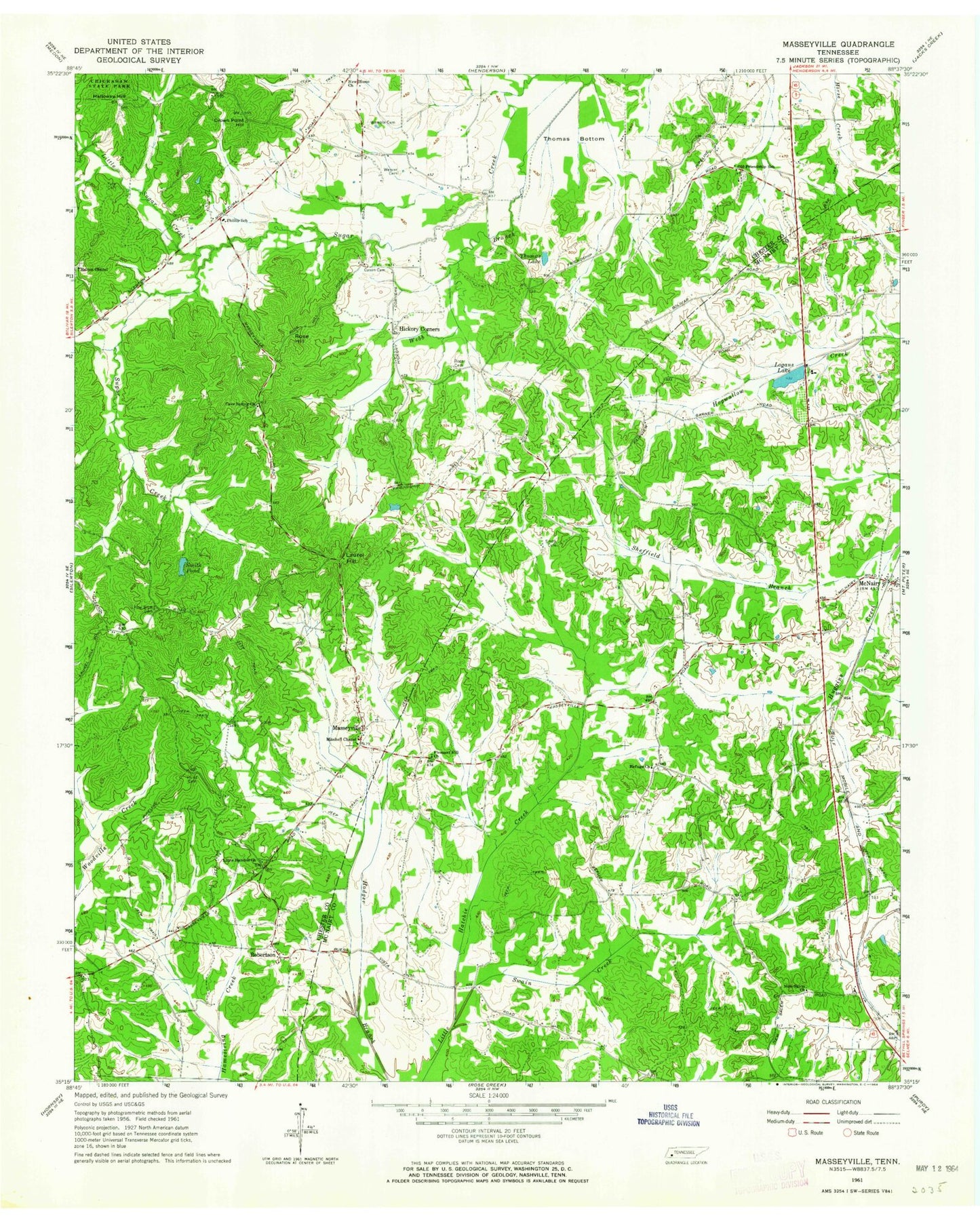
Classic USGS Masseyville Tennessee 7.5'x7.5' Topo Map
Couldn't load pickup availability
Historical USGS topographic quad map of Masseyville in the state of Tennessee. Map scale may vary for some years, but is generally around 1:24,000. Print size is approximately 24" x 27"
This quadrangle is in the following counties: Chester, McNairy.
The map contains contour lines, roads, rivers, towns, and lakes. Printed on high-quality waterproof paper with UV fade-resistant inks, and shipped rolled.
Contains the following named places: Cason Cemetery, Cave Spring Church, Cave Springs Cemetery, Chester County Fire Department / Masseyville Volunteer Fire Department Station 550, Commissioner District 3, Crown Point Hill, Fyre Cemetery, Gail, Halloway Hill, Haltoms Chapel Cemetery, Halton Chapel, Hickory Corner School, Hickory Corners, Hurst Cemetery, Ivys Store, Laurel Hill, Little Hatchie Cemetery, Little Hatchie Church, Little Sugar Creek, Logans Lake, Logans Lake Dam, Masseyville, Masseyville School, McNairy, McNairy County Fire Department Station 11 McNairy Fire Department, McNairy Post Office, Mitchell Chapel, New Home Church, New Salem Cemetery, New Salem Church, Old Friendship Baptist Church, Old Friendship Cemetery, Old Friendship School, Phillip School, Pine Bluff Cemetery, Pleasant Hill Church, Refuge Cemetery, Refuge Church, Robertson, Roger Cemetery, Rose Hill, Sheffield Branch, Smith Cemetery, Smith Pond, Swaim Creek, Thomas Bottom, Thomas Lake, Wamble Cemetery, Weaver Cemetery