MyTopo
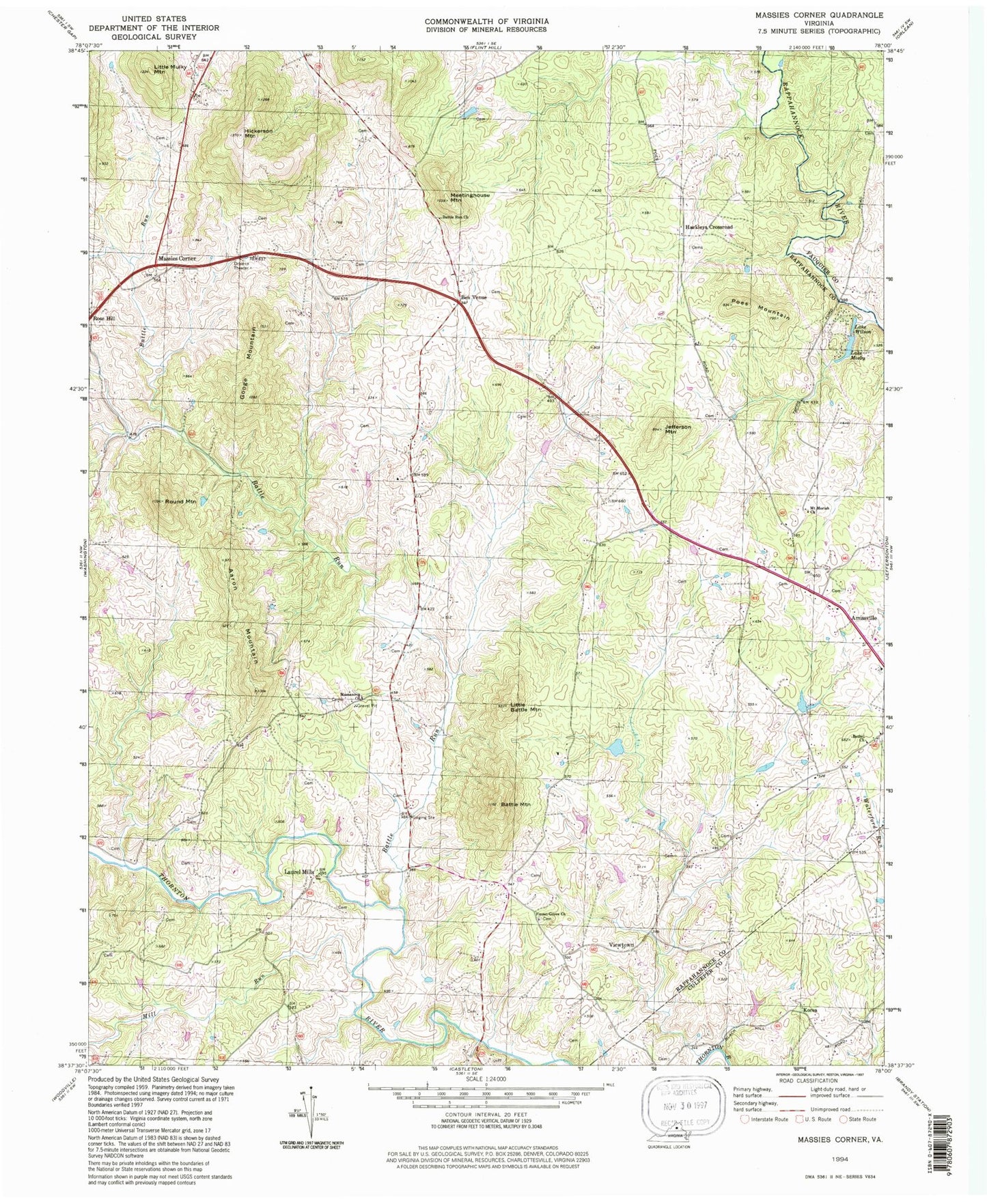
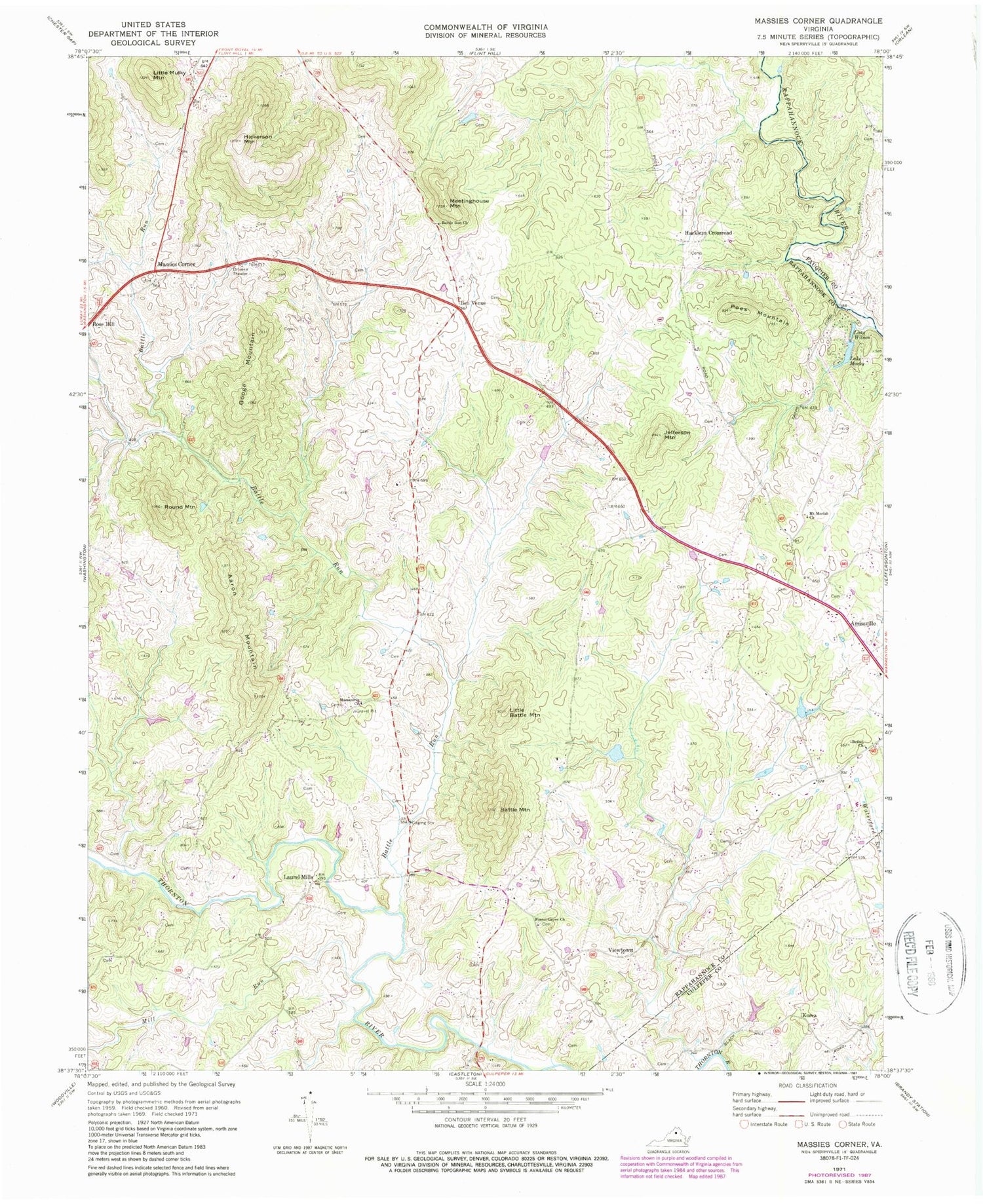
Classic USGS Massies Corner Virginia 7.5'x7.5' Topo Map
Couldn't load pickup availability
Historical USGS topographic quad map of Massies Corner in the state of Virginia. Typical map scale is 1:24,000, but may vary for certain years, if available. Print size: 24" x 27"
This quadrangle is in the following counties: Culpeper, Fauquier, Rappahannock.
The map contains contour lines, roads, rivers, towns, and lakes. Printed on high-quality waterproof paper with UV fade-resistant inks, and shipped rolled.
Contains the following named places: Aaron Mountain, Battle Mountain, Battle Run Church, Ben Venue, Bethel Church, Forest Grove Church, Googe Mountain, Hickerson Mountain, Jefferson Mountain, Little Battle Mountain, Massanova Church, Meetinghouse Mountain, Mill Run, Lake Mosby, Mount Moriah Church, Poes Mountain, Round Mountain, Lake Wilson, Little Mulky Mountain, Smiley Dam, Liverman Dam, Liverman Pond, Mosby Dam, Sweeney Dam, Sweeney Lake, Hackleys Crossroad, Korea, Laurel Mills, Massies Corner, Viewtown, Hawkins Run, Thornton River Airport (historical), Long Mountain, Amissville Church, Amissville School (historical), Battle Run, Cannons Run, Forest Grove School (historical), Massanova, Newbus Cross Roads, Tapps Ford, Jackson District, Amissville Volunteer Fire and Rescue Company, Massanova Christian Academy, Muskrat Haven Farm, Williams Orchard, Long Mountain Nursery