MyTopo
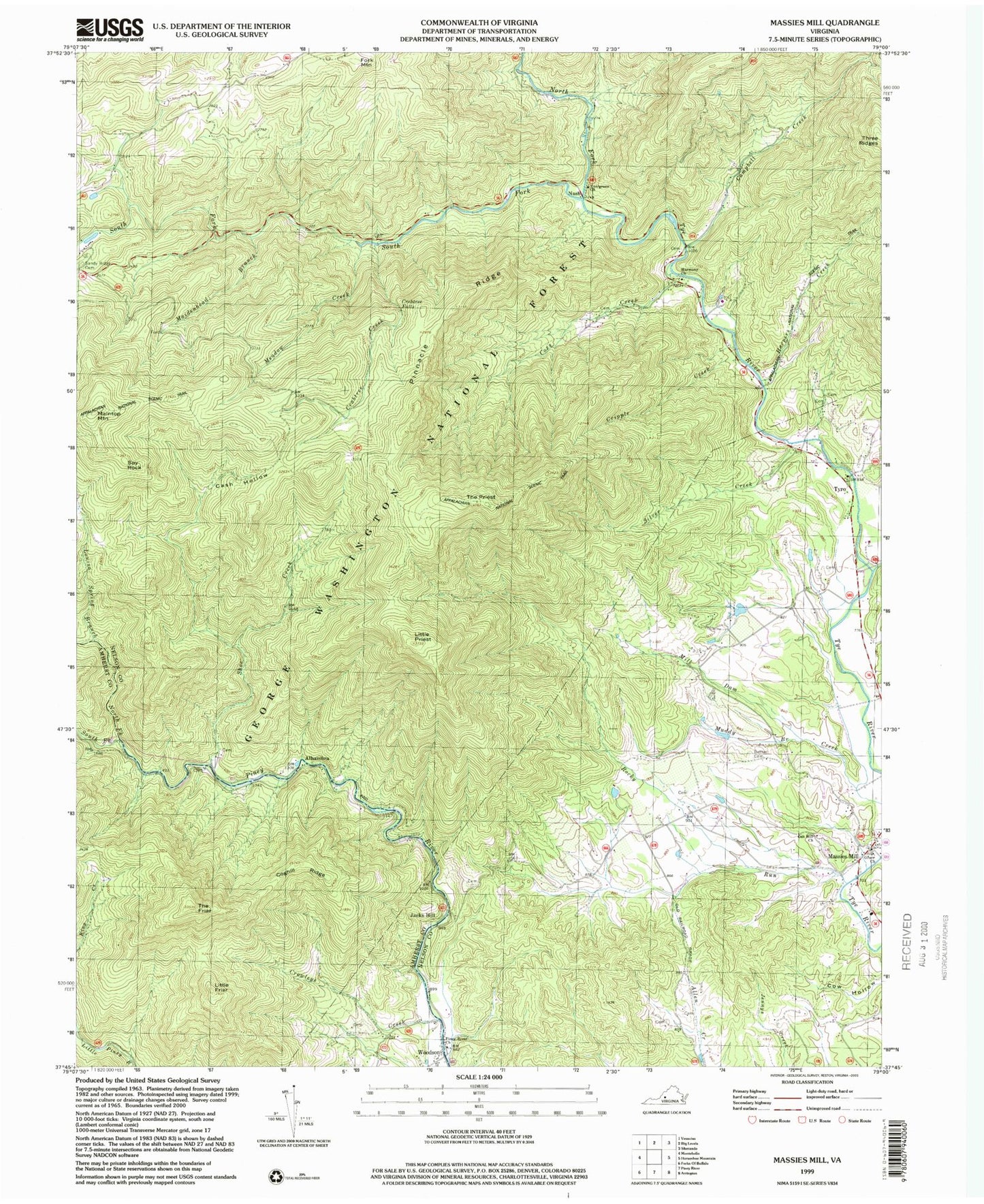
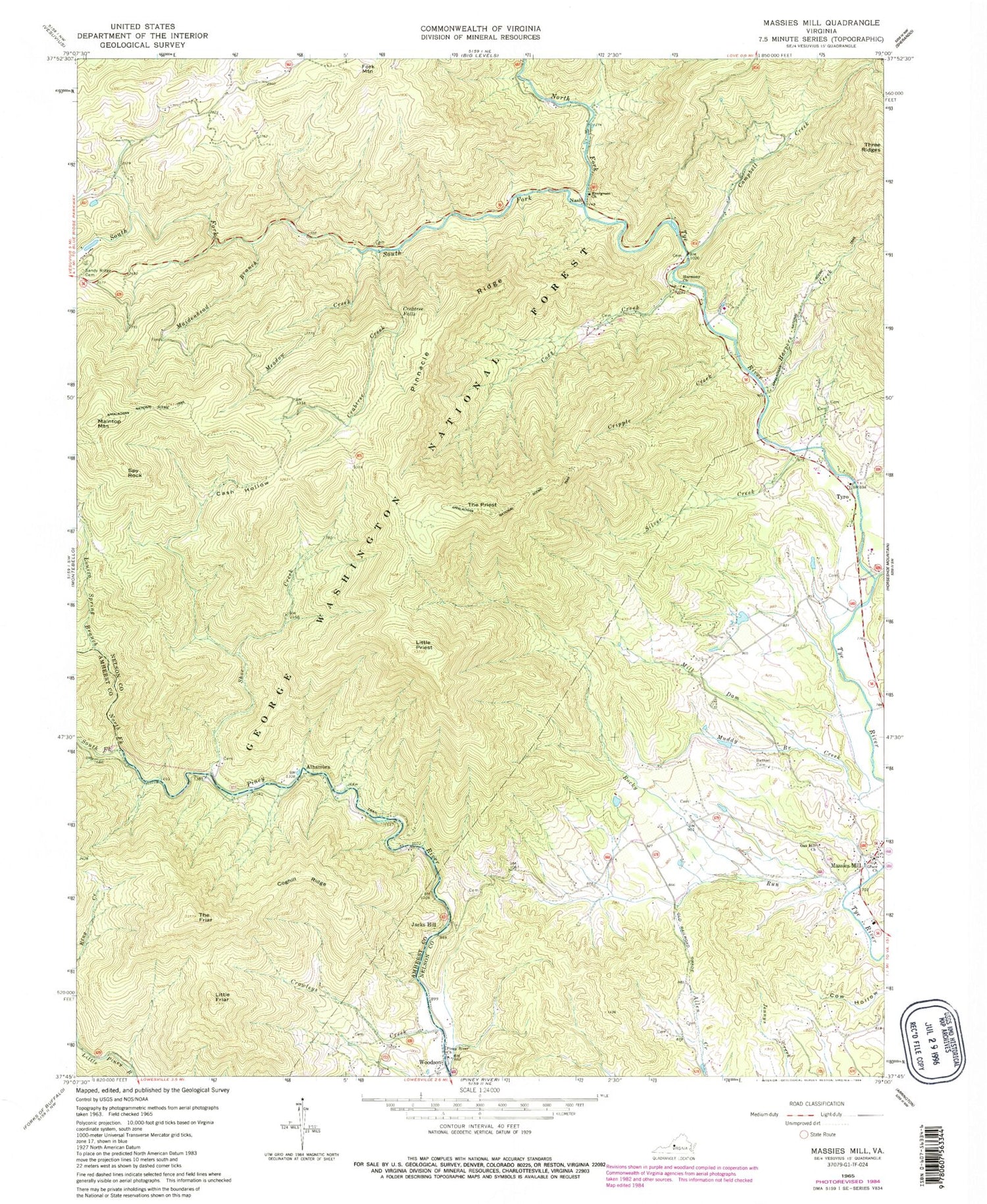
Classic USGS Massies Mill Virginia 7.5'x7.5' Topo Map
Couldn't load pickup availability
Historical USGS topographic quad map of Massies Mill in the state of Virginia. Typical map scale is 1:24,000, but may vary for certain years, if available. Print size: 24" x 27"
This quadrangle is in the following counties: Amherst, Nelson.
The map contains contour lines, roads, rivers, towns, and lakes. Printed on high-quality waterproof paper with UV fade-resistant inks, and shipped rolled.
Contains the following named places: Evergreen Church, Harpers Creek, South Fork Tye River, Alhambra, Bethel Cemetery, Campbell Creek, Cash Hollow, Coghill Ridge, Coxs Creek, Crabtree Creek, Crabtree Falls, Crawleys Creek, Cripple Creek, Cub Creek, Grace Church, Harmony Church, Jacks Hill, Little Friar, Little Hollow, Little Priest, Louisa Spring Branch, Maidenhead Branch, Meadow Creek, Muddy Branch, Nash, North Fork Piney River, North Fork Tye River, Oak Hill Church, Piney River Church, Pinnacle Ridge, Rocky Run, Sandy Ridge Cemetery, Shoe Creek, Silver Creek, South Fork Piney River, The Friar, The Priest, Harpers Creek Shelter, Priest Trail Shelter, Maintop Mountain, Massies Mill, Fork Mountain, Spy Rock, Tyro, Woodson, Oak Hill Cemetery, White Rock School (historical), Massies Mill District (historical), Priest Wilderness, West District