MyTopo
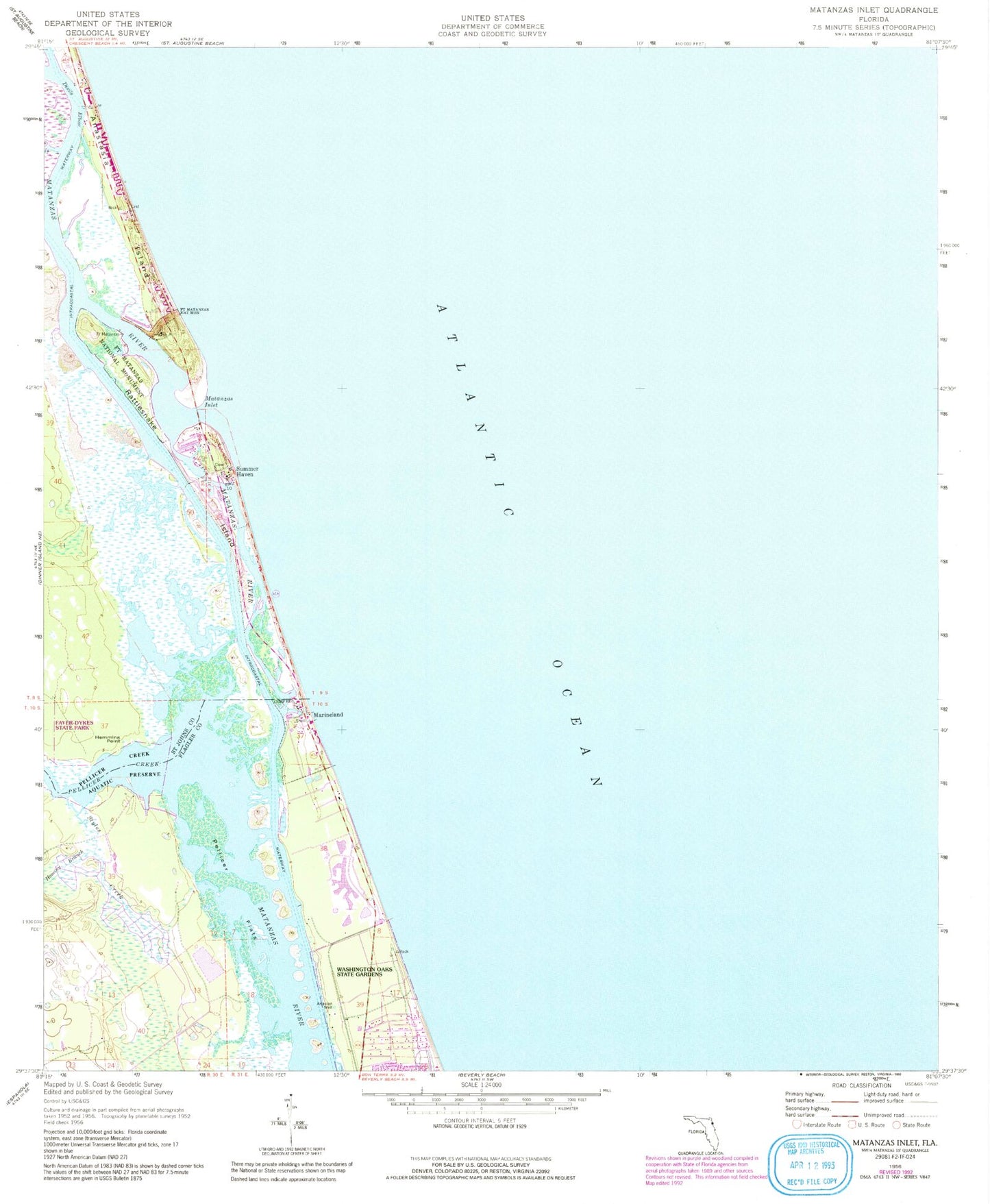
Classic USGS Matanzas Inlet Florida 7.5'x7.5' Topo Map
Couldn't load pickup availability
Historical USGS topographic quad map of Matanzas Inlet in the state of Florida. Map scale may vary for some years, but is generally around 1:24,000. Print size is approximately 24" x 27"
This quadrangle is in the following counties: Flagler, St. Johns.
The map contains contour lines, roads, rivers, towns, and lakes. Printed on high-quality waterproof paper with UV fade-resistant inks, and shipped rolled.
Contains the following named places: Claude Varne Bridge, Crescent Beach Census Designated Place, Devils Elbow, Faver-Dykes State Park, Fort Matanzas, Fort Matanzas National Monument, Hemming Point, Hominy Branch, Lake Rayonier One, Marineland, Matanzas Inlet, Pellicer Creek, Pellicer Creek Aquatic Preserve, Pellicer Flats, Rattlesnake Island, Styles Creek, Summer Haven, Town of Marineland, Washington Oaks Gardens State Park