MyTopo
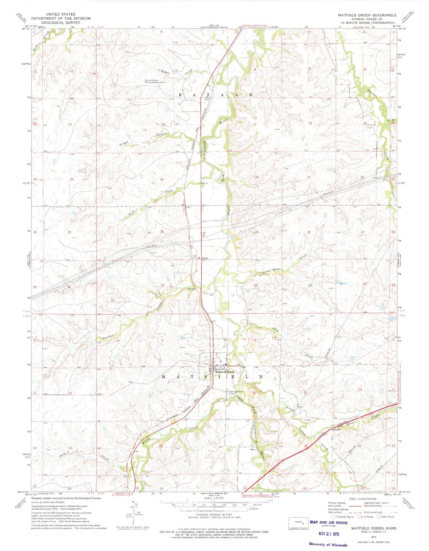
Classic USGS Matfield Green Kansas 7.5'x7.5' Topo Map
Couldn't load pickup availability
Historical USGS topographic quad map of Matfield Green in the state of Kansas. Map scale may vary for some years, but is generally around 1:24,000. Print size is approximately 24" x 27"
This quadrangle is in the following counties: Chase.
The map contains contour lines, roads, rivers, towns, and lakes. Printed on high-quality waterproof paper with UV fade-resistant inks, and shipped rolled.
Contains the following named places: Baker Creek, Chase County Rural Fire Department Matfield Green Station, City of Matfield Green, Corn Creek, Crocker Creek, East Branch Sharpes Creek, Folsom Creek, Jack Creek, Kirk Creek, Knute Rockne Memorial Monument, Little Cedar Creek, Matfield Green, Matfield Green Cemetery, Mercer Creek, Nickel Creek, Rural, Shaw Creek, Steak Bake Creek, ZIP Code: 66862