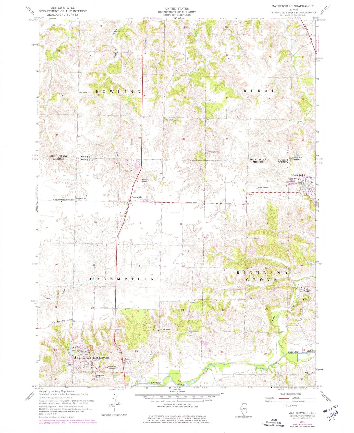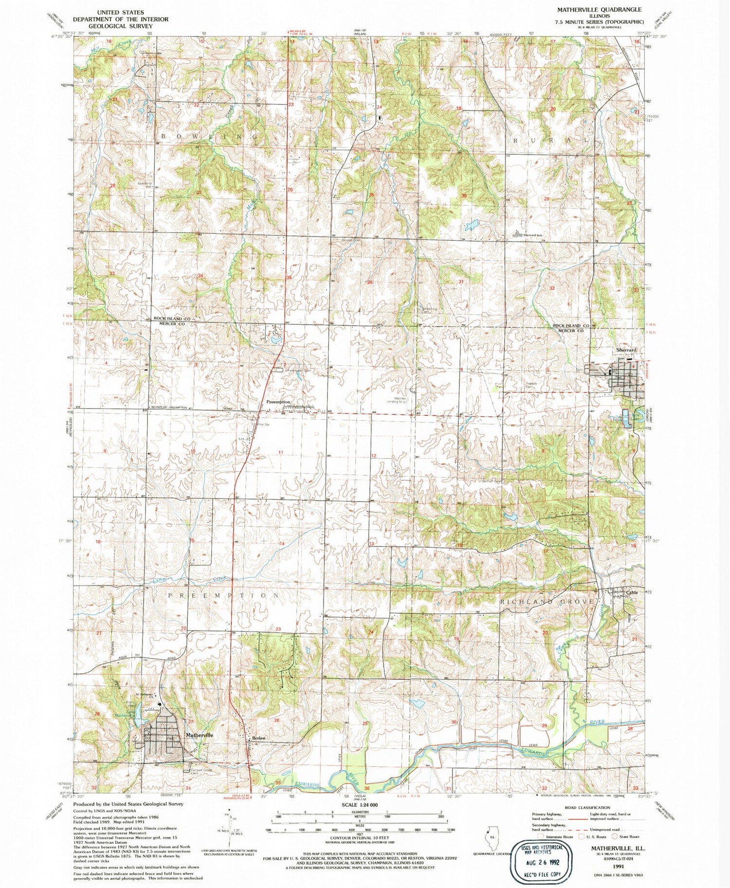

MyTopo
Classic USGS Matherville Illinois 7.5'x7.5' Topo Map
Couldn't load pickup availability
Historical USGS topographic quad map of Matherville in the state of Illinois. Map scale may vary for some years, but is generally around 1:24,000. Print size is approximately 24" x 27"
This quadrangle is in the following counties: Mercer, Rock Island.
The map contains contour lines, roads, rivers, towns, and lakes. Printed on high-quality waterproof paper with UV fade-resistant inks, and shipped rolled.
Contains the following named places: Boden, Cable, Cable Census Designated Place, Cable Village Cemetery, Camp Creek, Center School, Coal Creek, Coal Dale School, Coal Valley Mine, Farlows Grove Cemetery, Friends Cemetery, German Cemetery, Gilchrist Mine, Greene Township Fire Station Matherville, Lake Matherville, Lake Matherville Dam, Matherville, Matherville Elementary School, Matherville Post Office, Orangemans Hall, Preemption, Preemption Cemetery, Preemption Census Designated Place, Preemption Post Office, Quaker Cemetery, Saint Anthonys Church, Schoening Family Cemetery, Sherrard, Sherrard Cemetery, Sherrard Fire Protection District, Sherrard Police Department, Sherrard Post Office, Sherrard School, Township of Bowling, Township of Preemption, Village of Matherville, Weihler Airport, Woods Cemetery, ZIP Codes: 61263, 61276, 61281