MyTopo
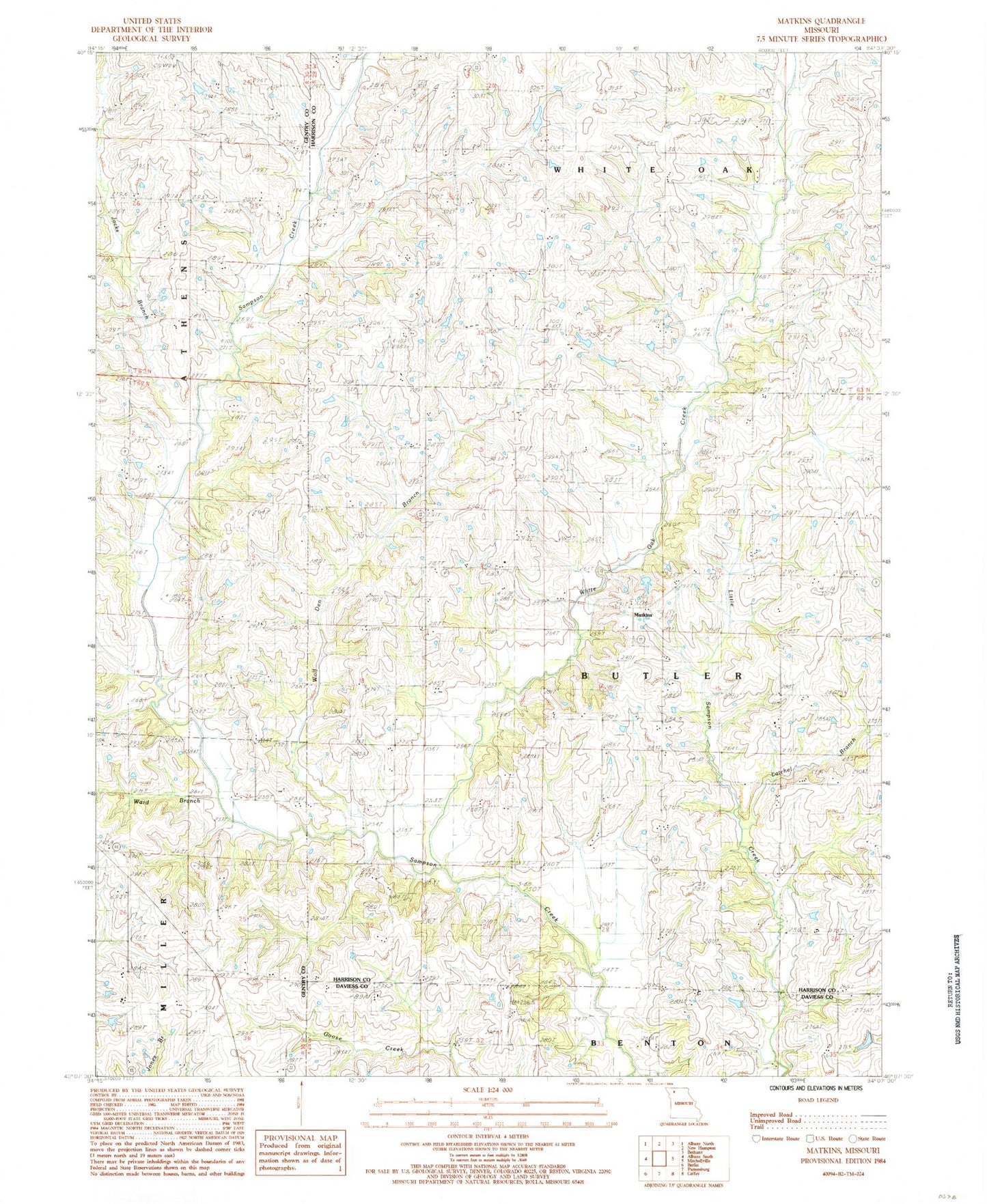
Classic USGS Matkins Missouri 7.5'x7.5' Topo Map
Couldn't load pickup availability
Historical USGS topographic quad map of Matkins in the state of Missouri. Map scale may vary for some years, but is generally around 1:24,000. Print size is approximately 24" x 27"
This quadrangle is in the following counties: Daviess, Gentry, Harrison.
The map contains contour lines, roads, rivers, towns, and lakes. Printed on high-quality waterproof paper with UV fade-resistant inks, and shipped rolled.
Contains the following named places: Bodam School, Crab Orchard School, Dover School, Foster Cemetery, Heath Church, Jacks Branch, Latchel Branch, Maple Grove School, Matkins, Matkins Church, New Hope Church, Newcastle Church, Pilot Knob School, Pleasant Ridge School, Shady Dell School, Township of Butler, Tull School, Union Chapel, Victor School, Ward Branch, White Oak Cemetery, White Oak Creek, White Oak Union Church, Wolf Den Branch, Wright Cemetery, ZIP Code: 64657