MyTopo
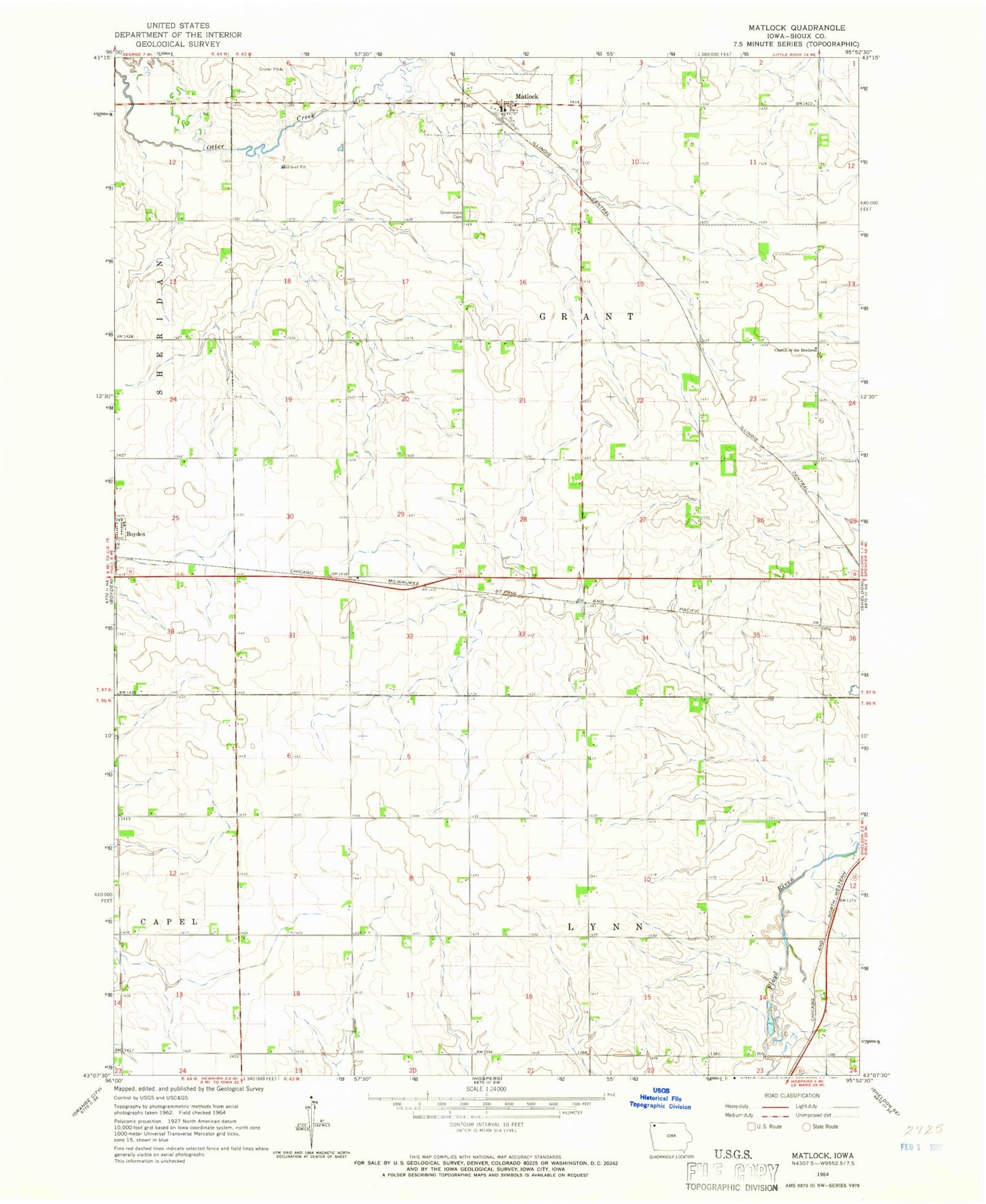
Classic USGS Matlock Iowa 7.5'x7.5' Topo Map
Couldn't load pickup availability
Historical USGS topographic quad map of Matlock in the state of Iowa. Map scale may vary for some years, but is generally around 1:24,000. Print size is approximately 24" x 27"
This quadrangle is in the following counties: Sioux.
The map contains contour lines, roads, rivers, towns, and lakes. Printed on high-quality waterproof paper with UV fade-resistant inks, and shipped rolled.
Contains the following named places: Administration Building, C and J Farms, Cherokee Hall, City of Matlock, Farmer Cooperative Elevator, Greenwood Cemetery, Henry K Farms, K and R Family Farms, Kreykes Family Farm, Kruse Farm, M and M Egg Farm, Matlock, Matlock Post Office, Meyers Farm, Midwest Farmers Co-op Elevator, Northwest Iowa Community College, Northwest Iowa Community College Library, Physical Plant Maintenance Shop, Sake Farm, Sheldon Church of the Brethren, Township of Grant, Township of Lynn, Trade/Technical Building, Triple Tree Farm, Van Farm, ZIP Code: 51244