MyTopo
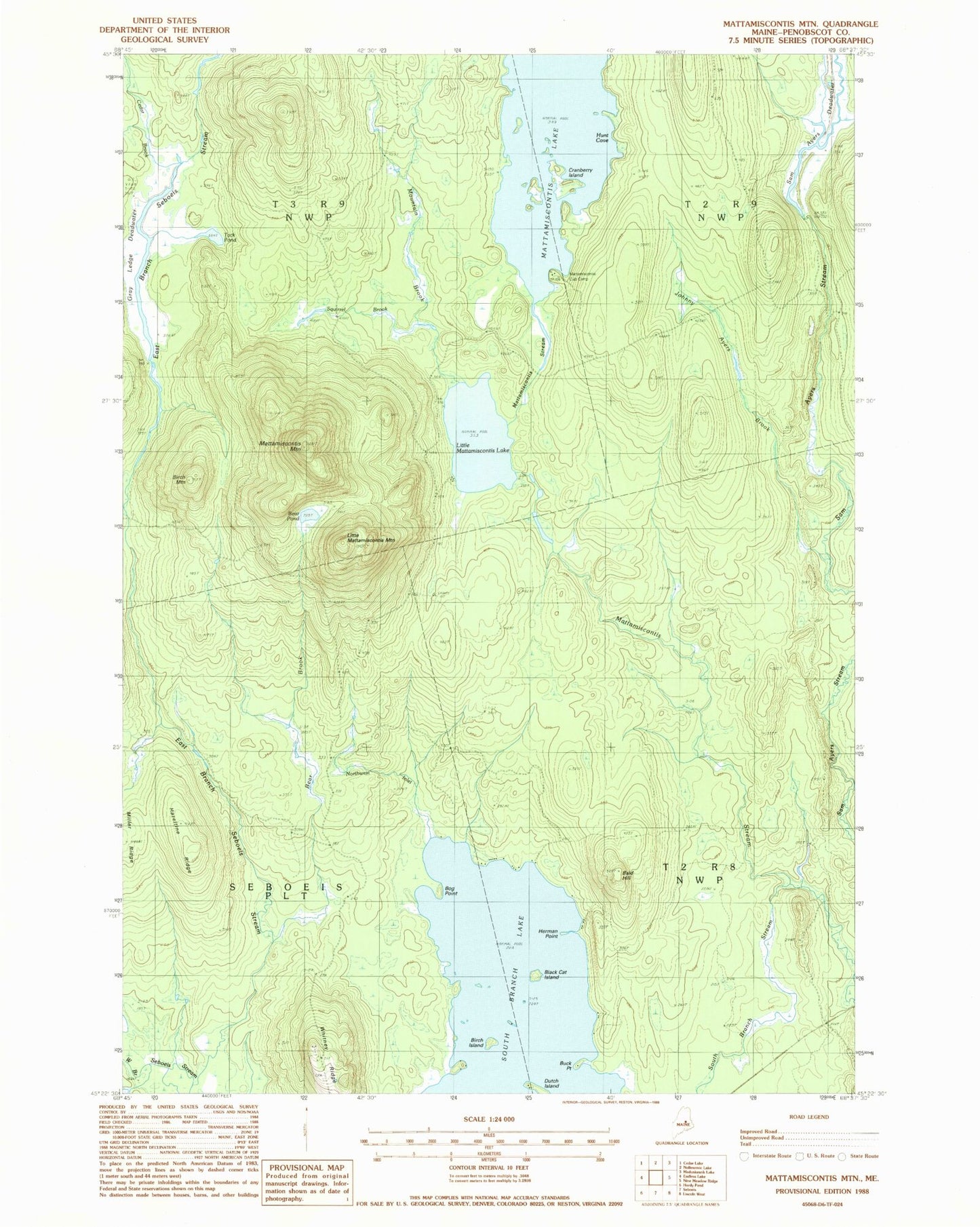
Classic USGS Mattamiscontis Mountain Maine 7.5'x7.5' Topo Map
Couldn't load pickup availability
Historical USGS topographic quad map of Mattamiscontis Mountain in the state of Maine. Map scale may vary for some years, but is generally around 1:24,000. Print size is approximately 24" x 27"
This quadrangle is in the following counties: Penobscot.
The map contains contour lines, roads, rivers, towns, and lakes. Printed on high-quality waterproof paper with UV fade-resistant inks, and shipped rolled.
Contains the following named places: Bald Hill, Bear Brook, Bear Pond, Birch Island, Birch Mountain, Black Cat Island, Bog Brook, Bog Point, Buck Point, Cedar Brook, Cranberry Island, Dutch Island, East Branch Seboeis Stream, Gray Ledge Deadwater, Hazeltine Ridge, Herman Point, Hunt Cove, Johnny Ayers Brook, Little Mattamiscontis Lake, Little Mattamiscontis Mountain, Mattamiscontis Club Camp, Mattamiscontis Lake, Mattamiscontis Mountain, Mountain Brook, Northwest Inlet, Penobscot County, Penobscot Reservation, Plantation of Seboeis, Sam Ayers Deadwater, Sam Ayers Stream, Seboeis Cemetery, Shore Road Trail, South Branch Lake, South Branch Stream, Squirrel Brook, Sweat Bog Brook, Tack Pond, West Branch Seboeis Stream, Whitney Ridge