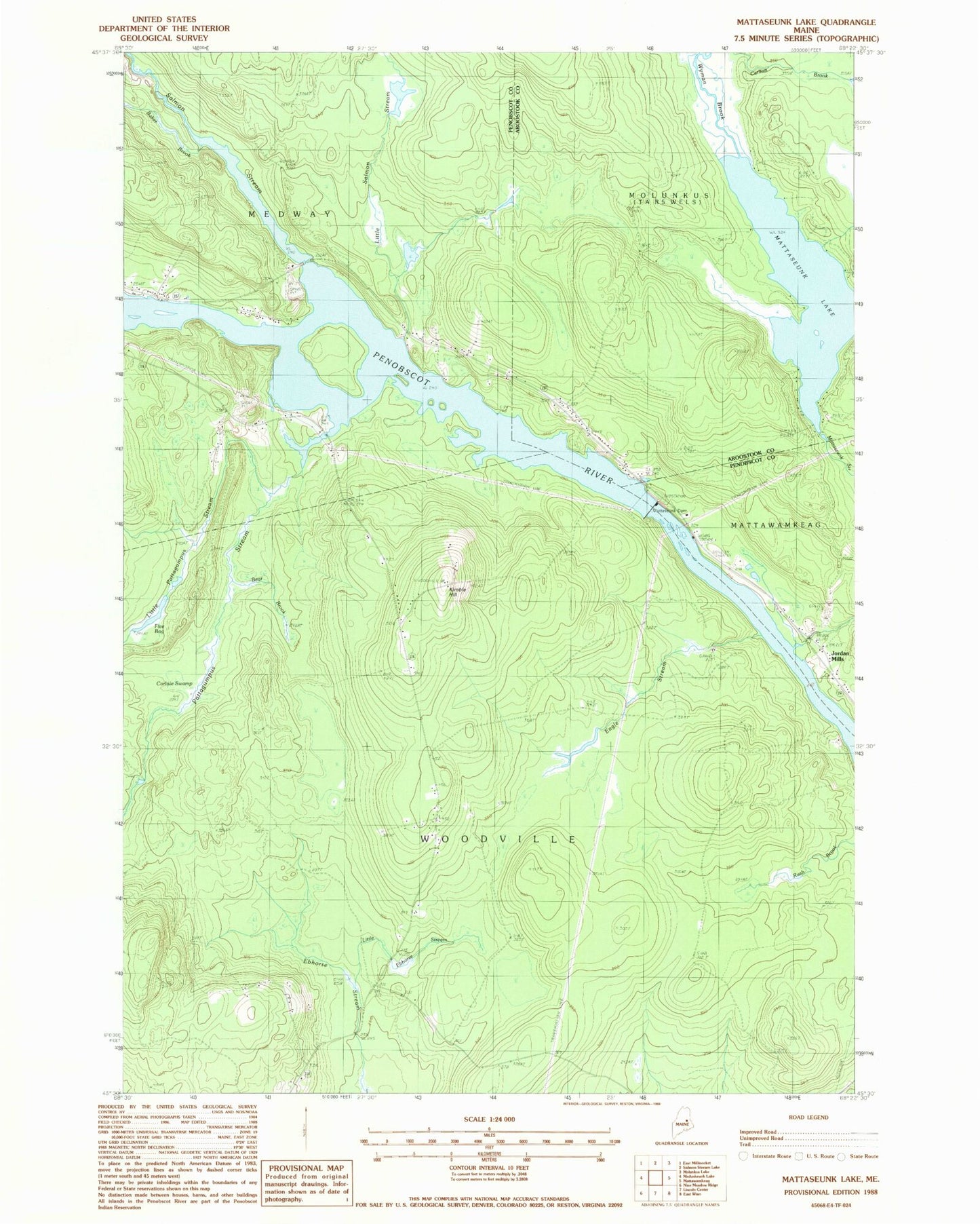
MyTopo
Classic USGS Mattaseunk Lake Maine 7.5'x7.5' Topo Map
Couldn't load pickup availability
Historical USGS topographic quad map of Mattaseunk Lake in the state of Maine. Map scale may vary for some years, but is generally around 1:24,000. Print size is approximately 24" x 27"
This quadrangle is in the following counties: Aroostook, Penobscot.
The map contains contour lines, roads, rivers, towns, and lakes. Printed on high-quality waterproof paper with UV fade-resistant inks, and shipped rolled.
Contains the following named places: Baker Brook, Bear Brook, Carlisle Swamp, Carlton Brook, Eagle Stream, Five Bog, Jordan Mills, Kimble Hill, Little Ebhorse Stream, Little Pattagumpus Stream, Little Salmon Stream, Mattaseunk Dam, Mattaseunk Lake, Mattaseunk Stream, North Woodville School, Pattagumpus Stream, Penobscott River Reservoir, Salmon Stream, South Woodville School, Town of Medway, Town of Woodville, Wyman Brook