MyTopo
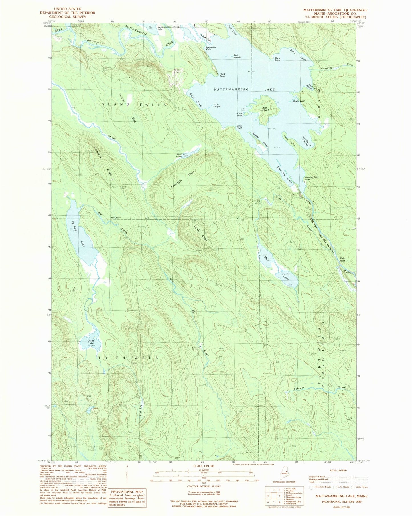
Classic USGS Mattawamkeag Lake Maine 7.5'x7.5' Topo Map
Couldn't load pickup availability
Historical USGS topographic quad map of Mattawamkeag Lake in the state of Maine. Map scale may vary for some years, but is generally around 1:24,000. Print size is approximately 24" x 27"
This quadrangle is in the following counties: Aroostook.
The map contains contour lines, roads, rivers, towns, and lakes. Printed on high-quality waterproof paper with UV fade-resistant inks, and shipped rolled.
Contains the following named places: Bible Point, Big Island, Birch Point, Black Point, Bug Island, Bush Bog, Caribou Lake, Devils Wall, First Brook, Greenlaw Cove, Hamiltons Mistake, Hitching Post Point, Hook Point, Hurricane Ridge, Little Sly Brook, Long Point, Loon Ledge, Mattawamkeag Lake, Mosquito Point, Mud Lake, Mud Pond, Norway Island, Otter Lake, Otter Lake Firetower, Pettingill Ridge, Round Island, Sand Cove, Soucier Bog, T3 R4 WELS, Tapley Ridge, The Pocket, The Thorofare, Town of Island Falls, Trueworthy Brook, West Cove