MyTopo
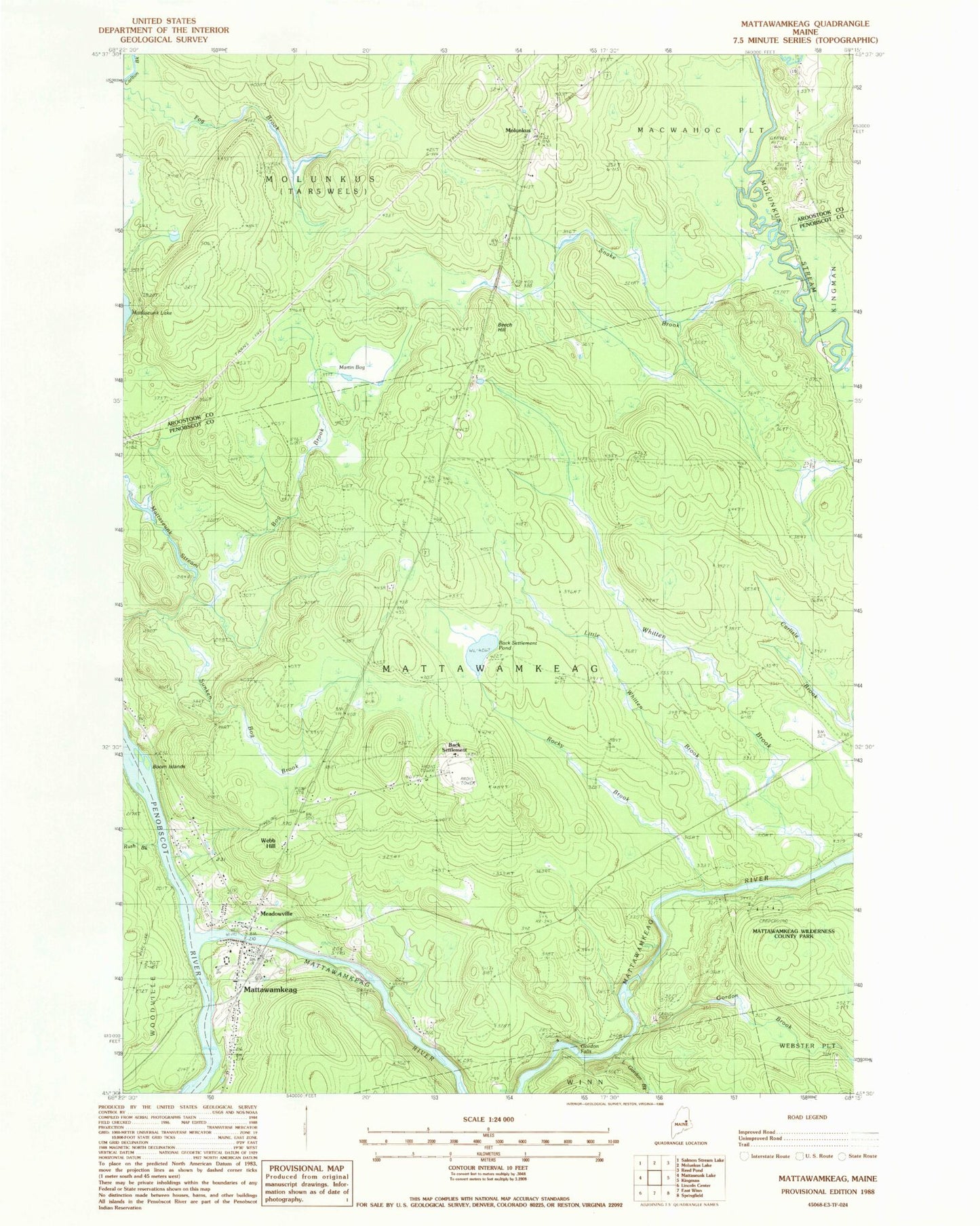
Classic USGS Mattawamkeag Maine 7.5'x7.5' Topo Map
Couldn't load pickup availability
Historical USGS topographic quad map of Mattawamkeag in the state of Maine. Typical map scale is 1:24,000, but may vary for certain years, if available. Print size: 24" x 27"
This quadrangle is in the following counties: Aroostook, Penobscot.
The map contains contour lines, roads, rivers, towns, and lakes. Printed on high-quality waterproof paper with UV fade-resistant inks, and shipped rolled.
Contains the following named places: Back Settlement Pond, Beech Hill, Bog Brook, Boom Islands, Davis Farm (historical), Fog Brook, Gordon Brook, Gordon Falls, Little Gordon Brook, Little Whitten Brook, Martin Bog, Mattawamkeag, Mattawamkeag River, Meadow Brook, Meadowville, Molunkus, Rush Brook, Snake Brook, Sunken Bog Brook, Webb Hill, Back Settlement, Gordon (historical), Town of Mattawamkeag, Church of God, Doctor Carl E Troutt School, Mattawamkeag Bible Baptist Church, Mattawamkeag Post Office, Mattawamkeag Library, Mattawamkeag Wilderness County Park, Mattawamkeag Fire Department, Mattawamkeag Cemetery, Mattawamkeag Census Designated Place