MyTopo
Classic USGS Matterhorn Arizona 7.5'x7.5' Topo Map
Couldn't load pickup availability
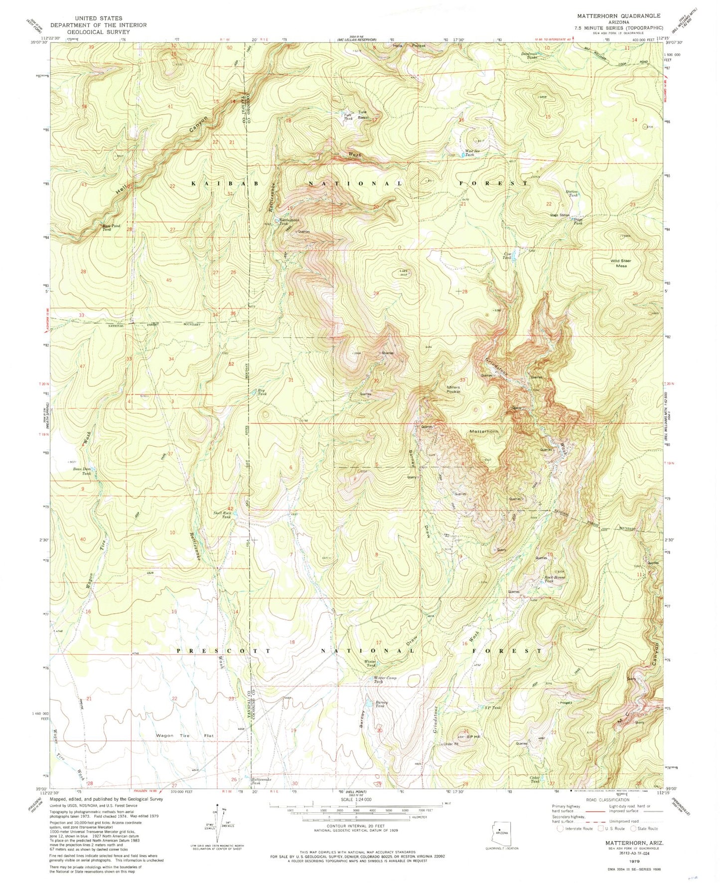
Historical USGS topographic quad map of Matterhorn in the state of Arizona. Map scale may vary for some years, but is generally around 1:24,000. Print size is approximately 24" x 27"
This quadrangle is in the following counties: Coconino, Yavapai.
The map contains contour lines, roads, rivers, towns, and lakes. Printed on high-quality waterproof paper with UV fade-resistant inks, and shipped rolled.
Contains the following named places: Barney Tank, Bass Pond Tank, Bean Dam Tank, Cedar Tank, Cow Tank, Deadman Tanks, Matterhorn, Millers Pocket, Mills Quarry, Rattlesnake Tank, Rock House Tank, Roy Tank, S P Hill, S P Tank, Shell Rock Tank, Stage Station, Stage Tank, Station Tank, Tule Basin, Tule Tank, Wagon Tire Flat, West Ike Tank, Wild Steer Mesa, Winter Camp Tank, Winter Tank