MyTopo
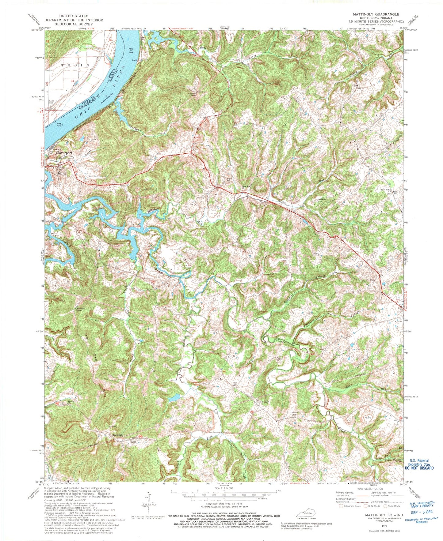
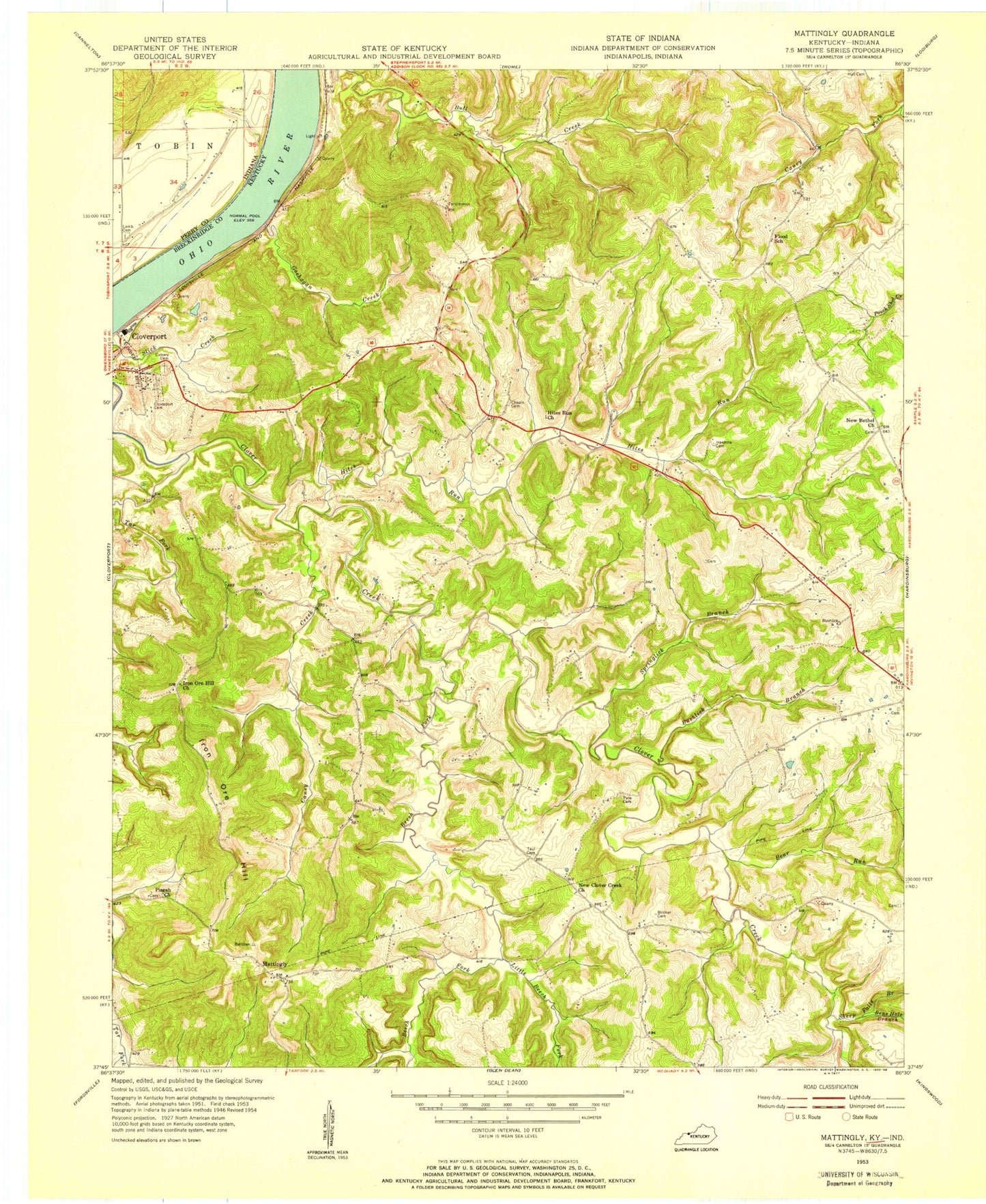
Classic USGS Mattingly Kentucky 7.5'x7.5' Topo Map
Couldn't load pickup availability
Historical USGS topographic quad map of Mattingly in the states of Kentucky, Indiana. Map scale may vary for some years, but is generally around 1:24,000. Print size is approximately 24" x 27"
This quadrangle is in the following counties: Breckinridge, Perry.
The map contains contour lines, roads, rivers, towns, and lakes. Printed on high-quality waterproof paper with UV fade-resistant inks, and shipped rolled.
Contains the following named places: Bear Run, Beech Fork, Bens Hole Branch, Bricker Cemetery, Bushlick Branch, Calvary Cemetery, Calvary Temple, Caney Creek, Carter Landing, Carters Landing Bar, Chapin Cemetery, Cloverport Division, First Coal Oil Production Historical Marker, Goehagan Creek, Hall Cemetery Number 1, Hawkins Cemetery, Hites Run, Hites Run Church, Iron Ore Hill, Lamb Cemetery, Little Beech Fork, Mattingly, New Bethel Church, New Clover Creek Church, Pate Cemetery, Pisgah Baptist Church, Sheep Falls Branch, Springlick Branch, Tar Fork, Taul Cemetery, Wildwood Chapel, ZIP Code: 40143