MyTopo
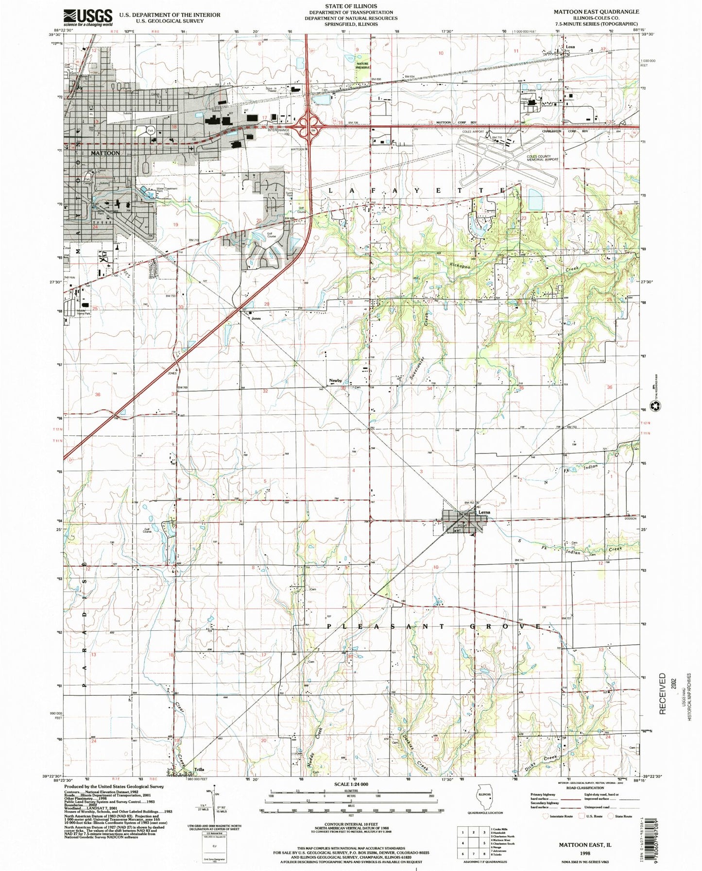
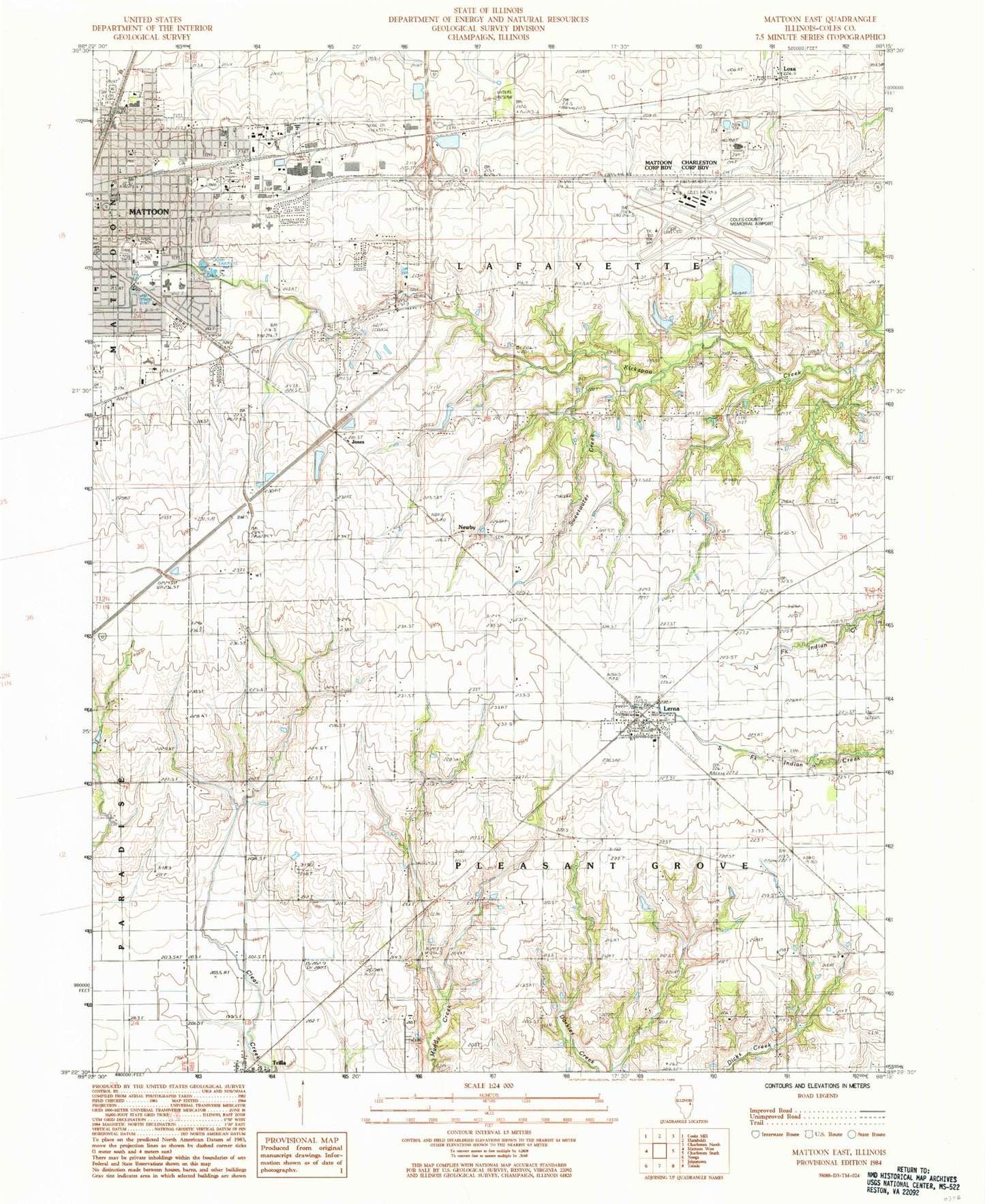
Classic USGS Mattoon East Illinois 7.5'x7.5' Topo Map
Couldn't load pickup availability
Historical USGS topographic quad map of Mattoon East in the state of Illinois. Map scale may vary for some years, but is generally around 1:24,000. Print size is approximately 24" x 27"
This quadrangle is in the following counties: Coles.
The map contains contour lines, roads, rivers, towns, and lakes. Printed on high-quality waterproof paper with UV fade-resistant inks, and shipped rolled.
Contains the following named places: Armstrong Cemetery, Beals Cemetery, Boles Cemetery, Broadway Christian Church, Buck Grove School, Cemetery, Central Community Church, Christian and Missionary Alliance Church, Church of God in Christ, City of Mattoon, Coles County Memorial Airport, Coles County Sheriff's Office, Country Club Estates, Cross Country Mall Shopping Center, Cunningham Park, Doty Cemetery, East Side Church of the Nazarene, Faith United Methodist Church, First Assembly of God Church, First Christian Church, First Church of Christ Scientist, First United Methodist Church, Franklin Elementary School, Free Methodist Church, Herman School, Indian School, Jones, Lake Windermere, Lake Windermere Dam, Lawson Park, Lerna, Lerna Elementary School, Lerna Post Office, Lincoln Elementary School, Lincoln Fire Protection District Station 5, Lowell Public School, Lower Muddy Cemetery, Loxa, Mattoon, Mattoon Fire Department Station 2, Mattoon Golf and Country Club, Mattoon Junior High School, Mattoon Post Office, Mattoon Public Library, Monroe School, Montgomery Cemetery, Muddy Point, Muddy Point School, New Liberty Church, Newby, Old Indian Presbyterian Church Cemetery, Old State Mobile Home Village, Ooley School, Peterson Park, Phipps School, Pleasant Prairie Indian Cemetery, Plummer Place, Rest Haven Memorial Gardens, Rolling Green, Saint Johns Lutheran Church, Sarah Bush Lincoln Health Center, Shinn School, South Loxa School, Southside Church of Christ, Sweetwater Creek, Township of Lafayette, Township of Pleasant Grove, Trilla, Trilla Census Designated Place, Upper Muddy Point Cemetery, Village of Lerna, Washington Elementary School, Wright Cemetery, Wright School, ZIP Codes: 61938, 62440