
MyTopo
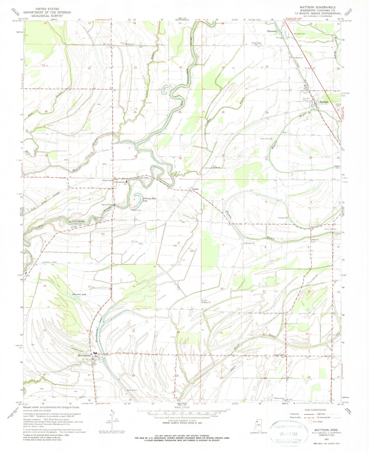
Classic USGS Mattson Mississippi 7.5'x7.5' Topo Map
Couldn't load pickup availability
Historical USGS topographic quad map of Mattson in the state of Mississippi. Map scale may vary for some years, but is generally around 1:24,000. Print size is approximately 24" x 27"
This quadrangle is in the following counties: Coahoma.
The map contains contour lines, roads, rivers, towns, and lakes. Printed on high-quality waterproof paper with UV fade-resistant inks, and shipped rolled.
Contains the following named places: Adams Chapel, Antioch Church, Bethel Church, Black Hill School, Bobo Lake, Carr Chapel, Cherry Hill Cemetery, Cherry Hill Church, Claremont, Clark Bayou, Counts, Dulaney-Ross Lake, Fairview Church, Fishing Bayou, Galilee Church, Harris Bayou, Harvey Chapel, Hickory Grove Church, Hilliard School, Johnson Cemetery, Marby Chapel, Mattson, Mount Horeb Cemetery, Mount Horeb Church, Mount Olive Church, Oak Grove Church, Olive Branch School, Plummer Lake, Robinson Cemetery, Rosenwald School, Ross Church, Roundaway, Roundaway Elementary School, Roundaway Lake, Rucks, Russell Cemetery, Saint Marys Church, Sentry Mount Church, Sunflower School, Sunshine Church, Sunshine School, Supervisor District 4, Traynham, True Vine Cemetery, Union Chapel, Williams Chapel, Willis Store


