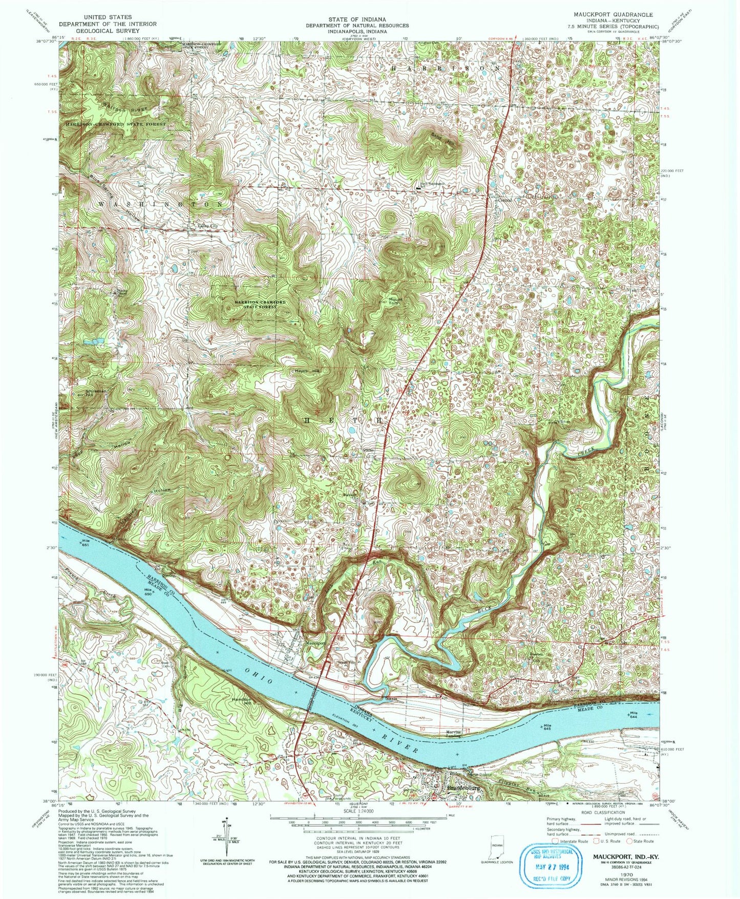
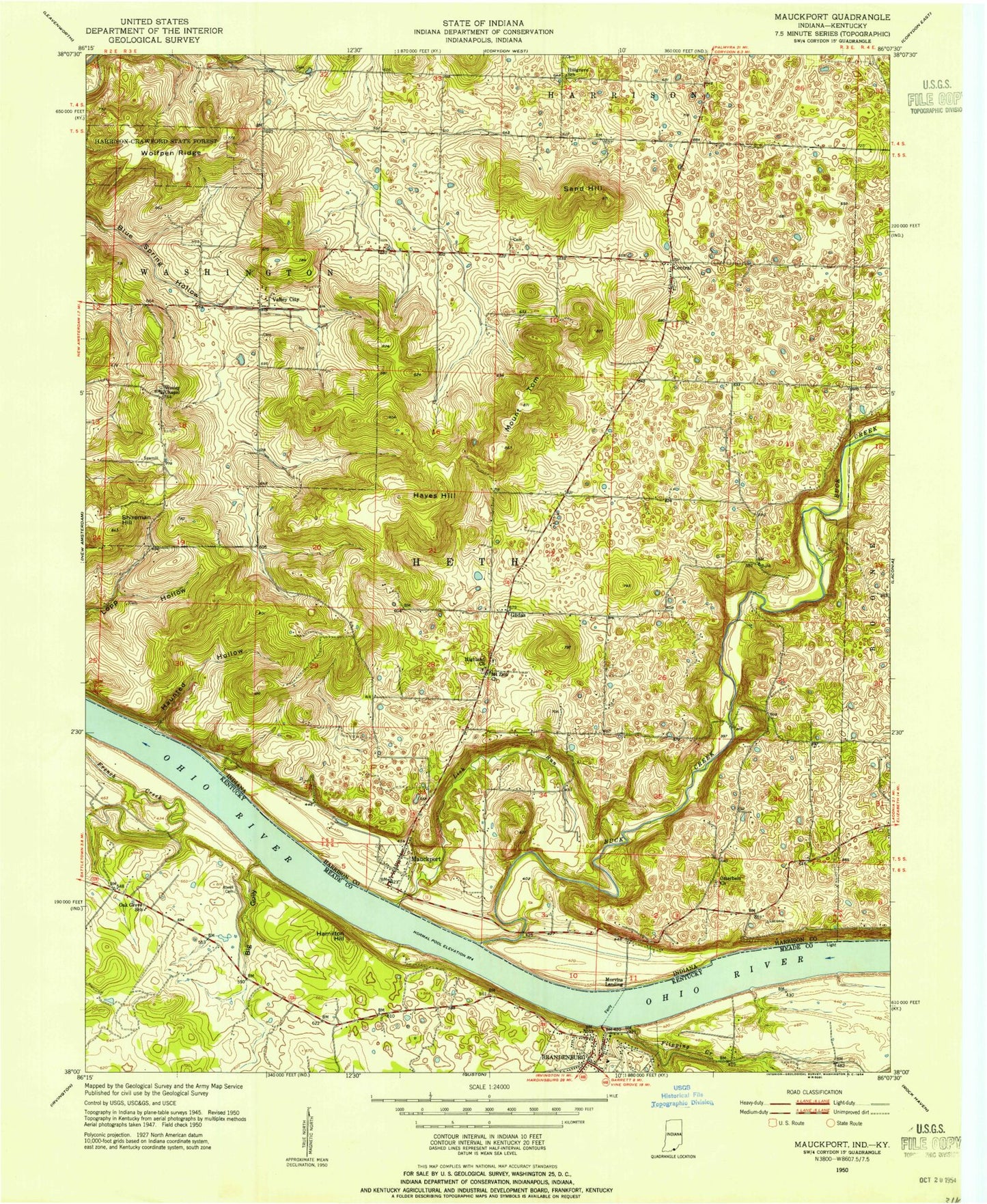
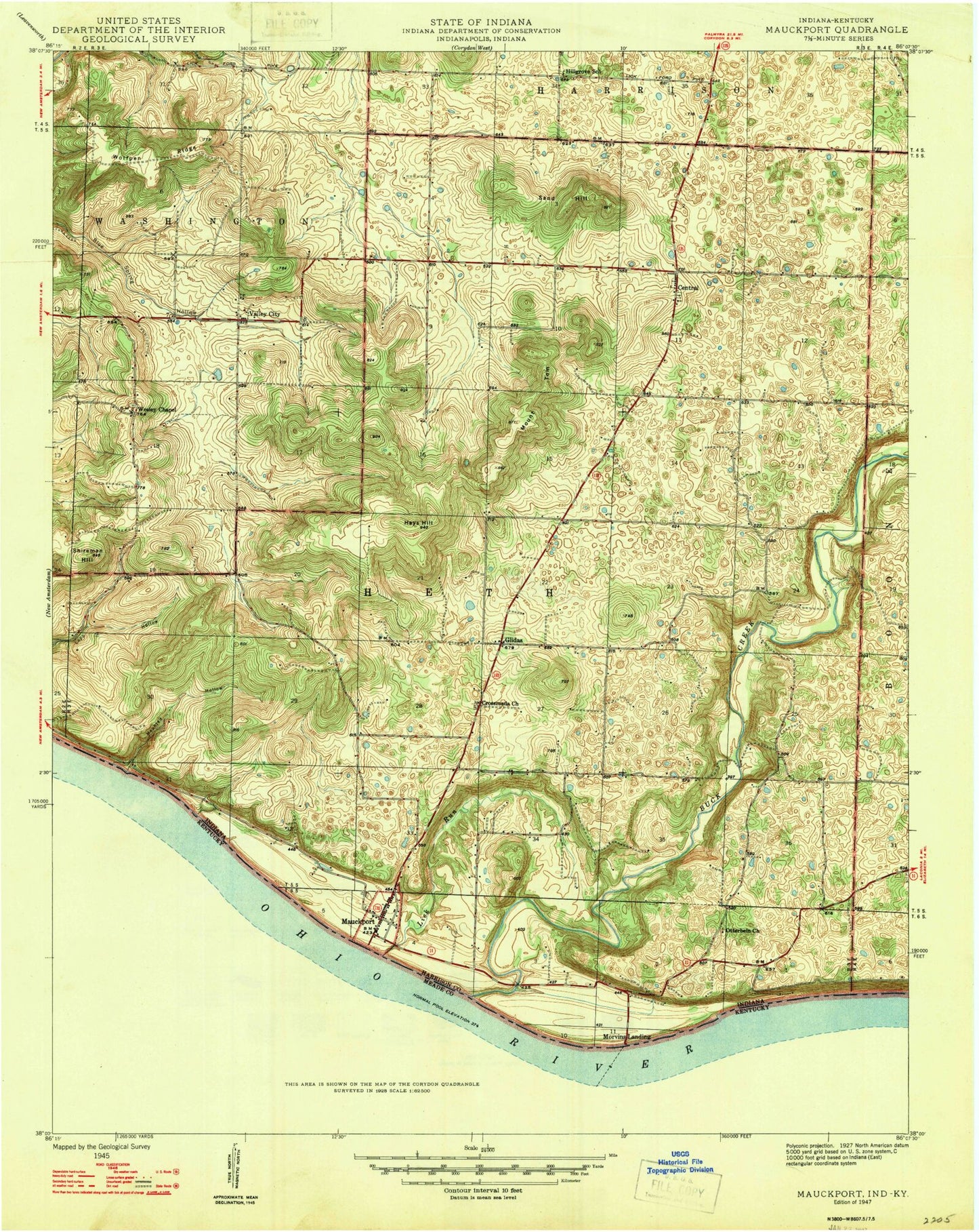
MyTopo
Classic USGS Mauckport Indiana 7.5'x7.5' Topo Map
Couldn't load pickup availability
Historical USGS topographic quad map of Mauckport in the states of Indiana, Kentucky. Map scale may vary for some years, but is generally around 1:24,000. Print size is approximately 24" x 27"
This quadrangle is in the following counties: Harrison, Meade.
The map contains contour lines, roads, rivers, towns, and lakes. Printed on high-quality waterproof paper with UV fade-resistant inks, and shipped rolled.
Contains the following named places: Atwell Cemetery, Boones Landing, Brandenburg Post Office, Buck Creek, Central, Crisps Crossroads, Flippins Run, Glidas, Hamilton Hill, Haunted Hollow, Hayes Hill, Heth Township Fire Department Central Station, Heth-Washington Elementary School, Highland Church, Hillgrove Cemetery, Hyland Cemetery, John Hunt Morgans Crossing Historical Marker, Lick Run, Matthew Welsh Bridge, Mauckport, Mauckport Post Office, Meade County Fire Protection District Station 1, Meade County Sheriff's Office, Morgans Headquarters Historical Marker, Morvins Landing, Mount Tom, Mount Zion Cemetery, Mount Zion Church, Neely Pit Number 1, Old Mauckport Cemetery, Old Mount Zion Cemetery, Otterbein Church, Russell Airport, Sand Hill, Shireman Hill, Solomon Brandenburg Historical Marker, Town of Mauckport, Township of Heth, Township of Washington, Valley City, Wesley Chapel, West Hill, Wolfpen Ridge, ZIP Codes: 47110, 47142