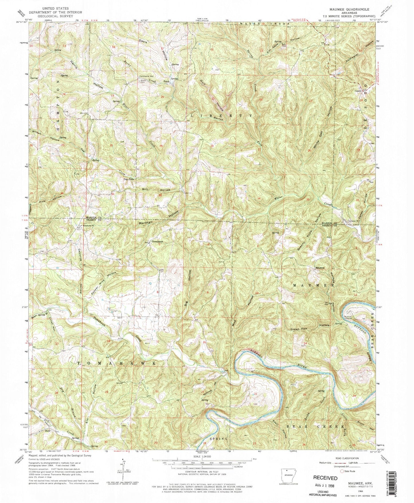
MyTopo
Classic USGS Maumee Arkansas 7.5'x7.5' Topo Map
Couldn't load pickup availability
Historical USGS topographic quad map of Maumee in the state of Arkansas. Typical map scale is 1:24,000, but may vary for certain years, if available. Print size: 24" x 27"
This quadrangle is in the following counties: Marion, Searcy.
The map contains contour lines, roads, rivers, towns, and lakes. Printed on high-quality waterproof paper with UV fade-resistant inks, and shipped rolled.
Contains the following named places: Baker Spring Branch, Barren Fork, Big Hollow, Burns Creek, Caney Hollow, Coldwater Hollow, Copper Mine Hollow, Cross Hollow, Davis Hollow, Dry Branch, Elm Cave Hollow, Elm Hollow, Ezell Hollow, Granny Price Hollow, Green Haw Hollow, Gulf Hollow, Harris Hollow, Lay Creek, Lay Falls, Marshall Hollow, Maumee Hollow, McKinney Hollow, Mill Hollow, Mud Hollow, Osborne Hollow, Scott Hollow, Spring Creek, Tomahawk Creek, White Oak Hollow, Wilson Hollow, Tomahawk, Caney, Maumee, Maumee Crossing, Caney Cemetery, Township of Tomahawk, Township of Liberty (historical), Tomahawk Cemetery, Burns Cemetery, Caney Church of Christ, Freck, Rocky Creek, Tomahawk Baptist Church, Little Rocky Creek, Sanders Cemetery