MyTopo
Classic USGS Maunie Illinois 7.5'x7.5' Topo Map
Couldn't load pickup availability
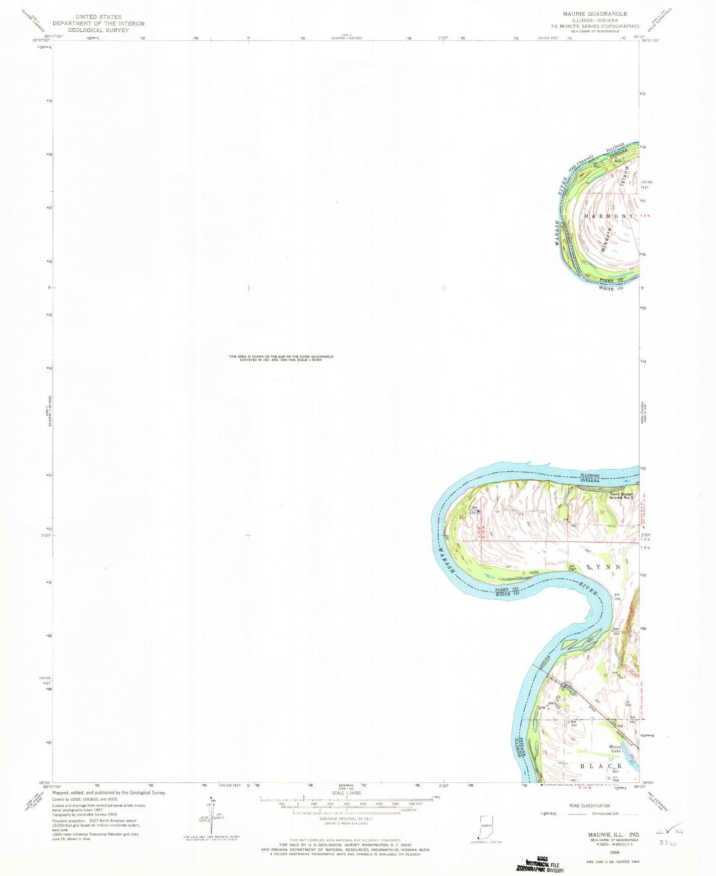
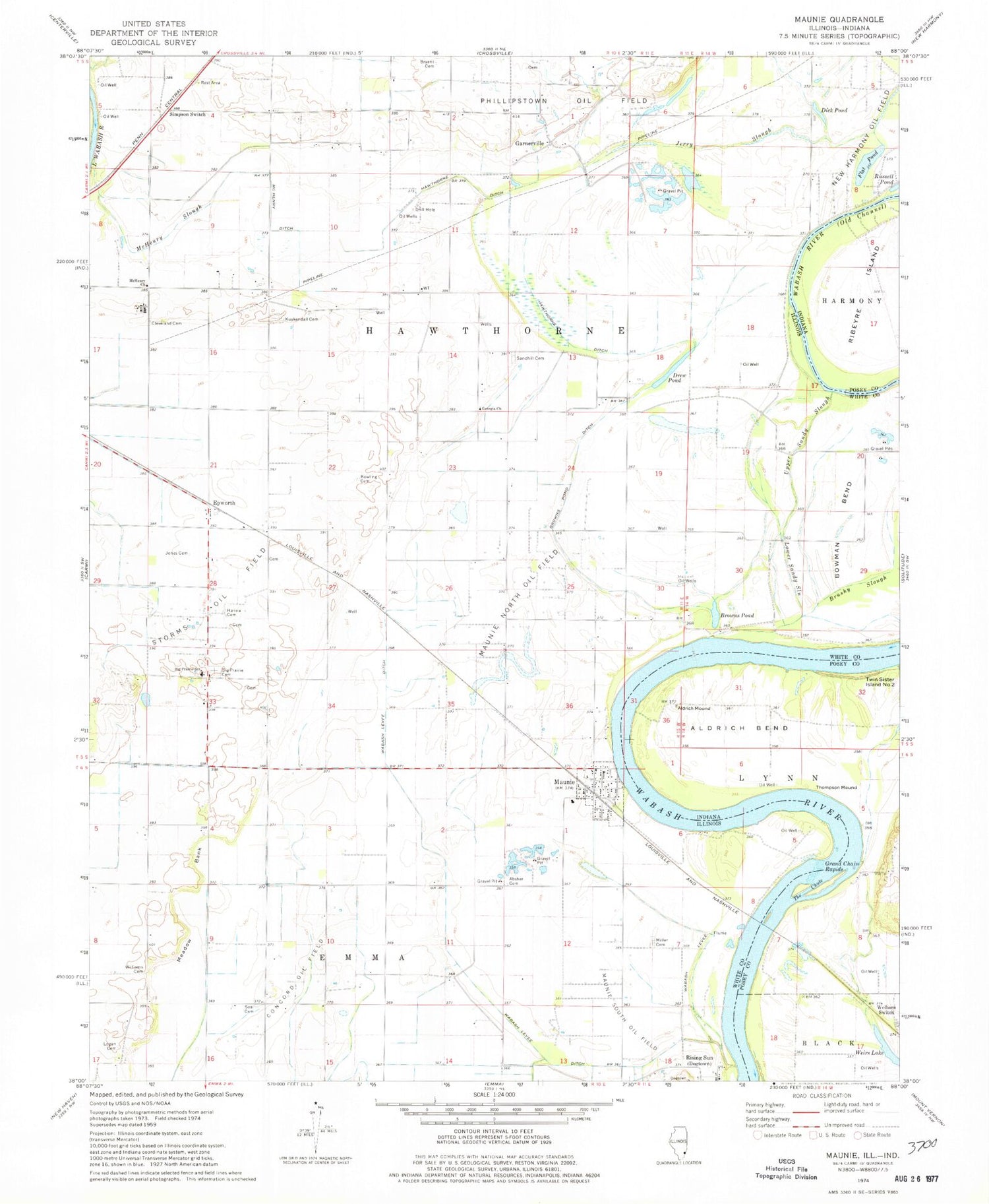
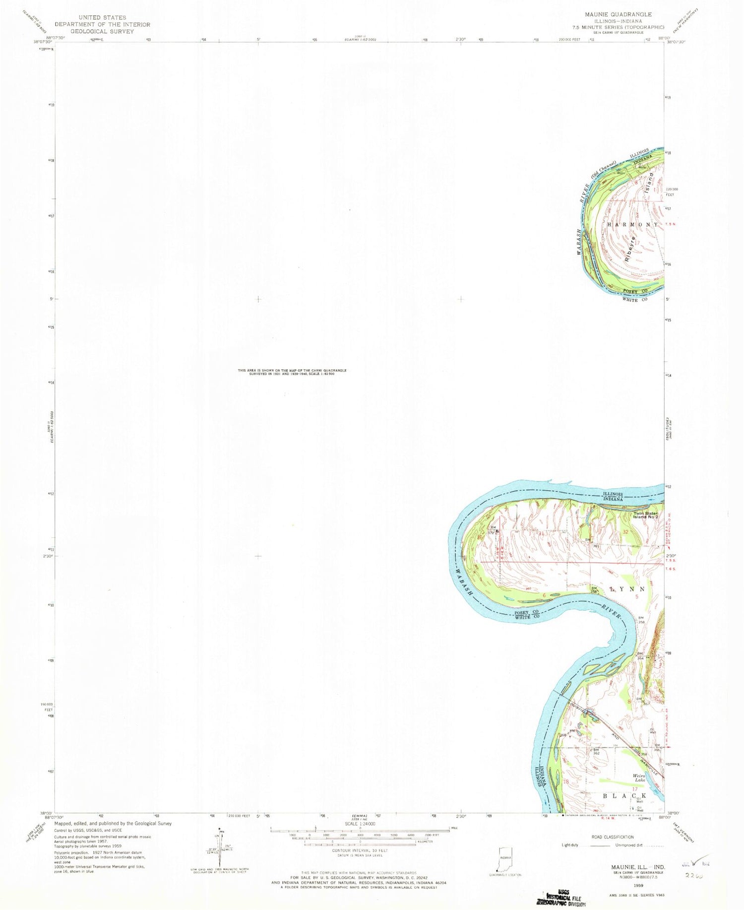
Historical USGS topographic quad map of Maunie in the states of Illinois, Indiana. Map scale may vary for some years, but is generally around 1:24,000. Print size is approximately 24" x 27"
This quadrangle is in the following counties: Posey, White.
The map contains contour lines, roads, rivers, towns, and lakes. Printed on high-quality waterproof paper with UV fade-resistant inks, and shipped rolled.
Contains the following named places: Absher Cemetery, Aldrich Bend, Aldrich Mound, Big Prairie Cemetery, Big Prairie School, Bowling Cemetery, Brown School, Browns Pond, Browns Pond Ditch, Brownsport, Brushy Slough, Bryant Cemetery, Carmi Air Force Station, Carmi Municipal Airport, Cleveland Cemetery, Cleveland School, Concord Oil Field, Dick Pond, Drew Pond, Duck Pond School, Elmgrove School, Epworth, Flat Pond, Garnerville, Georgia Church, Georgia School, Grand Chain Rapids, Hanna Cemetery, Hawthorne Ditch, Jerry Slough, Jones Family Cemetery, Kuykendall Cemetery, Logan Family Cemetery, Lower Sandy Slough, Maunie, Maunie North Oil Field, Maunie Post Office, Maunie South Oil Field, McHenry Church, McHenry Ditch, McHenry Slough, Meadow Bank, Miller Cemetery, New Harmony Oil Field, Old Channel Wabash River, Rising Sun, Rudolph School, Sandhill Cemetery, Seal Cemetery, Seal Church, Seal School, Simpson School, Simpson Switch, The Chute, Thompson Mound, Township of Hawthorne, Twin Sister Island Number Two, Upper Sandy Slough, Village of Maunie, Wabash Levee, Wabash Levee Ditch, Weirs Lake, Welborn Switch, Williams Family Cemetery, ZIP Code: 62861