MyTopo
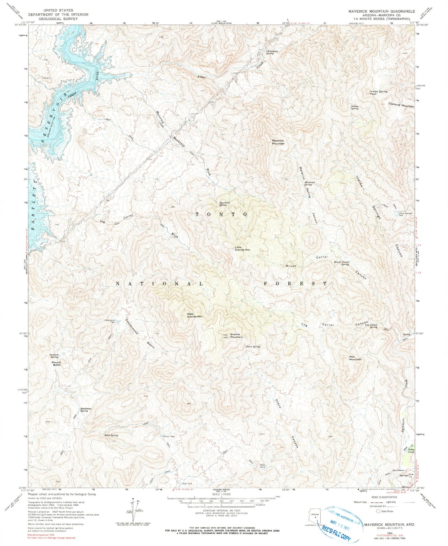
Classic USGS Maverick Mountain Arizona 7.5'x7.5' Topo Map
Couldn't load pickup availability
Historical USGS topographic quad map of Maverick Mountain in the state of Arizona. Map scale may vary for some years, but is generally around 1:24,000. Print size is approximately 24" x 27"
This quadrangle is in the following counties: Maricopa.
The map contains contour lines, roads, rivers, towns, and lakes. Printed on high-quality waterproof paper with UV fade-resistant inks, and shipped rolled.
Contains the following named places: Alder Creek, Alder Point, Brush Corral Canyon, Brush Corral Spring, Camp Creek, Carlock Tank, Chinatown Spring, Cottonwood Basin, Cottonwood Tank, Diamond Spring, Dos S Ranch, Granite Mountain, Hog Island, Indian Point, Indian Spring, Indian Spring Peak, Indian Springs Canyon, Indian Springs Tank, Little Granite Mountain, Log Corral Canyon, Log Corral Spring, Log Corral Wash, Maverick Mountain, Maverick Mountain Wash, Maverick Spring, Maverick Spring Canyon, Otero Spring, Otero Tank, Panic Rock, Pine Creek, Quartz Tank, Red Mountain, Rock Spring, Round Butte, Round Valley, Ryan Tank, Sandstone Spring, SB Cove Administrative Site, Summit Spring, Sycamore Spring, West Granite Mountain, Yellow Jacket Spring, ZIP Code: 85263