MyTopo
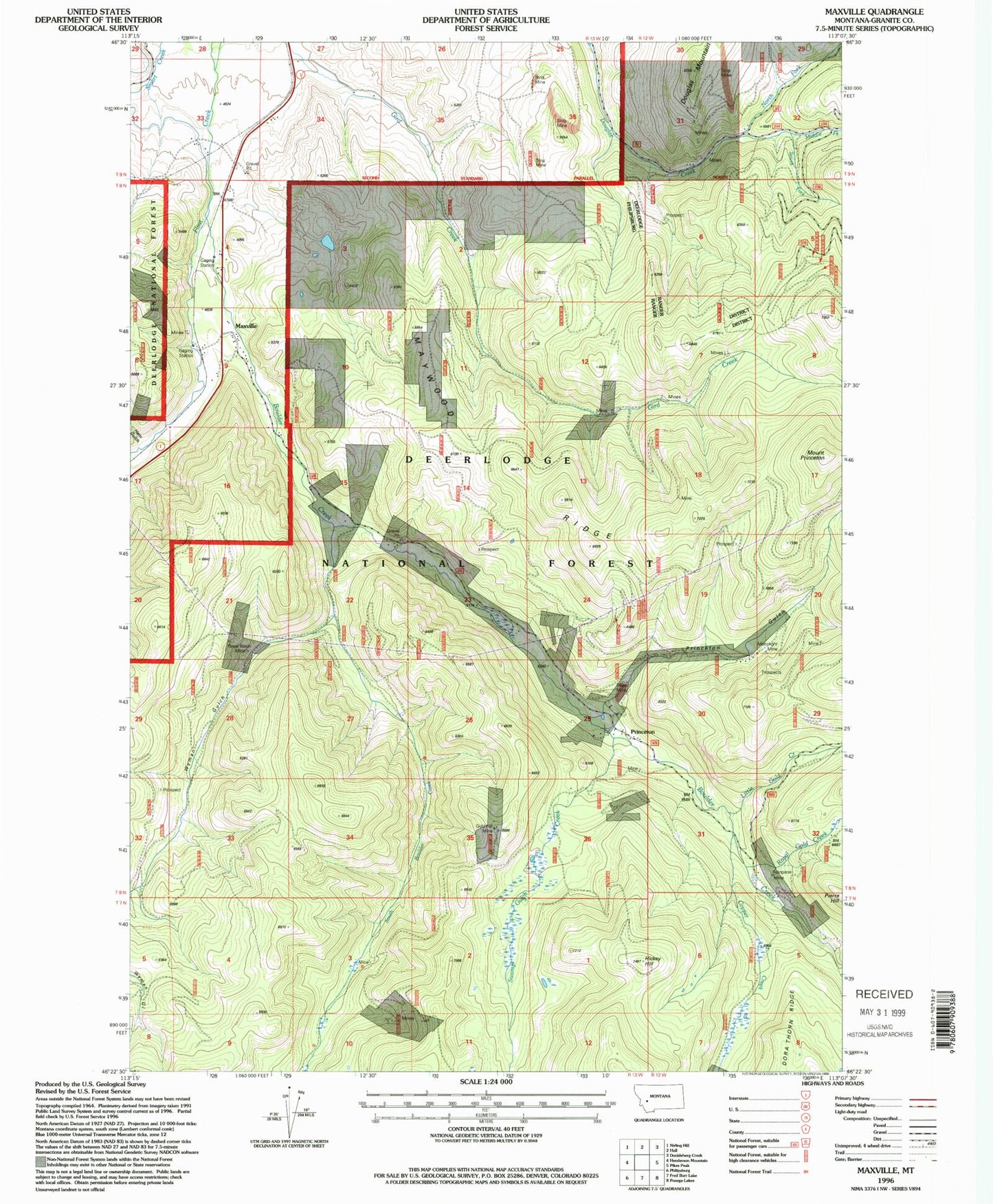
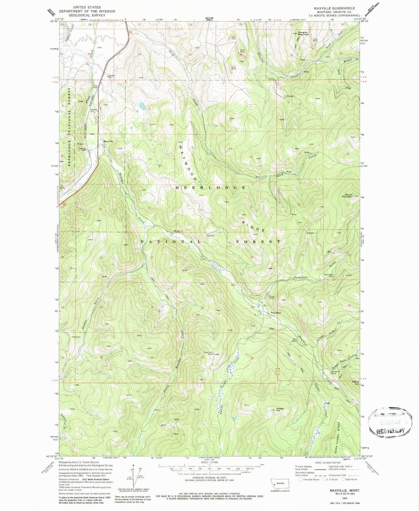
Classic USGS Maxville Montana 7.5'x7.5' Topo Map
Couldn't load pickup availability
Historical USGS topographic quad map of Maxville in the state of Montana. Map scale may vary for some years, but is generally around 1:24,000. Print size is approximately 24" x 27"
This quadrangle is in the following counties: Granite.
The map contains contour lines, roads, rivers, towns, and lakes. Printed on high-quality waterproof paper with UV fade-resistant inks, and shipped rolled.
Contains the following named places: 08N13W04BAAB01 Well, 08N13W04BDAC01 Well, 08N13W04CAAA01 Well, 08N13W04CADA01 Well, 08N13W09BDBA01 Well, Achegan Mine, Boulder, Boulder Creek, Brooklyn Mine, Cominco Phosphate Mine, Copper Creek, Copper Creek Mine, Death Road Mine, Douglas Mountain, Fields, Flint School, Gird Creek Mine, Gold Hill Mine, Gold Reef, Ham Gulch, Ham Gulch Mine, Hickey Hill, Little Gold Creek, Londonderry Mine, Maxville, Maxville Census Designated Place, Maxville Post Office, Maywood Ridge, Medhurst Post Office, Middle Fork Douglas Creek, Moonlight Mine, Mount Princeton, NE Section 7 Mine, NE SW Section 17 Mine, New Seattle Mine, Nonpareil Mine, North Fork Douglas Creek, Pierre Hill, Princeton, Princeton Gulch, Princeton Mine, Princeton Placer Mine, Princeton Post Office, Princeton School, Royal Basin Mine, Royal Gold Creek, Saranac Mine, SE Section 12 Mine, Snow Cap Mine, Snowcap Mine, South Boulder Creek, South Fork Douglas Creek, SW Section 7 Mine, Swamp Gulch Creek, Travonia Mine, Wyman Gulch