MyTopo
Classic USGS Maxwelton Washington 7.5'x7.5' Topo Map
Couldn't load pickup availability
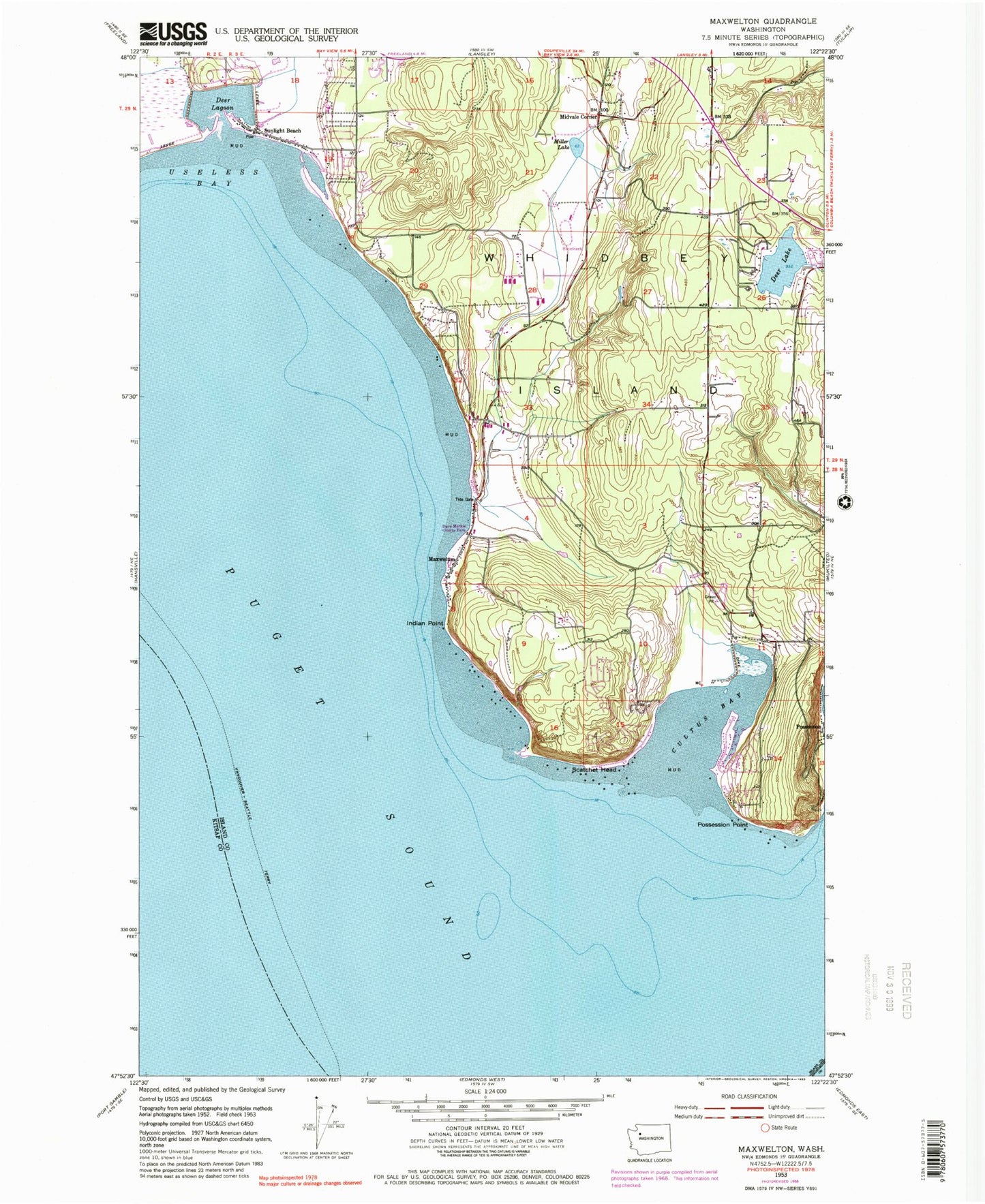
Historical USGS topographic quad map of Maxwelton in the state of Washington. Map scale may vary for some years, but is generally around 1:24,000. Print size is approximately 24" x 27"
This quadrangle is in the following counties: Island, Kitsap, Snohomish.
The map contains contour lines, roads, rivers, towns, and lakes. Printed on high-quality waterproof paper with UV fade-resistant inks, and shipped rolled.
Contains the following named places: Bayview Cemetery, Calvary Chapel, Cultus Bay, Dave Mackie County Park, Deer Lagoon, Deer Lake, Indian Point, Island County Fire Protection District 3 South Whidbey Fire / EMS Bayview Station 36, Island County Fire Protection District 3 South Whidbey Fire / EMS Maxwelton Station 33, Ken's Korner Shopping Plaza, Maxwelton, Midvale Corner, Miller Lake, Possession, Possession Point, Sandy Hook Yacht Club Estates, Scatchet Head, South Whidbey Island Division, Sunlight Beach, Toddle Inn Daycare Center, Useless Bay, Whidbey Island Waldorf School, ZIP Code: 98236