MyTopo
Classic USGS May Tank Pocket Arizona 7.5'x7.5' Topo Map
Couldn't load pickup availability
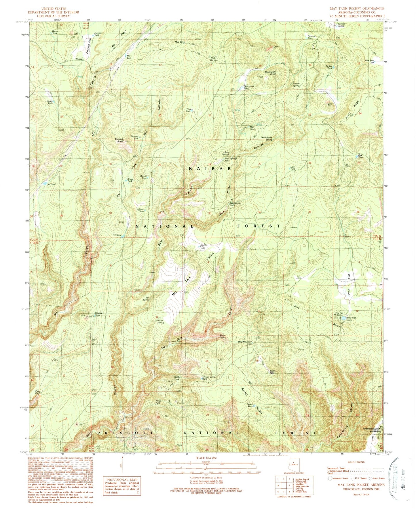
Historical USGS topographic quad map of May Tank Pocket in the state of Arizona. Typical map scale is 1:24,000, but may vary for certain years, if available. Print size: 24" x 27"
This quadrangle is in the following counties: Coconino.
The map contains contour lines, roads, rivers, towns, and lakes. Printed on high-quality waterproof paper with UV fade-resistant inks, and shipped rolled.
Contains the following named places: Bandit Tank, Bear Springs, Buzzard Knoll, Davenport Knoll, Davenport Tank, DT Tank, East Fork M C Canyon, Frog Pool, Highway Tank, Jackass Flat, MC Tank, May Tank, May Tank Canyon, May Tank Pocket, Mud Springs, Oak Tank, Pine Flat, Pine Flat Tank, Pine Ridge, Secret Pocket, Secret Tank, Sheep Tank, Stewart Spring, Summit Spring, Thirtysix Tank, Wild Horse Canyon, Wild Horse Spring, Winter Camp Tank, Bear Springs Tank, County Tank, Golden Bucksin Mine, Hidden Tank, Jackass Tank, Last Tank, Little Pine Flat, Mud Seep Tank, Nat Tanks, Pine Mountain Tank, Rock Tank, Rocky Ridge, Susan Tank, Verde Spring, Wild Horse Tank, Burro Tank, Wyno Tank, Baldy Tank, Pine Flat Headquarters, Indian Spring, Ben Spring, Hat Tank, Trap Tank, Pot Tank, Buzzard Tank, Turkey Tank, Summit Tank, Mud Tank, Overland Road Historic Trail, Breached Tank