MyTopo
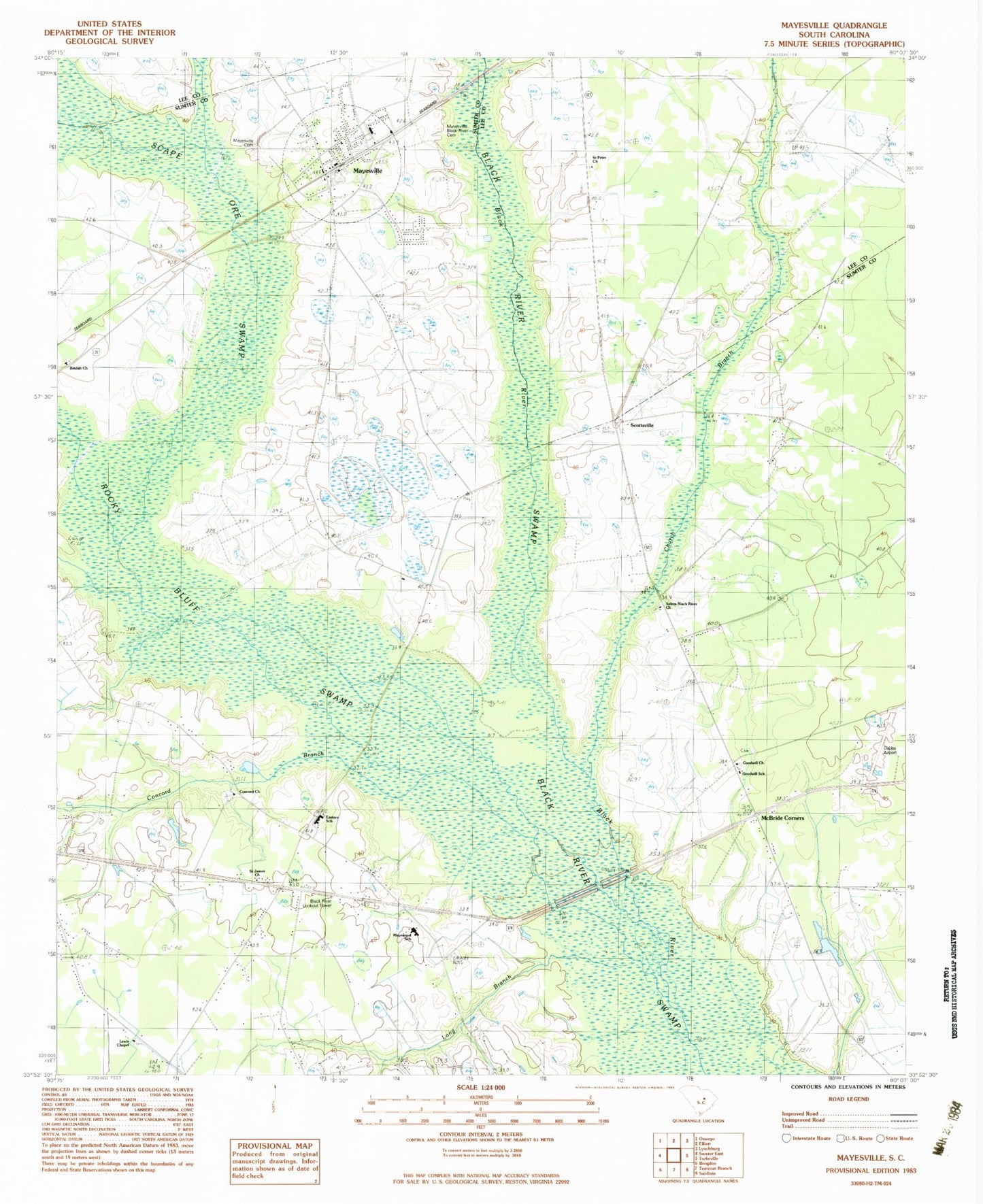
Classic USGS Mayesville South Carolina 7.5'x7.5' Topo Map
Couldn't load pickup availability
Historical USGS topographic quad map of Mayesville in the state of South Carolina. Map scale may vary for some years, but is generally around 1:24,000. Print size is approximately 24" x 27"
This quadrangle is in the following counties: Lee, Sumter.
The map contains contour lines, roads, rivers, towns, and lakes. Printed on high-quality waterproof paper with UV fade-resistant inks, and shipped rolled.
Contains the following named places: Alligator Branch, Beulah Cemetery, Beulah Church, Beulah School, Black River Lookout Tower, Brunsons Store, Church Branch, Coldstream Plantation, Concord Branch, Concord Church, Dabbs Airport, Eastern School, Friersons Store, Goodwill Chapel, Goodwill Church, Goodwill School, Howard Chapel, Howard School, Lewis Chapel, Lewis School, Little Long Branch, Long Branch, Mayesville, Mayesville Black River Cemetery, Mayesville Elementary School, Mayesville Post Office, Mayewood School, McBride Corners, McBride Crossing, Muldrows Crossing, Rocky Bluff Swamp, Saint James Church, Saint Peter Church, Saint Peter School, Salem Black River Church, Scape Ore Swamp, Scottsville, Scottville School, Sumter Fire Department Concord Station 10, Sumter Fire Department Dabbs Station 19, Sumter Fire Department Mayesville Station 5, Town of Mayesville, Wilsons Store, Witherspoon School