
MyTopo
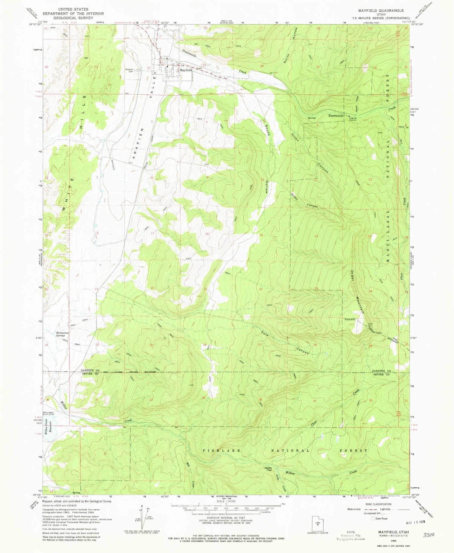
Classic USGS Mayfield Utah 7.5'x7.5' Topo Map
Couldn't load pickup availability
Historical USGS topographic quad map of Mayfield in the state of Utah. Map scale may vary for some years, but is generally around 1:24,000. Print size is approximately 24" x 27"
This quadrangle is in the following counties: Sanpete, Sevier.
The map contains contour lines, roads, rivers, towns, and lakes. Printed on high-quality waterproof paper with UV fade-resistant inks, and shipped rolled.
Contains the following named places: Clear Creek, Jacks Creek, Jacks Flat, Mayfield, Mayfield Cemetery, Mayfield Face Wildlife Management Area, Mayfield Post Office, Michaelson Springs, Mill Creek, North Cove, North Hollow, North Pine Creek, Olsen Canyon, Order Canyon, Order Mountain, Pole Canyon, South Hollow, South Pine Creek, The Church of Jesus Christ of Latter Day Saints, Town of Mayfield, Twelvemile Canyon, White Hills, Willow Creek Wildlife Management Area, ZIP Code: 84643


