MyTopo
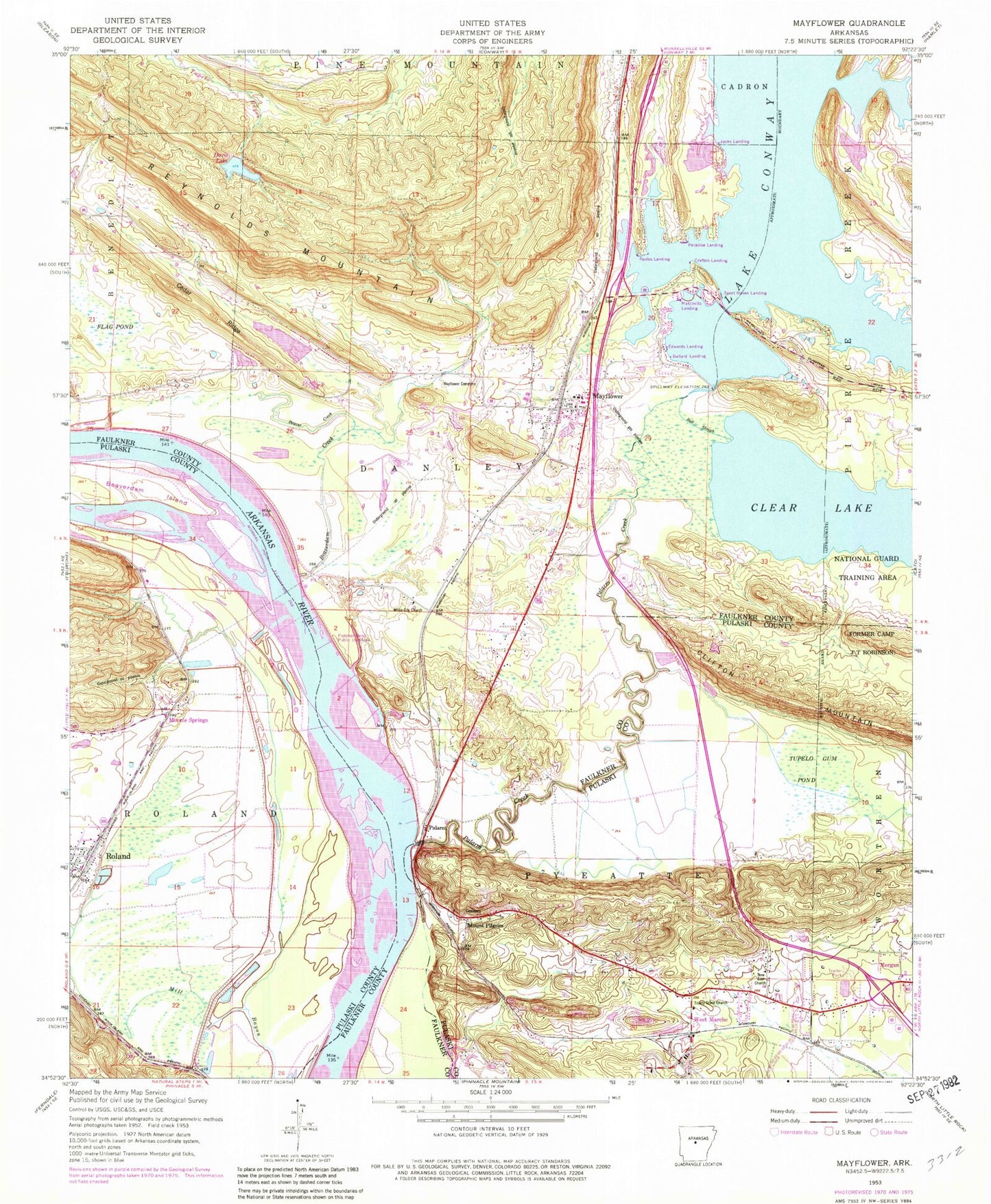
Classic USGS Mayflower Arkansas 7.5'x7.5' Topo Map
Couldn't load pickup availability
Historical USGS topographic quad map of Mayflower in the state of Arkansas. Map scale may vary for some years, but is generally around 1:24,000. Print size is approximately 24" x 27"
This quadrangle is in the following counties: Faulkner, Pulaski.
The map contains contour lines, roads, rivers, towns, and lakes. Printed on high-quality waterproof paper with UV fade-resistant inks, and shipped rolled.
Contains the following named places: Arkansas Game and Fish Enforcement, Ballard Landing, Beaver Creek, Beaverdam Creek, Beaverdam Island, Bell Slough, Bell Slough State Wildlife Management Area, Bibleway Church, Catorce, Cedar Ridge, City of Mayflower, Cobb Lake, Conway Lake Church, Crafton Landing, Davis Lake, Davis Lake Dam, Devils Bend, Edwards Landing, Flag Pond, Fletcher Bend, Fletcher Bend Public Use Area, Grassy Lake, Greens Lake, Haydens Store, Hi-way Landing, Jacks Landing, Jewell Lake, Jewell Lake Dam, Jones Hill, Jones Hill Baptist Church, L D Rogers Lake, L D Rogers Lake Dam, Lake Conway Dam, Lake Conway Nursery Pond, Lake Conway Nursey Pond Dam, Lake Maumelle Fire Department, Lake Maumelle Volunteer Fire Department District 8 Station 1, Maumelle Police Department, Mayflower, Mayflower Cemetery, Mayflower Elementary School, Mayflower High School, Mayflower Middle School, Mayflower Police Department, Mayflower Post Office, Mayflower Volunteer Fire Department, Methodist Behavioral Hospital, Monnie Springs, Mount Pilgrim, New Zion Church, Northside Church, Northwest Assembly Church, Palarm, Palarm Public Use Area, Paradise Landing, Pierce Creek Public Boat Landing, Pine Village Airport, Pine Village Volunteer Fire Department, Pooles Landing, Reynolds Mountain, Roberts Minnow Pond Dam, Roberts Pond, Rocky Gap, Roland, Sport Haven Landing, State of Arkansas, Stone Lake, Stone Lake Dam, Township of Danley, Township of Roland, Trinity Grove Church, Tupelo Gum Pond, Washam School, West Marche, White City Church