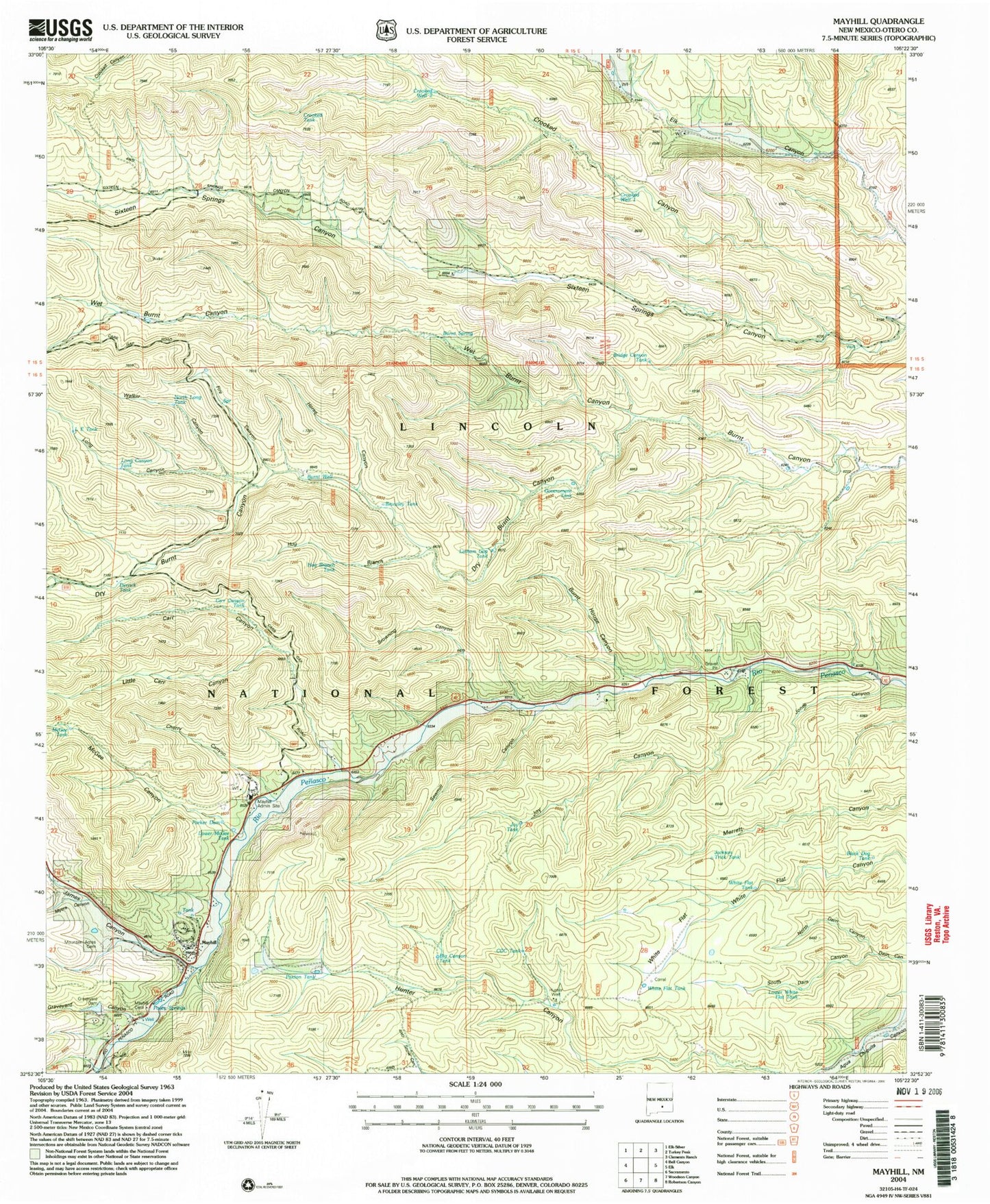
MyTopo
Classic USGS Mayhill New Mexico 7.5'x7.5' Topo Map
Couldn't load pickup availability
Historical USGS topographic quad map of Mayhill in the state of New Mexico. Map scale may vary for some years, but is generally around 1:24,000. Print size is approximately 24" x 27"
This quadrangle is in the following counties: Otero.
The map contains contour lines, roads, rivers, towns, and lakes. Printed on high-quality waterproof paper with UV fade-resistant inks, and shipped rolled.
Contains the following named places: Big Canyon Tank, Black Dog Tank, Brantley Tank, Bridge Canyon, Bridge Canyon Tank, Browning Canyon, Burnt House Canyon, Burnt Spring, Burnt Well, Carr Canyon, Carr Canyon Tank, CCC Tank, Cherry Canyon, Crooked Canyon, Crooked Tank, Crooked Well One, Crooked Well Two, Derrick Tank, Dry Burnt Canyon, Fire Canyon, First Baptist Church, Government Tank, Graveyard Canyon, Graveyard Dam, Hog Branch, Hog Branch Tank, Horse Canyon, Jackson Trick Tank, James Canyon, Jones Canyon, Joy Canyon, Joy Tank, Latham Gap Tank, LE Tank, Lincoln National Forest, Little Carr Canyon, Long Canyon, Long Canyon Tank, Lower McGee Tank, Lower White Flat Tank, Mayhill, Mayhill Administration Site, Mayhill Administrative Site, Mayhill Cemetery, Mayhill Census Designated Place, Mayhill Post Office, Mayhill Volunteer Fire Department Headquarters, Mayhill Volunteer Fire Department Substation 3, Mayhill Weather Station, McGee Canyon, McGee Tank, Mountain Acres Cemetery, Myers Canyon, North Dam Canyon, North Long Tank, Parker Dam, Parker Reservoir, Paxton Tank, Posey Springs, Sawmill Canyon, South Dam Canyon, Upper Rio Penasco Site 3a Dam, Walker Canyon, Wet Burnt Canyon, White Flat, White Flat Tank