MyTopo
Classic USGS Maynard Arkansas 7.5'x7.5' Topo Map
Couldn't load pickup availability
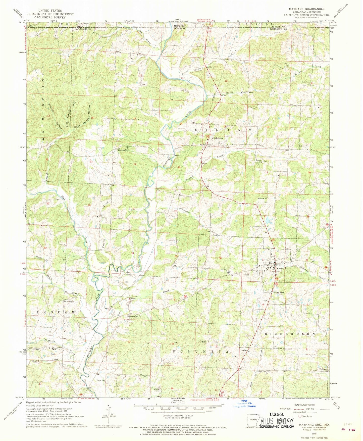
Historical USGS topographic quad map of Maynard in the state of Arkansas. Map scale may vary for some years, but is generally around 1:24,000. Print size is approximately 24" x 27"
This quadrangle is in the following counties: Randolph, Ripley.
The map contains contour lines, roads, rivers, towns, and lakes. Printed on high-quality waterproof paper with UV fade-resistant inks, and shipped rolled.
Contains the following named places: Albritten Creek, Barnett Cemetery, Blue Spring Hollow, Brakebill, Brakebill Church of Christ, Camp Creek, Columbia Jarrett Baptist Church, Dry Creek, Elkins Park, Foster Cemetery, Glaze Creek, Glaze Creek Cemetery, Glaze Creek Church of Christ, Hagood Creek, Harper Cemetery, Jarrett School, Jerrett, Lewis Creek, Martin Cemetery, Maynard, Maynard Cemetery, Maynard Elementary School, Maynard High School, Maynard Post Office, Maynard Volunteer Fire Department, Middlebrook, Middlebrook United Methodist Church, Mock, Mud Creek, Niccum Hollow, Old Siloam, Overby Cemetery, Overby Church, Rock Spring Hollow, Salem Baptist Church, Shaver Creek, Siloam Cemetery, Siloam Church, Sparkman Cemetery, Spencer Creek, Spring Creek, Tattle Creek, Tennessee Creek, Town of Maynard, Township of Ingram, Township of Siloam, Waldron Creek, Washington, Washington Cemetery, Washington Church of Christ, Washington School, Wright Creek