MyTopo
Classic USGS Maynardville Tennessee 7.5'x7.5' Topo Map
Couldn't load pickup availability
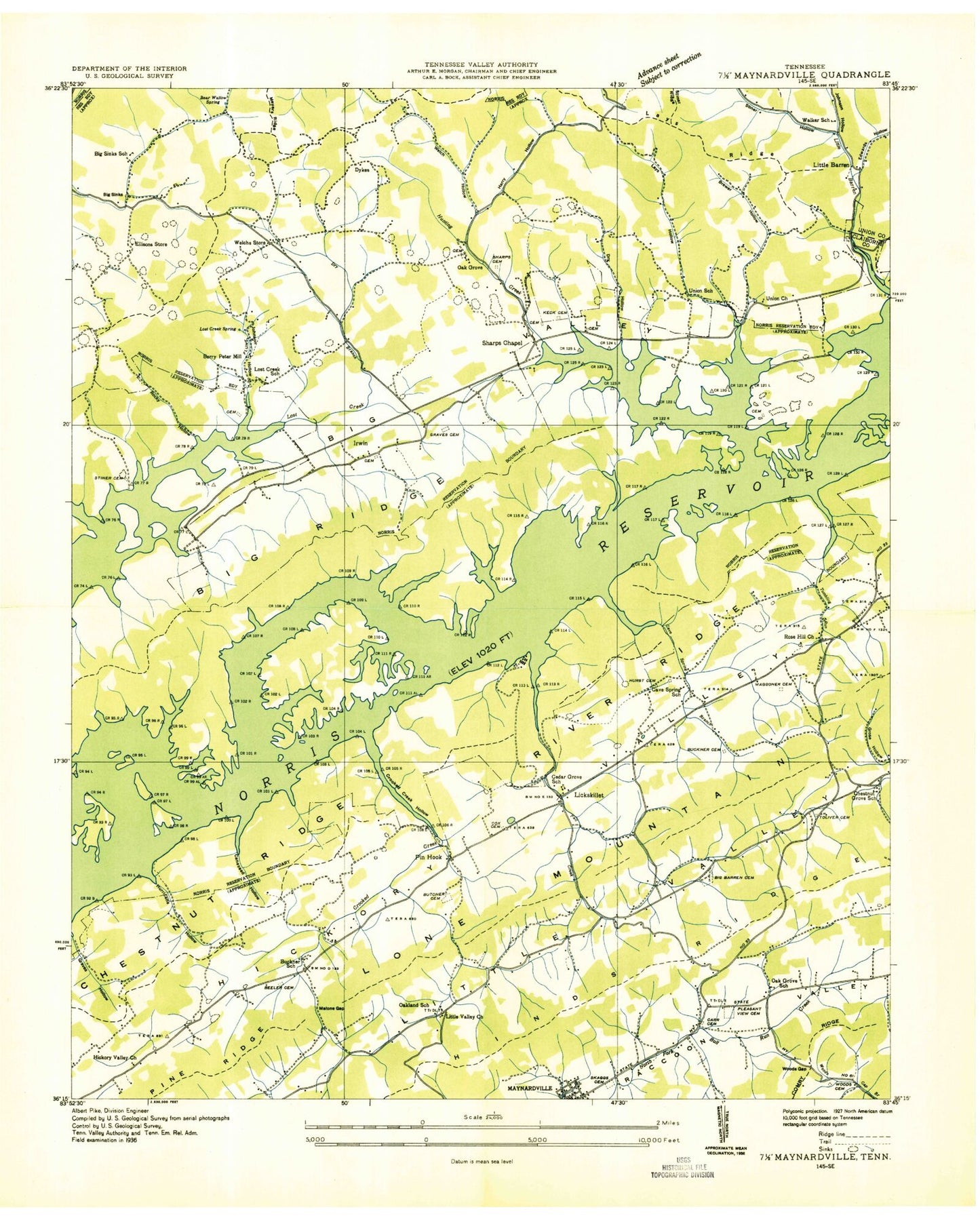
Historical USGS topographic quad map of Maynardville in the state of Tennessee. Map scale may vary for some years, but is generally around 1:24,000. Print size is approximately 24" x 27"
This quadrangle is in the following counties: Union.
The map contains contour lines, roads, rivers, towns, and lakes. Printed on high-quality waterproof paper with UV fade-resistant inks, and shipped rolled.
Contains the following named places: Bearwallow Spring, Beech Island, Beeler Cemetery, Beeler Gap, Berry-Peters Mill, Big Barren Cemetery, Big Ridge, Big Sinks, Big Sinks School, Big Valley, Brewer Hollow, Brewer Ridge, Browning Cemetery, Buckner Cemetery, Buckner School, Butcher Cemetery, Butcher Gap, Caneseed Hollow, Cave Spring, Cave Spring Branch, Cave Spring School, Cedar Grove Church, Cedar Grove School, Chestnut Grove, Chestnut Grove School, Commissioner District 3, Commissioner District 5, Cook Cemetery, Coon Cemetery, Cox Cemetery, Craig Ridge, Crooked Creek, Crooked Creek Hollow, Dry Branch, Dry Hollow, Dykes, Edwards Hollow, Ellison Cemetery, Ellisons Store, Fall Creek, Graves Cemetery, Graves Prospect, Grose Hollow, Hacker Gap, Hamilton Ford, Harry Hollow, Haversons, Hickory Valley Church, Hinds Ridge, Hubbs Cemetery, Hubbs Grove Baptist Church, Hubbs Grove School, Hughes Cemetery, Hunting Creek, Hurricane Branch, Hurricane Hollow, Hurricane Spring, Hurst Cemetery, Irwin, Irwin Chapel, Irwin Chapel Cemetery, Irwin School, Island F, Johnson Cemetery, Johnson Hollow, Keck Cemetery, Kelly Ford, Kettle Hollow School, Kiser Cemetery, Lake View Airport, Lake View School, Lakeview Dock, Lamdin Cemetery, Lay Cemetery, Lay Hollow, Lay Ridge, Lickskillet, Little Barren, Little Barren Creek, Little Valley Church, Loo, Lost Creek Mine, Lost Creek Spring, Malone Gap, Malone Spring, Maynardville, McBee Cemetery, Miller Cemetery, Moyers Ridge, Myers Cemetery, Needham Ford, Nelson Cemetery, Northeast Union Volunteer Fire Department, Oak Grove, Oak Grove Cemetery, Oak Grove School, Oakland School, Ousley Cemetery, Ousley Ford, Paulette Volunteer Fire Department Station 62, Pinhook, Pleasant View Cemetery, Pleasant View Church, Rabbit Island, River Ridge, Rocky Hollow, Rose Hill, Rose Hill Church, Rose Hill School, Rouse Prospect, Russell Ridge, Salling Cemetery, Sharp Cemetery, Sharps Chapel, Sharps Chapel Division, Sharps Chapel Elementary School, Sharps Chapel Post Office, Sharps Chapel Volunteer Fire Department, Shelby Cemetery, Skaggs Cemetery, Sky Park Fishing Lodge, Sparks Landing, Stiner Cemetery, Stiner Hollow, Tanner Hollow, Tennessee Department of Agriculture Division of Forestry Union, Toliver Cemetery, Tumbling Run, Union, Union Baptist Church, Union County, Union School, Waggoner Cemetery, Walker Cemetery, Walker School, Wattington Cemetery, Welch Crossroad, Welch Hollow, White Creek, Wood Cemetery, Wood Gap, Woods Prospect, ZIP Codes: 37807, 37866