MyTopo
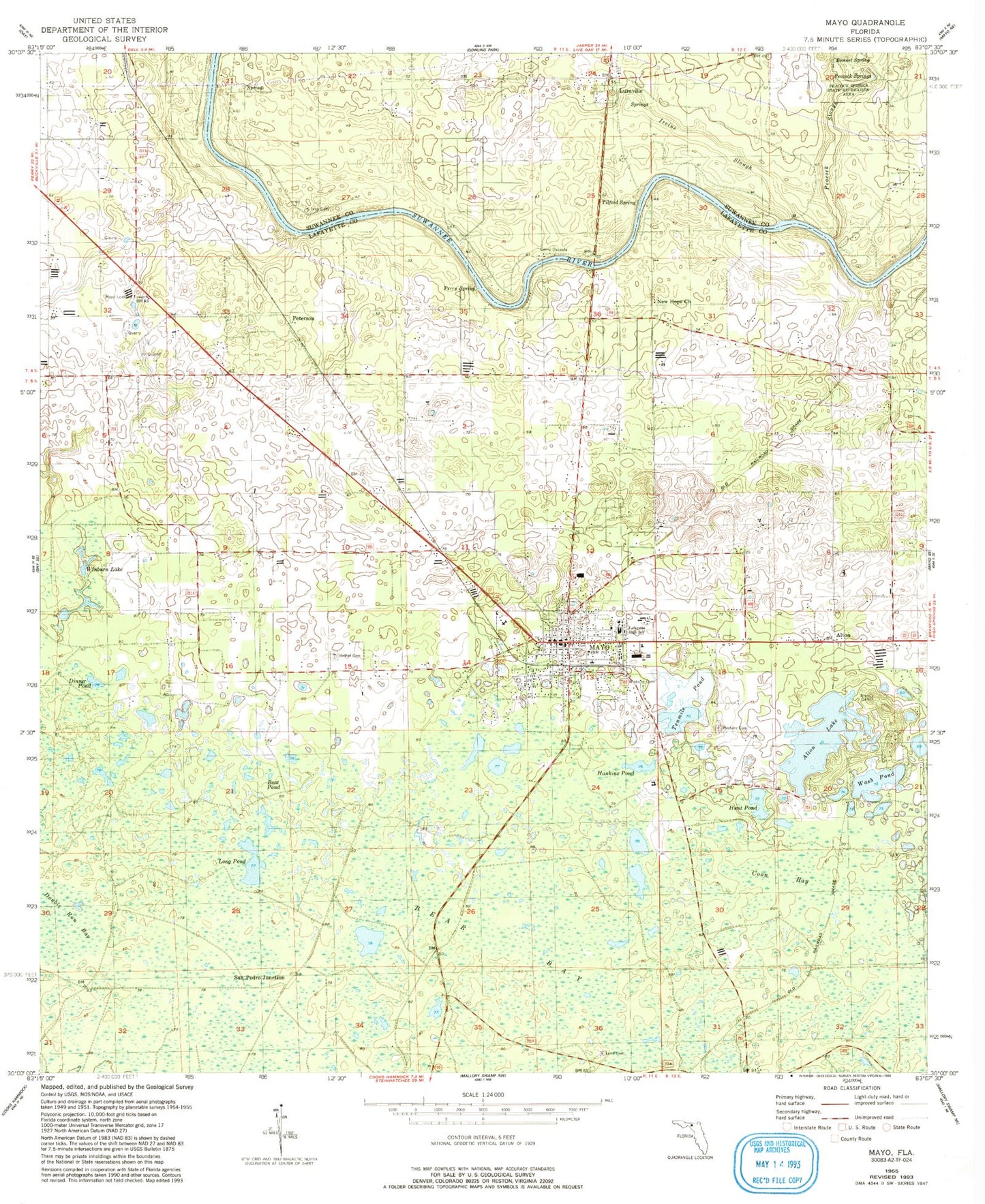
Classic USGS Mayo Florida 7.5'x7.5' Topo Map
Couldn't load pickup availability
Historical USGS topographic quad map of Mayo in the state of Florida. Map scale may vary for some years, but is generally around 1:24,000. Print size is approximately 24" x 27"
This quadrangle is in the following counties: Lafayette, Suwannee.
The map contains contour lines, roads, rivers, towns, and lakes. Printed on high-quality waterproof paper with UV fade-resistant inks, and shipped rolled.
Contains the following named places: Alton, Alton Cemetery, Alton Dairy, Alton Lake, Bethel Cemetery, Boat Pond, Bonnet Spring, Camp Osceola, Coon Bay, Dinner Pond, Double Run Bay, Hankins Pond, Hunt Pond, Irvine Slough, Ivey Cemetery, Kerbys Dairy, Lafayette County Sheriff's Office, Lafayette Elementary School, Lafayette High School, Land Cemetery, Long Pond, Luraville, Luraville Baptist Church, Luraville Volunteer Fire Department, May Volunteer Fire Department, Mayo, Mayo Lookout Tower, Mayo Mine, Mayo Post Office, Mayo Volunteer Fire Department, New Hope Church, Our Lady of Guadalupe Church, Peacock Slough, Peacock Springs, Perry Spring, Peterson, San Pedro Junction, Telford Spring, Tenmile Pond, The Trails Airport, Three Rivers Library System Lafayette County Public Library, Town of Mayo, Wash Pond, Wayfare Cemetery, WGSG-FM (Mayo), Winburn Cemetery, Winburn Lake, Winburn Pond, ZIP Code: 32066