MyTopo
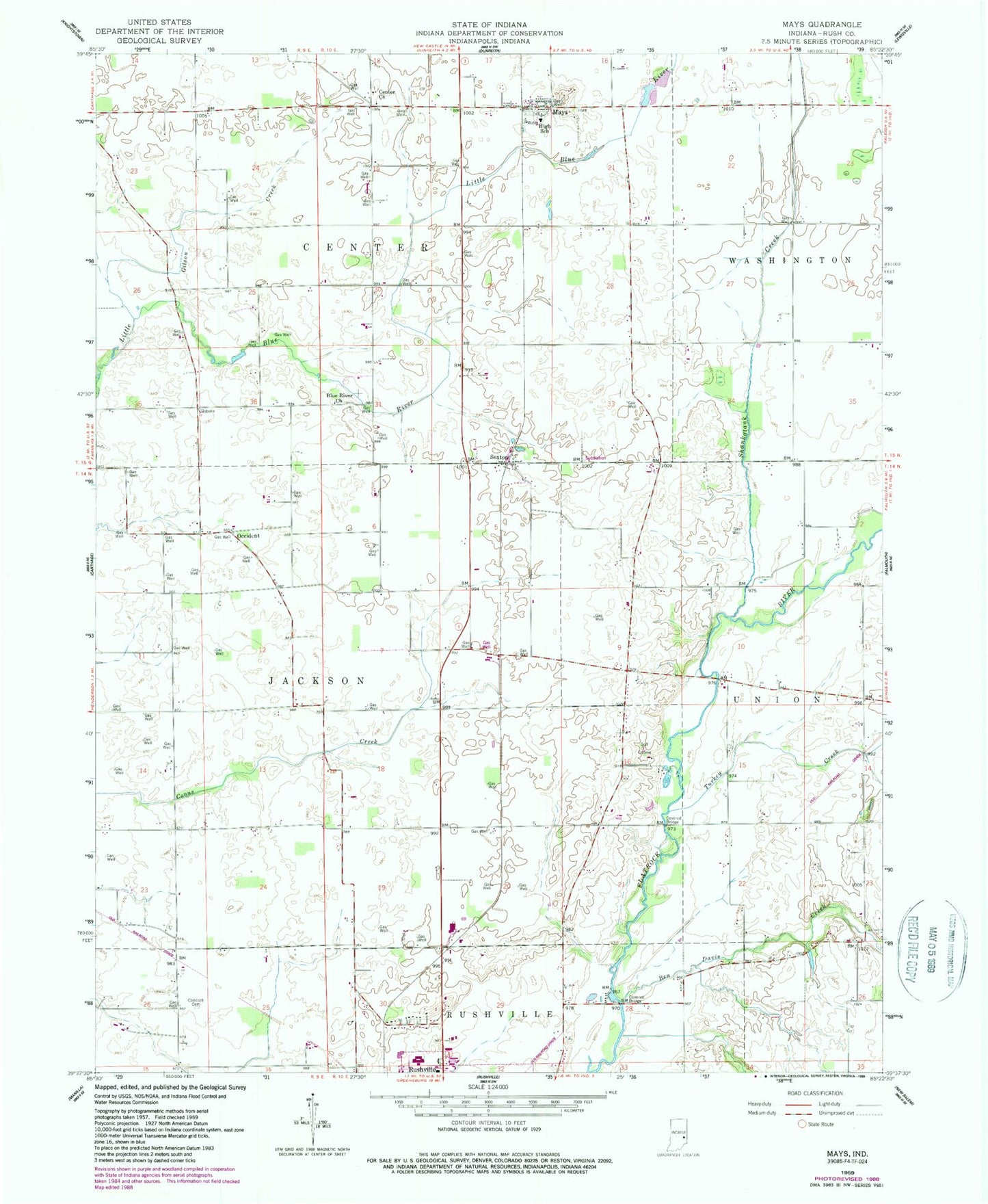
Classic USGS Mays Indiana 7.5'x7.5' Topo Map
Couldn't load pickup availability
Historical USGS topographic quad map of Mays in the state of Indiana. Map scale may vary for some years, but is generally around 1:24,000. Print size is approximately 24" x 27"
This quadrangle is in the following counties: Rush.
The map contains contour lines, roads, rivers, towns, and lakes. Printed on high-quality waterproof paper with UV fade-resistant inks, and shipped rolled.
Contains the following named places: Ben Davis Creek, Blue River Church, Center Church, Center Church Cemetery, Concord Cemetery, Conns Creek, Gilson Creek, Mays, Mays Elementary School, Occident, Raleigh Fire Department and Ambulance Service, Raleigh Fire Department Station 2, Raleigh Fire Department Station 3, Sexton, Shankatank Creek, Township of Center, Township of Jackson, Turkey Creek, WRCR-FM (Rushville), ZIP Code: 46155