
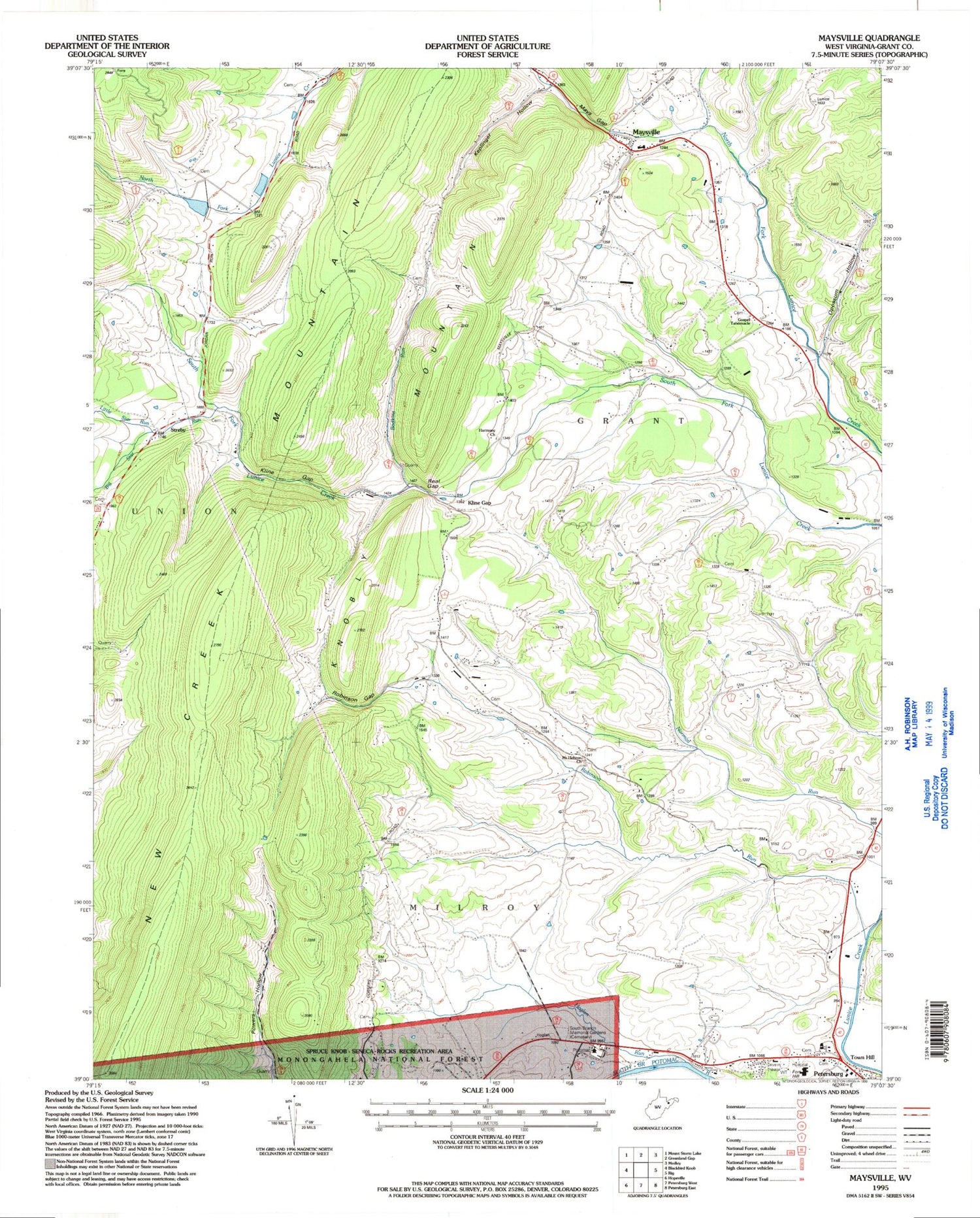
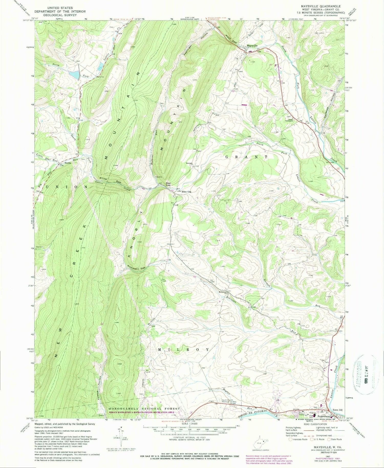
MyTopo
Classic USGS Maysville West Virginia 7.5'x7.5' Topo Map
Couldn't load pickup availability
Historical USGS topographic quad map of Maysville in the state of West Virginia. Map scale may vary for some years, but is generally around 1:24,000. Print size is approximately 24" x 27"
This quadrangle is in the following counties: Grant.
The map contains contour lines, roads, rivers, towns, and lakes. Printed on high-quality waterproof paper with UV fade-resistant inks, and shipped rolled.
Contains the following named places: Big Star Run, Bodkins Run, Eureka School, Fort Hill, Fort Mullegan, Gospel Tabernacle, Grant County, Grant Memorial Hospital, Harmony Church, Hoglan Run, Johnsonville School, Keplinger Hollow, Kline Gap, Kline Gap School, Little Star Run, Lunice Creek Structure Number Nine Dam, Mays Gap, Maysville, Maysville Elementary School, Maysville Post Office, Maysville Volunteer Fire Department, Mount Hebron Cemetery, Mount Hebron Church, Mountain Top School, Opossum Hollow, Patomac District Ranger Station, Petersburg Post Office, Quantico School, Real Gap, Robinson Gap, Robinson Run, Scott School, South Branch Memorial Gardens, Streby, Town Hill, ZIP Code: 26833


