MyTopo
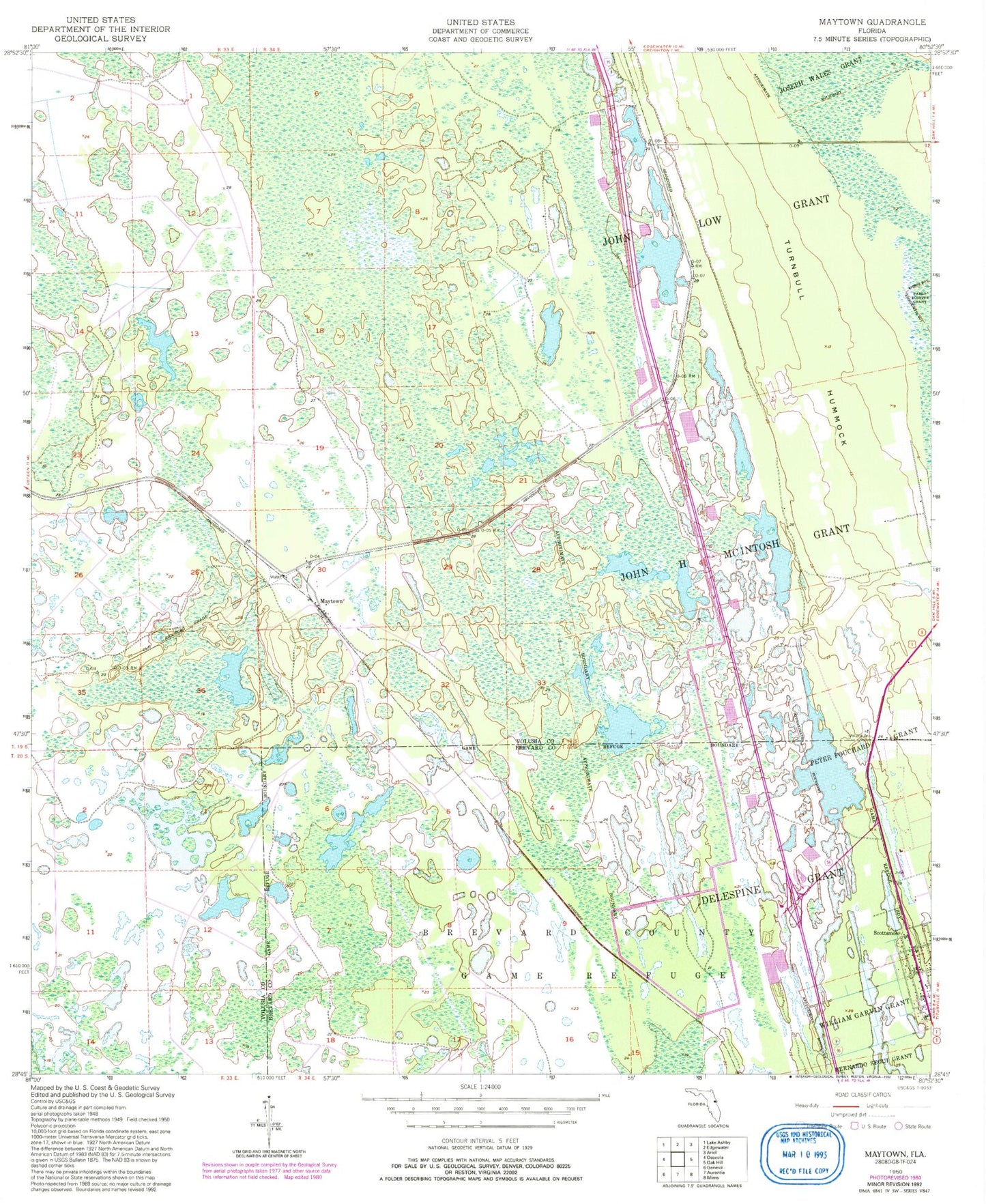
Classic USGS Maytown Florida 7.5'x7.5' Topo Map
Regular price
$16.95
Regular price
Sale price
$16.95
Unit price
per
Couldn't load pickup availability
Historical USGS topographic quad map of Maytown in the state of Florida. Typical map scale is 1:24,000, but may vary for certain years, if available. Print size: 24" x 27"
This quadrangle is in the following counties: Brevard, Volusia.
The map contains contour lines, roads, rivers, towns, and lakes. Printed on high-quality waterproof paper with UV fade-resistant inks, and shipped rolled.
Contains the following named places: John H McIntosh Grant, John Low Grant, Maytown, Peter Fouchard Grant, Scottsmoor, Challenger Lake, Farmton Wildlife Management Area, Blue Ridge Flightpark, Scottsmoor Post Office, Little Lake X, Scottsmoor Volunteer Fire Department Station 20, Davis Grave Site