MyTopo
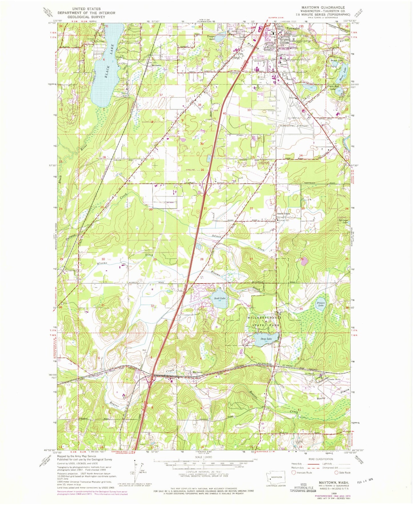
Classic USGS Maytown Washington 7.5'x7.5' Topo Map
Couldn't load pickup availability
Historical USGS topographic quad map of Maytown in the state of Washington. Map scale may vary for some years, but is generally around 1:24,000. Print size is approximately 24" x 27"
This quadrangle is in the following counties: Thurston.
The map contains contour lines, roads, rivers, towns, and lakes. Printed on high-quality waterproof paper with UV fade-resistant inks, and shipped rolled.
Contains the following named places: Allen Creek, Belmore, Black Lake, Black Lake Elementary School, Bush, Bush Prairie, City of Tumwater, Cricket Field, Deep Lake, Dempsey Creek, Maytown, McLane / Black Lake Fire Department Station 95, Millersylvania State Park, Mountain View Christian Church of the Nazarene, Munn Lake, Nazarene Christian School, Northwest Helicopters Heliport, Olympia Army Air Field, Olympia Regional Airport, Olympic Memorial Garden Cemetery, Peter G Schmidt Elementary School, Pitman Lake, Scott Lake, South Union, Springer Lake, Susan Lake, Thurston County Fire District 6 East Olympia Fire District Station 63, Trails End Lake, Trosper Lake, Tumwater Fire Department Headquarters, Tumwater High School, Tumwater Middle School, Tumwater Police Department, Tumwater Post Office, West Thurston Regional Fire Authority Central Battalion Station 1 - 6 Maytown, West Thurston Regional Fire Authority North Battalion Station 1 - 2 Littlerock, West Thurston Regional Fire Authority North Battalion Station 1 - 4 - Scott Lake, ZIP Code: 98501