MyTopo
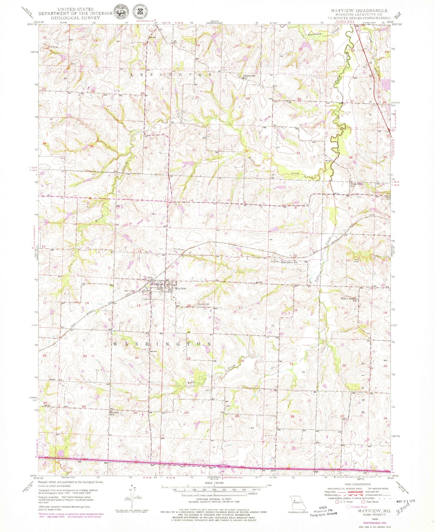
Classic USGS Mayview Missouri 7.5'x7.5' Topo Map
Couldn't load pickup availability
Historical USGS topographic quad map of Mayview in the state of Missouri. Map scale may vary for some years, but is generally around 1:24,000. Print size is approximately 24" x 27"
This quadrangle is in the following counties: Lafayette.
The map contains contour lines, roads, rivers, towns, and lakes. Printed on high-quality waterproof paper with UV fade-resistant inks, and shipped rolled.
Contains the following named places: Bertz Lake, Brush Creek, City of Mayview, Douthitt School, Elm Grove School, Fortyville, Gray Lake Dam, Hoeppner South Lake Dam, Iles Lake Dam, Irrigation Lake Dam, Lafayette C-24 Lake, Lafayette County, Lake Mizzou Dam, Maple Glen School, Mayview, Mayview - Zion Cemetery, Mayview Fire Department, Mayview Post Office, Number 142 Reservoir, Number 186 Reservoir, Number 187 Reservoir, Odell Lake Section 1 Dam, Plum Grove School, Poole Cemetery, Prairie School, Stewart Lake, Tabo Creek Watershed Structure A-20 Dam, Tabo Creek Watershed Structure A-26 Dam, Tabo Creek Watershed Structure A-31 Dam, Tabo Creek Watershed Structure B-20 Dam, Tabo Creek Watershed Structure B-21 Dam, Tabo Creek Watershed Structure B-23 Dam, Tabo Creek Watershed Structure B-24 Dam, Tabo Creek Watershed Structure B-27 Dam, Tabo Creek Watershed Structure B-28 Dam, Tabo Creek Watershed Structure B-31 Dam, Tabo Creek Watershed Structure B-32 Dam, Tabo Creek Watershed Structure B-33 Dam, Tabo Creek Watershed Structure C-20 Dam, Tabo Creek Watershed Structure C-21 Dam, Tabo Creek Watershed Structure C-23 Dam, Tabo Creek Watershed Structure C-24 Dam, Tabo Creek Watershed Structure C-32 Dam, Township of Washington, Wegener Dam, Wheatly School, Willow Branch School, ZIP Code: 64071