MyTopo
Classic USGS Mayville Michigan 7.5'x7.5' Topo Map
Couldn't load pickup availability
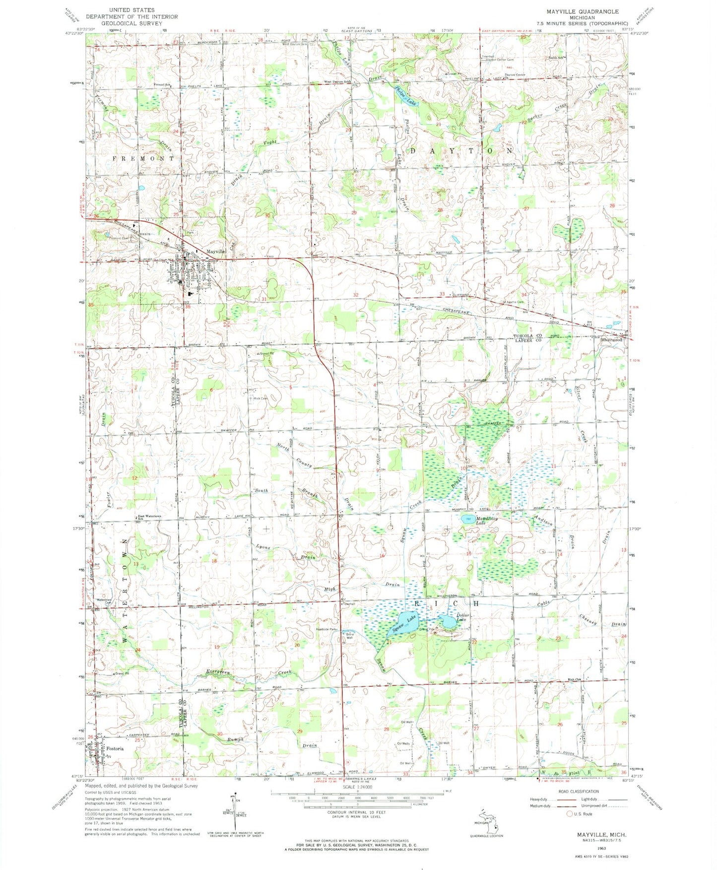
Historical USGS topographic quad map of Mayville in the state of Michigan. Map scale may vary for some years, but is generally around 1:24,000. Print size is approximately 24" x 27"
This quadrangle is in the following counties: Lapeer, Tuscola.
The map contains contour lines, roads, rivers, towns, and lakes. Printed on high-quality waterproof paper with UV fade-resistant inks, and shipped rolled.
Contains the following named places: Andison Drain, Cable Drain, Cox Drain, Dayton Center Cemetery, Dayton Center Church, Dollar Lake, East Watertown School, Evergreen Creek, Fisher Convalescent Home, Fostoria, Fostoria Baptist Church, Fostoria Post Office, Fostoria United Methodist Church, Fowler Drain, Fremont Cemetery, Fremont Drain, Frenzel School, Greenbrier Golf Club, High Drain, Lyons Drain, Mawdesley Lake, Mayville, Mayville Area Ambulance Service, Mayville District Public Library, Mayville Elementary School, Mayville Fire Department, Mayville High School, Mayville Museum, Mayville Police Department, Mayville Post Office, Mayville Station, Mayville United Methodist Church, Mills Memorial Baptist Church, North County Drain, Phelps Lake, Pleasant View Free Methodist Church, Rich Cemetery, Rich Church, Rumph Drain, Saint Agatha Cemetery, Saint Joseph Church, Saint Paul Lutheran Church, Silver Creek, Smith School, South Branch North County Drain, Spring of Life Community Church, Squaw Creek Drain, Squaw Lake, Township of Dayton, Township of Rich, Village of Mayville, Voght Drain, Wait Post Office, Watertown Cemetery, Watertown Township Fire Department, Watertown Township Hall, West Dayton Cemetery, West Dayton School, ZIP Codes: 48744, 48760