MyTopo
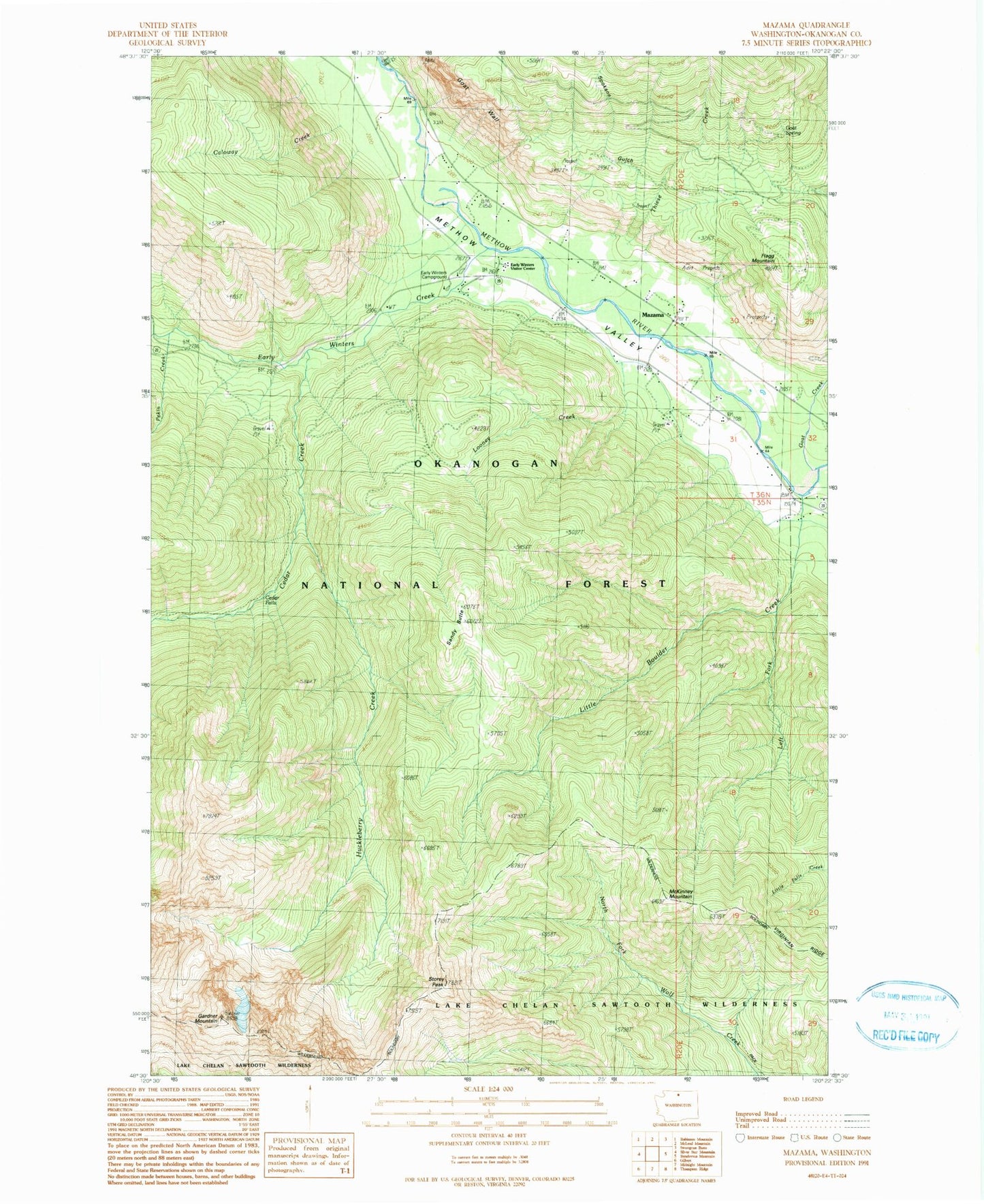
Classic USGS Mazama Washington 7.5'x7.5' Topo Map
Couldn't load pickup availability
Historical USGS topographic quad map of Mazama in the state of Washington. Map scale may vary for some years, but is generally around 1:24,000. Print size is approximately 24" x 27"
This quadrangle is in the following counties: Okanogan.
The map contains contour lines, roads, rivers, towns, and lakes. Printed on high-quality waterproof paper with UV fade-resistant inks, and shipped rolled.
Contains the following named places: Aero Methow Rescue Service, Caloway Creek, Cedar Creek, Cedar Creek Trail, Cedar Falls, Early Winters Campground, Early Winters Creek, Early Winters Visitor Center, Early Winters Visitors Station, Flagg Mountain, Gardner Mountain, Goat Creek, Goat Peak Trail, Goat Spring, Goat Wall, Goat Wall Creek, Huckleberry Creek, Left Fork Little Boulder Creek, Little Boulder Creek, Looney Creek, Mazama, McKinney Mountain, Okanogan Fire District 6 Mazama Fire Department, Pekin Creek, Sandy Butte, Spokane Gulch, Storey Peak, Thiese Creek, Virginian Ridge