
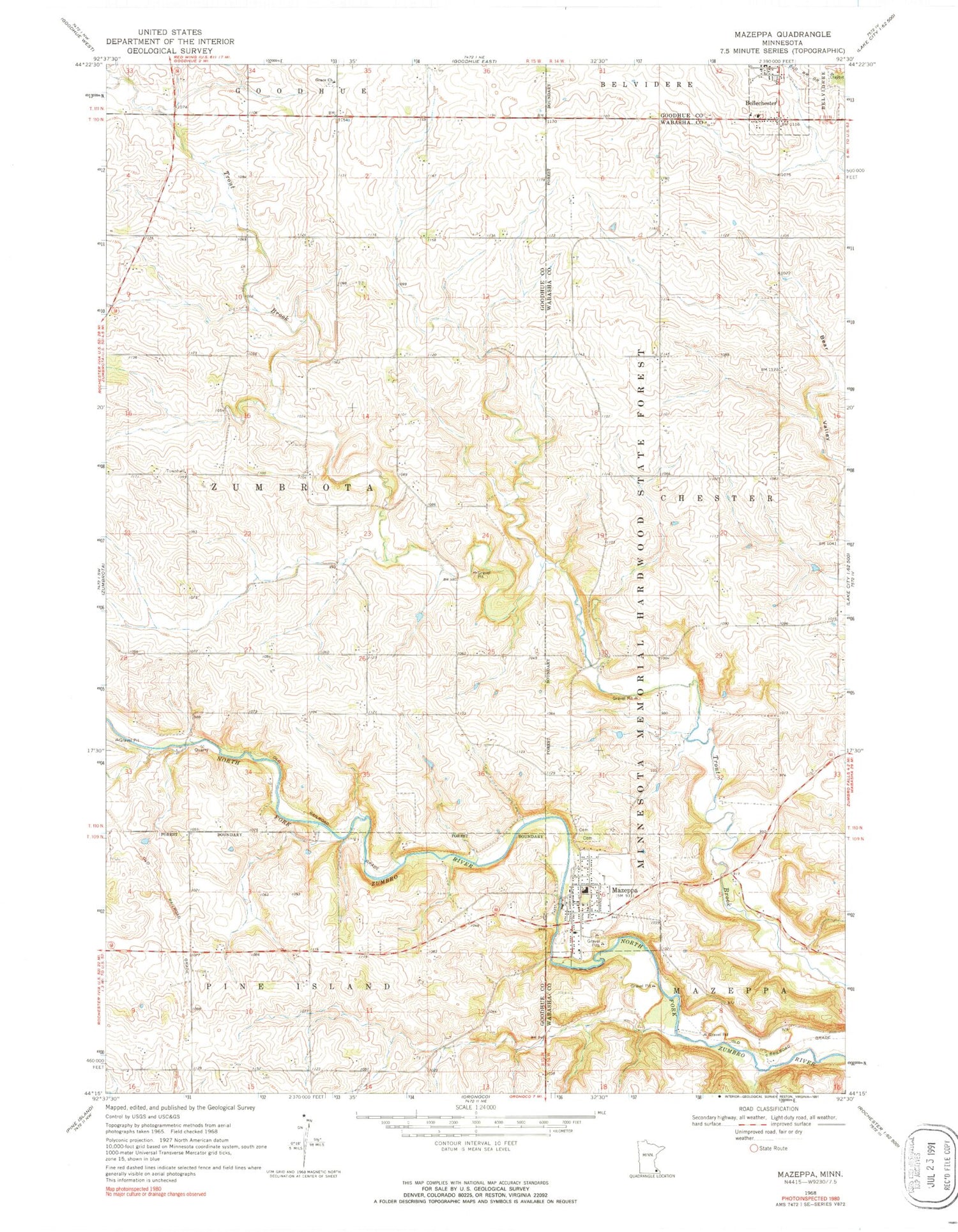
MyTopo
Classic USGS Mazeppa Minnesota 7.5'x7.5' Topo Map
Couldn't load pickup availability
Historical USGS topographic quad map of Mazeppa in the state of Minnesota. Map scale may vary for some years, but is generally around 1:24,000. Print size is approximately 24" x 27"
This quadrangle is in the following counties: Goodhue, Wabasha.
The map contains contour lines, roads, rivers, towns, and lakes. Printed on high-quality waterproof paper with UV fade-resistant inks, and shipped rolled.
Contains the following named places: Apple Ridge Orchard, Bellechester, Bellechester Post Office, City of Bellechester, City of Mazeppa, Grace Church, Grace Luthern Church Cemetery, Mazeppa, Mazeppa Cemetery, Mazeppa Fire and Rescue, Mazeppa Post Office, Mazeppa School, Merlyn Hadler, Merlyn Hadler Detention Dam, Pahl View Farm, Saint John's Lutheran Church, Saint Mary's Catholic Cemetery, Saint Peter and Paul Catholic Church, Saints Peter and Paul Catholic Cemetery, Structure S-21B Dam, Structure S-22B Dam, Township of Zumbrota, Zumbro River Dam, Zumbro River Reservoir, Zumbrota East Cemetery, ZIP Code: 55956


