MyTopo
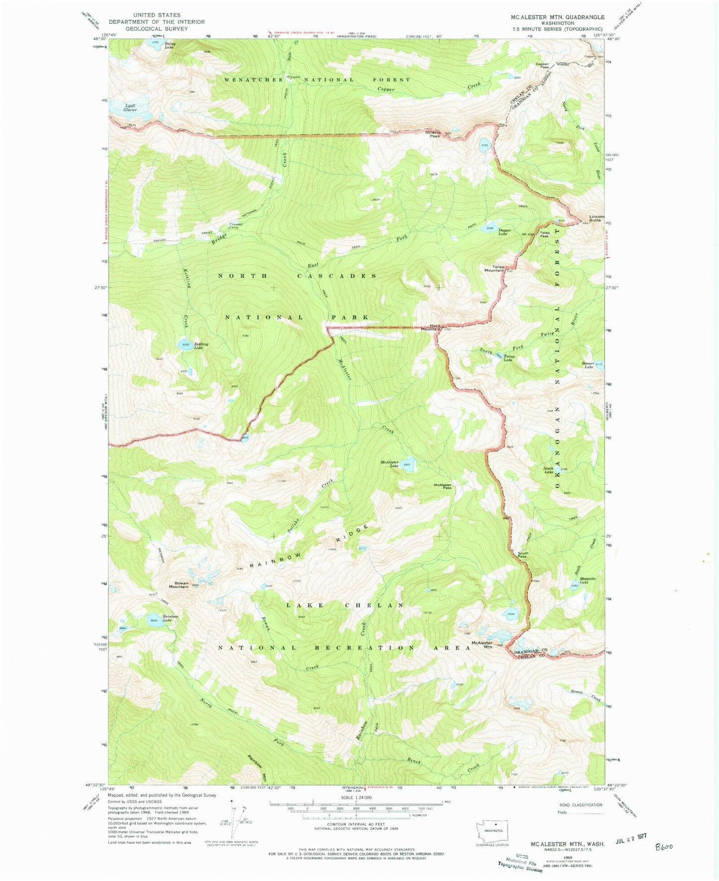
Classic USGS McAlester Mountain Washington 7.5'x7.5' Topo Map
Couldn't load pickup availability
Historical USGS topographic quad map of McAlester Mountain in the state of Washington. Typical map scale is 1:24,000, but may vary for certain years, if available. Print size: 24" x 27"
This quadrangle is in the following counties: Chelan, Okanogan.
The map contains contour lines, roads, rivers, towns, and lakes. Printed on high-quality waterproof paper with UV fade-resistant inks, and shipped rolled.
Contains the following named places: Beaner Lake, Bench Creek, Bowan Creek, Bowan Mountain, Copper Creek, Copper Pass, Dagger Lake, East Fork McAlester Creek, Fireweed Camp, Hock Mountain, Kettling Creek, Kettling Lake, Lincoln Butte, Lyall Glacier, McAlester Creek, McAlester Lake, McAlester Mountain, McAlester Pass, Mosquito Lake, North Fork Rainbow Creek, Rainbow Lake, Rainbow Lake Trail, Rainbow Ridge, Solleks Creek, South Lake, South Pass, State Creek, Stiletto Peak, Twisp Lake, Twisp Mountain, Twisp Pass