
MyTopo
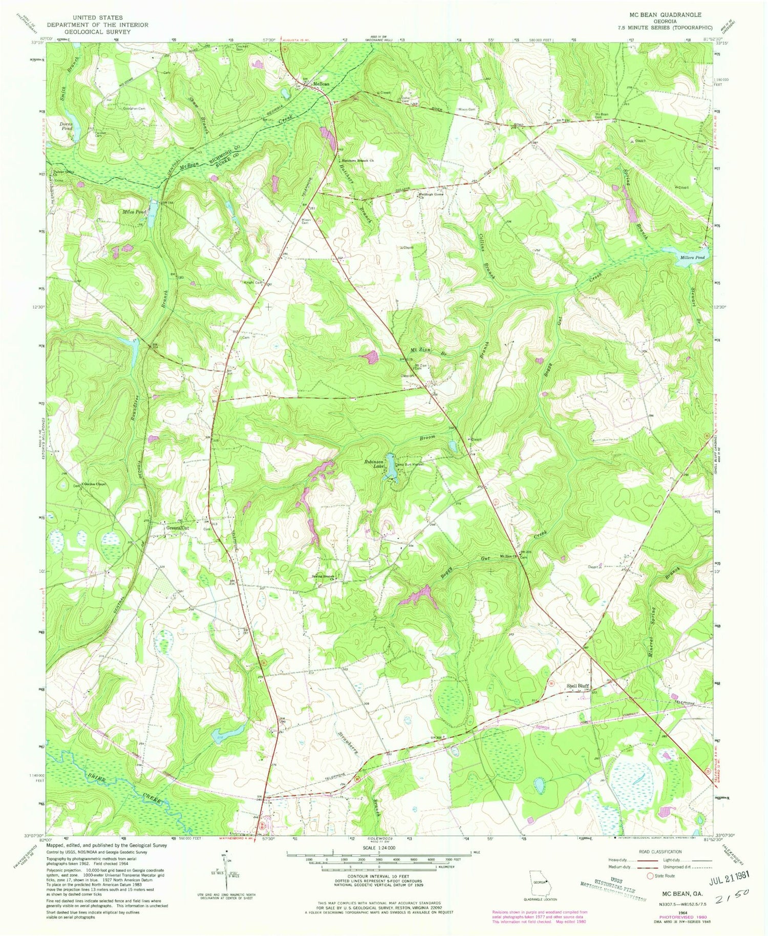
Classic USGS McBean Georgia 7.5'x7.5' Topo Map
Couldn't load pickup availability
Historical USGS topographic quad map of McBean in the state of Georgia. Map scale may vary for some years, but is generally around 1:24,000. Print size is approximately 24" x 27"
This quadrangle is in the following counties: Burke, Richmond.
The map contains contour lines, roads, rivers, towns, and lakes. Printed on high-quality waterproof paper with UV fade-resistant inks, and shipped rolled.
Contains the following named places: Boyd Lake, Boyd Lake Dam, Broom Branch, Burke County Emergency Management Agency Engine Company 2, Camp Burt Maxwell, Collins Branch, Colson School, Cosnahan Cemetery, Crockett Lake, Crockett Lake Dam, Dorns Pond, Fieldings Grove Church, Fryhofer Lake, Fryhofer Lake Dam, Fulcher Cemetery, Gordon Chapel, Gordon Hill School, Greens Cut, Greens Cut Church, Greens Cut Division, Hagler Lake, Hagler Lake Dam, Hatchers Branch, Hatchers Branch Church, Hatchers School, Knight Cemetery, McBean, McBean Cemetery, McBean Church, Meeks Store, Miles Pond, Millers Pond, Millers Pond Dam, Mixon Cemetery, Mount Zion Branch, Mount Zion Cemetery, Mount Zion Church, Mount Zion Methodist Church, Palmer Grove Church, Red School, Robinson Lake, Robinson Lake Dam, Roundtree Branch, Sandy Hill Airport, Shaw Branch, Shell Bluff, Smith Branch, Smith Branch Pond Dam, Smith Cemetery, Southland Timber Lake, Southland Timber Lake Dam, Spring Branch, Spring Branch Church, Spring Branch School, Stewart Branch, Usher Cemetery, Watkins Pond, WYFA-FM (Waynesboro)


