MyTopo
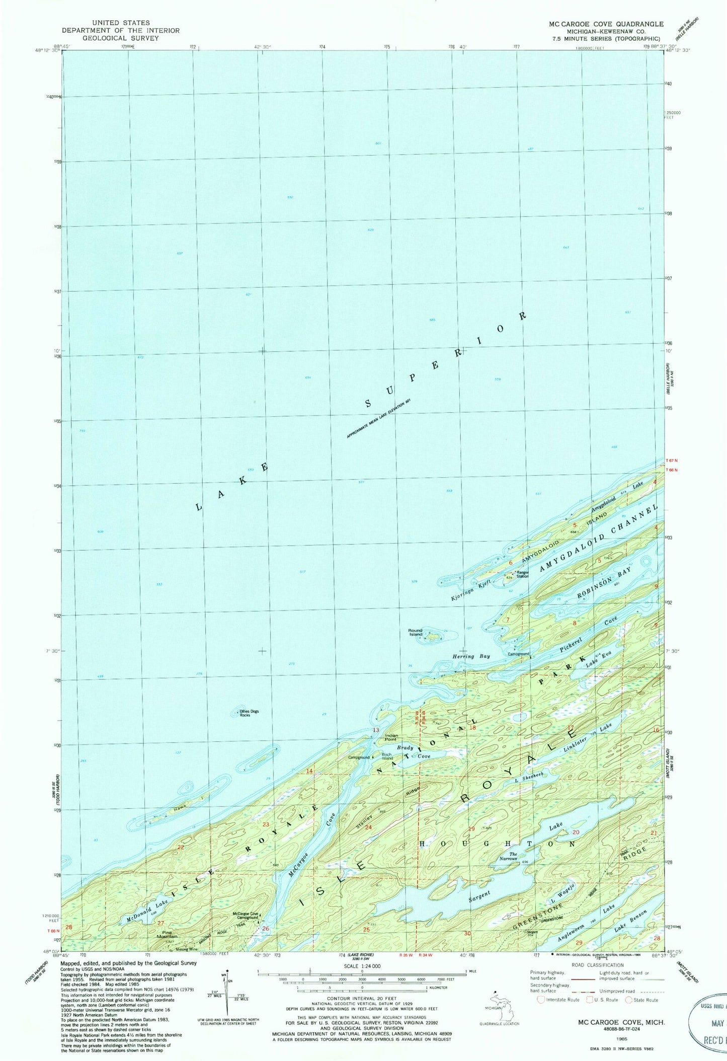
Classic USGS McCargoe Cove Michigan 7.5'x7.5' Topo Map
Couldn't load pickup availability
Historical USGS topographic quad map of McCargoe Cove in the state of Michigan. Map scale may vary for some years, but is generally around 1:24,000. Print size is approximately 24" x 27"
This quadrangle is in the following counties: Keweenaw.
The map contains contour lines, roads, rivers, towns, and lakes. Printed on high-quality waterproof paper with UV fade-resistant inks, and shipped rolled.
Contains the following named places: Amygdaloid Arch, Amygdaloid Lake, Angleworm Lake, Birch Island, Birch Island Campground, Brady Cove, Hawk Island, Herring Bay, Indian Point, Kjaringa Kjeft, Lake Benson, Lake Eva, Lake Shesheeb, Lake Wagejo, Linklater Lake, McCargoe Cove, McCargoe Cove Campground, McDonald Lake, Minong Mine, Minong Post Office, Ollies Dogs Rocks, Pickerel Cove, Pine Mountain, Round Island, Sargent Lake, Stanley Ridge, The Narrows