MyTopo
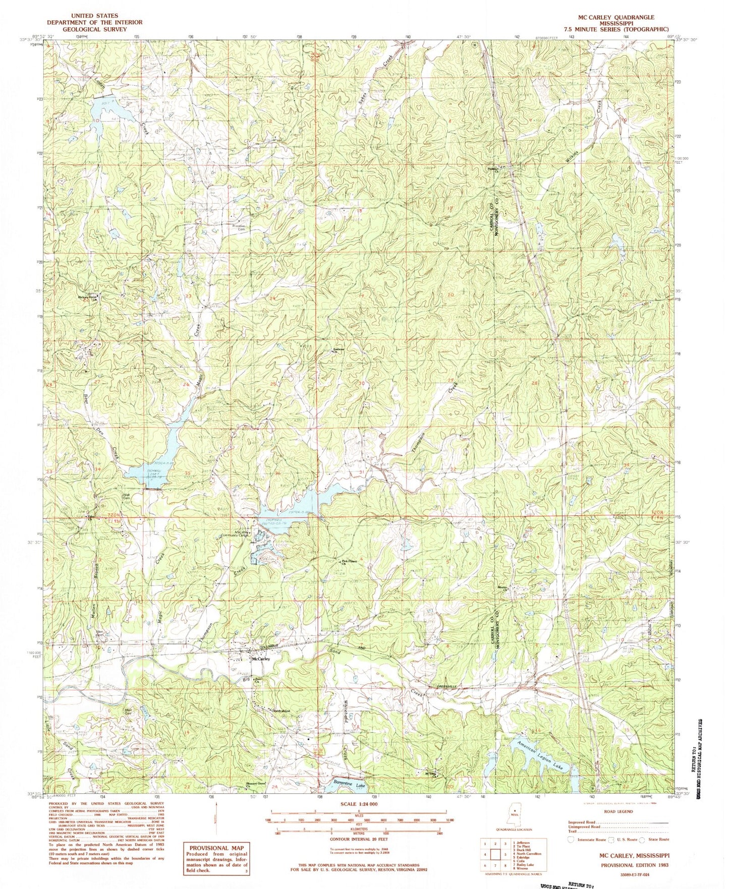
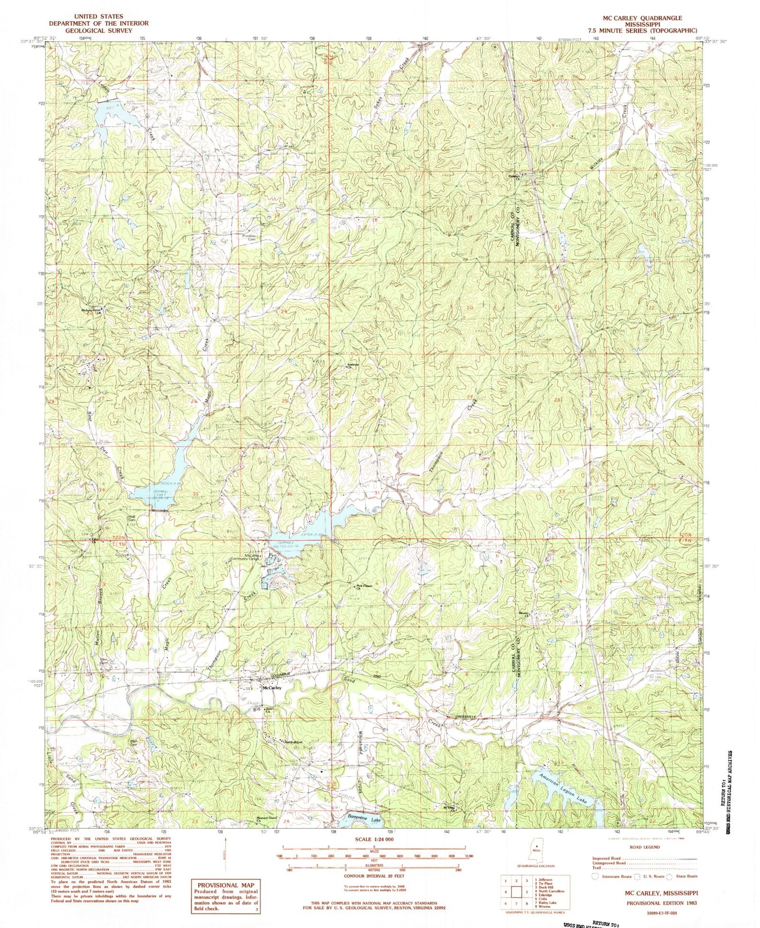
Classic USGS McCarley Mississippi 7.5'x7.5' Topo Map
Couldn't load pickup availability
Historical USGS topographic quad map of McCarley in the state of Mississippi. Map scale may vary for some years, but is generally around 1:24,000. Print size is approximately 24" x 27"
This quadrangle is in the following counties: Carroll, Montgomery.
The map contains contour lines, roads, rivers, towns, and lakes. Printed on high-quality waterproof paper with UV fade-resistant inks, and shipped rolled.
Contains the following named places: Allen Cemetery, Ambrose Church, American Legion Lake, American Legion Lake Dam, Barrentine Lake, Bear Den Creek, Beat 1 - Carroll County Volunteer Fire Department, Big Sand Watershed Y-32-10 Dam, Big Sand Watershed Y-32-11 Dam, Big Sand Watershed Y-32-22 Dam, Big Sand Watershed Y-32-8 Dam, Church of God, Eden Cemetery, Eden Methodist Church, Eden School, Ellis Lake Dam, Hickory Grove Baptist Church, Hickory Grove Cemetery, Magic Creek, McAnerney, McCarley, McCarley Community Center, McCarley Post Office, Mission Cemetery, Mission Church, Mount Olive Church, Mullen Branch, Pink Flower Cemetery, Pink Flower Church, Pleasant Green Baptist Church, Pleasant Green Cemetery, Potacocowa Structure Y-31a-5 Dam, Potacocowa Watershed Y-31a-12 Dam, Primitive Cemetery, Prospect Cemetery, Prospect Church, Supervisor District 1, Supervisor District 2, Thompson Creek, Wall Cemetery, Whitehead Creek, WONA-FM (Winona), Zion Church, ZIP Code: 38943