MyTopo
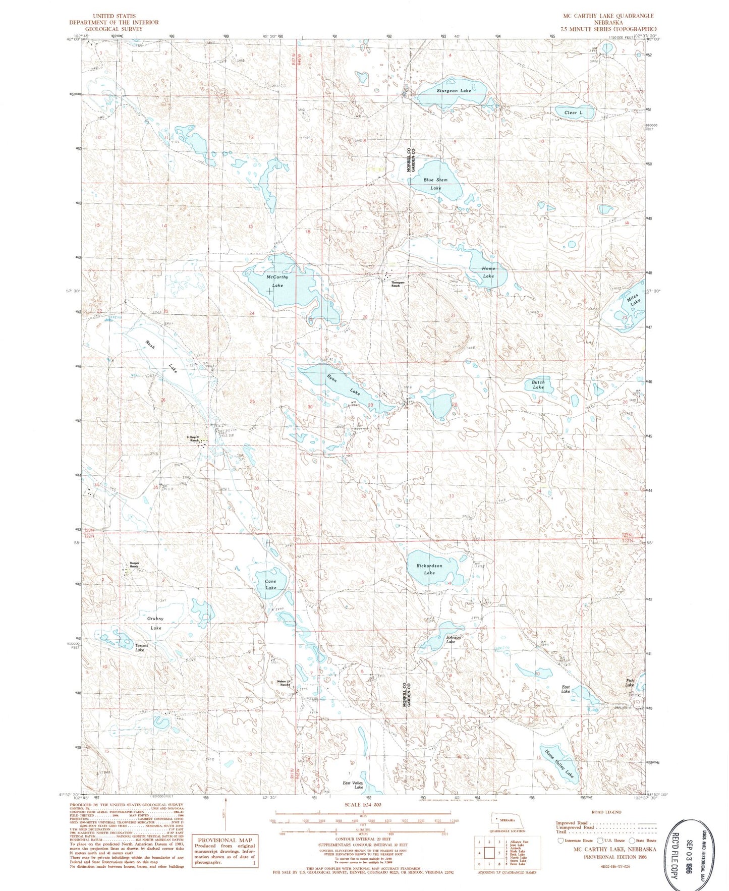
Classic USGS McCarthy Lake Nebraska 7.5'x7.5' Topo Map
Couldn't load pickup availability
Historical USGS topographic quad map of McCarthy Lake in the state of Nebraska. Map scale may vary for some years, but is generally around 1:24,000. Print size is approximately 24" x 27"
This quadrangle is in the following counties: Garden, Morrill.
The map contains contour lines, roads, rivers, towns, and lakes. Printed on high-quality waterproof paper with UV fade-resistant inks, and shipped rolled.
Contains the following named places: Blue Stem Lake, Butch Lake, Cane Lake, Clear Lake, East Lake, Grubny Lake, Hague Ranch, Home Lake, Home Valley Lake, Johnson Lake, Kooper Ranch, McCarthy Lake, Nelson J Ranch, Nine Over Nine Ranch, Richardson Lake, Rush Lake, Ryan Lake, Skala Ranch, Sturgeon Lake, Tercett Lake, Thompson Ranch, Witners Ranch