MyTopo
Classic USGS McCartney Peak Washington 7.5'x7.5' Topo Map
Couldn't load pickup availability
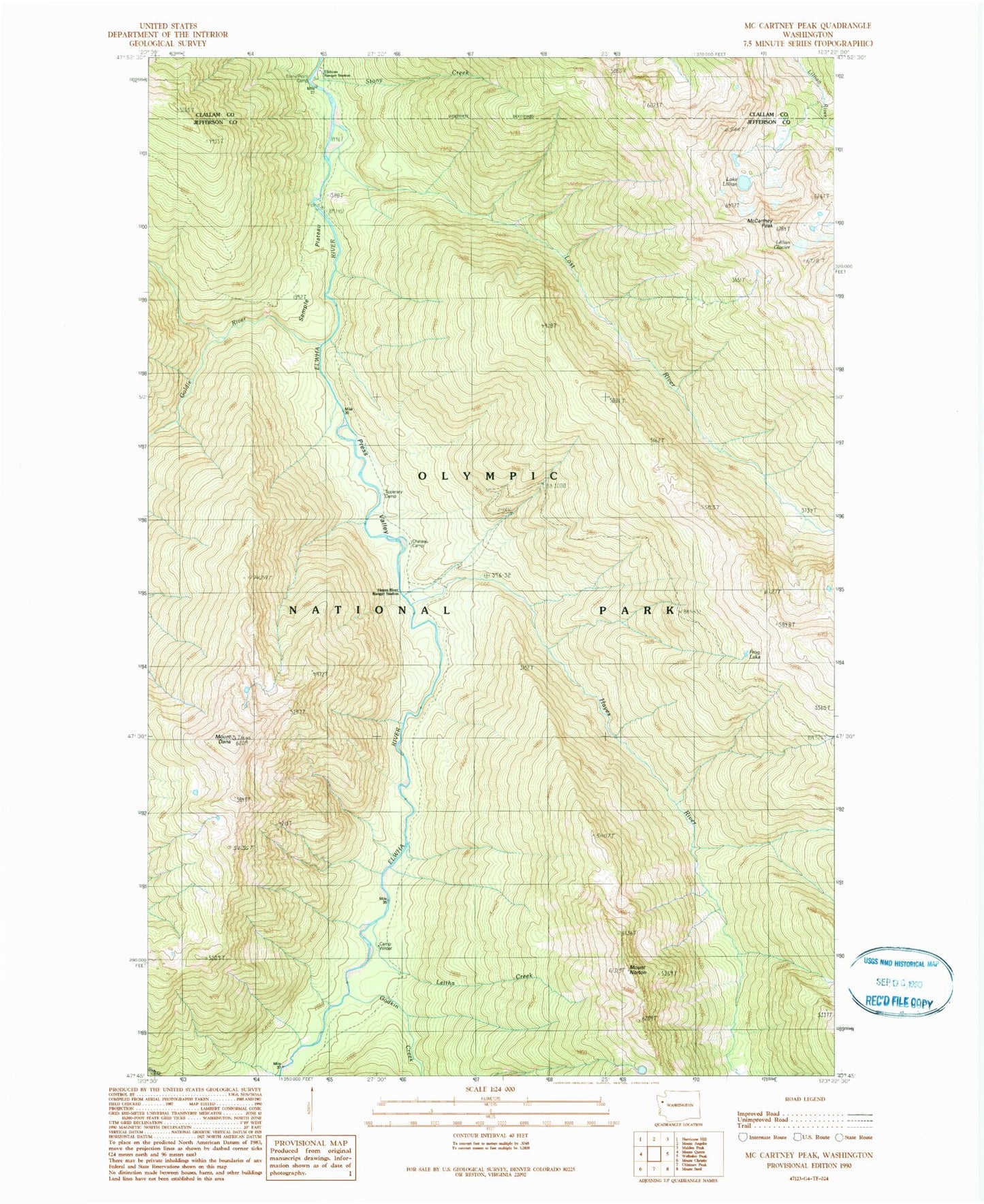
Historical USGS topographic quad map of McCartney Peak in the state of Washington. Typical map scale is 1:24,000, but may vary for certain years, if available. Print size: 24" x 27"
This quadrangle is in the following counties: Clallam, Jefferson.
The map contains contour lines, roads, rivers, towns, and lakes. Printed on high-quality waterproof paper with UV fade-resistant inks, and shipped rolled.
Contains the following named places: Camp Wilder, Chateau Camp, Mount Dana, Elkhorn Guard Station, Elwha River Trail, Frog Lake, Godkin Creek, Goldie River, Hayes River, Hayes River Guard Station, Leitha Creek, Lillian Glacier, Lake Lillian, Lost River, McCartney Peak, Mount Norton, Press Valley, Semple Plateau, Stony Creek, Stony Point Camp, Tipperary Camp, Elkhorn Ranger Station, South Dana