MyTopo
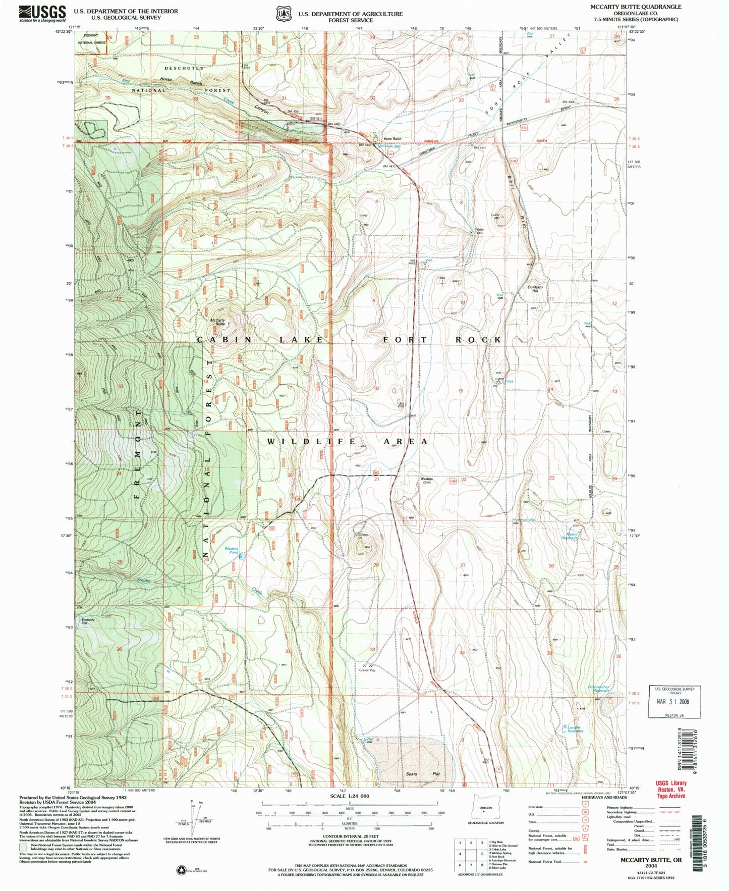
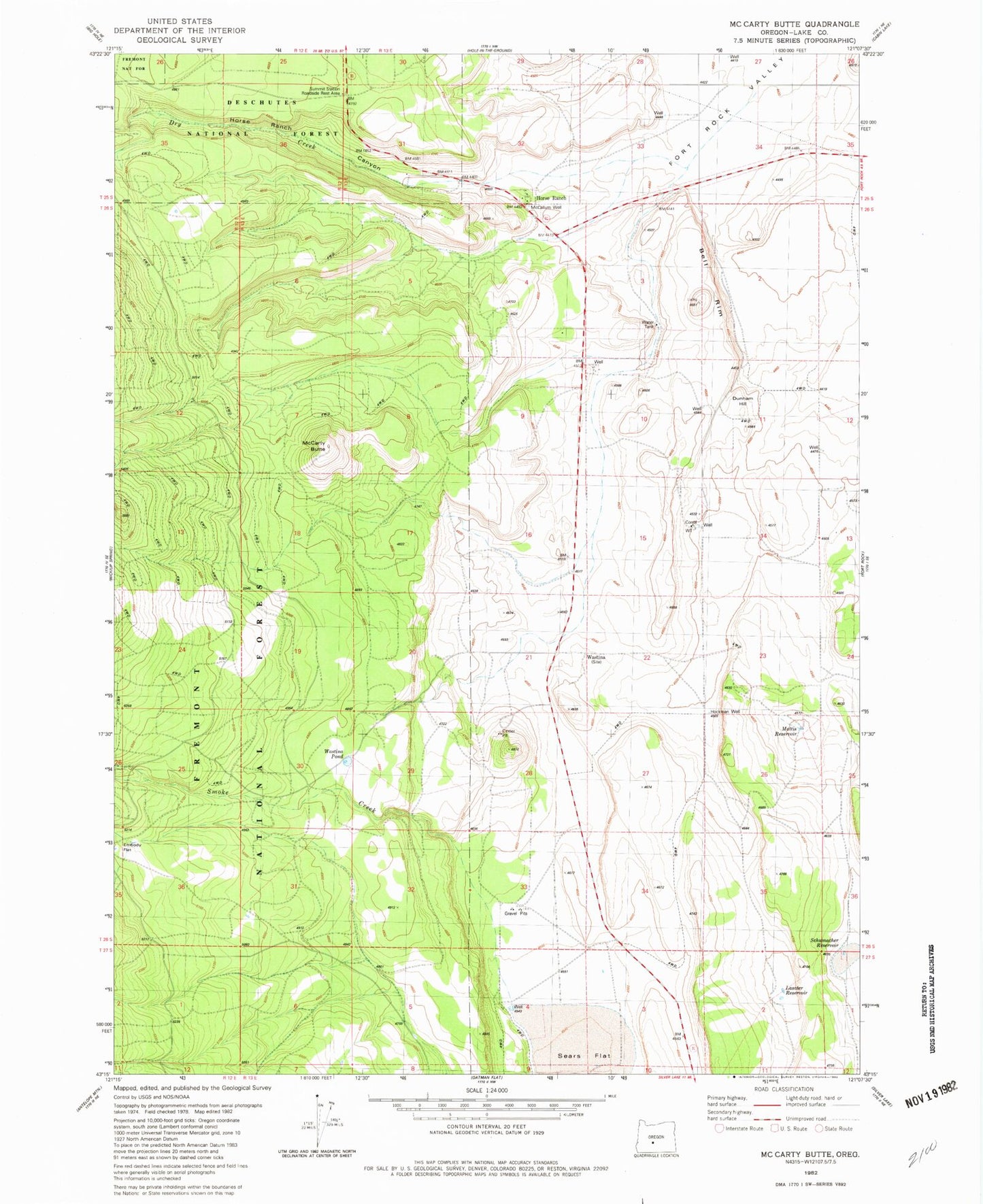
Classic USGS McCarty Butte Oregon 7.5'x7.5' Topo Map
Regular price
$16.95
Regular price
Sale price
$16.95
Unit price
per
Couldn't load pickup availability
Historical USGS topographic quad map of McCarty Butte in the state of Oregon. Map scale may vary for some years, but is generally around 1:24,000. Print size is approximately 24" x 27"
This quadrangle is in the following counties: Lake.
The map contains contour lines, roads, rivers, towns, and lakes. Printed on high-quality waterproof paper with UV fade-resistant inks, and shipped rolled.
Contains the following named places: Cabin Lake Wildlife Area, Dehne Ranch, Dry Creek, Dunham Hill, Geo Peyerl Ranch, Horse Ranch, Horse Ranch Canyon, Lasater Reservoir, McCarty Butte, Smoke Creek, Wastina, Wastina Pond, Wastina Post Office