MyTopo
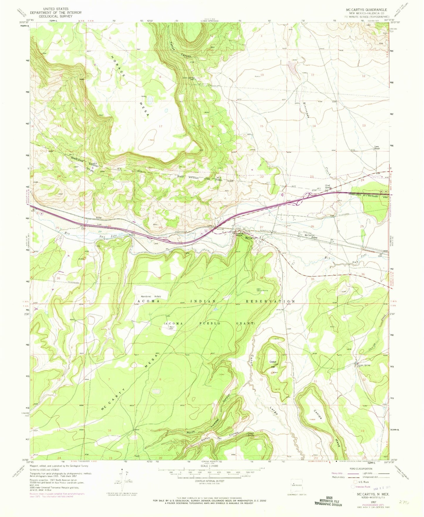
Classic USGS McCartys New Mexico 7.5'x7.5' Topo Map
Couldn't load pickup availability
Historical USGS topographic quad map of McCartys in the state of New Mexico. Map scale may vary for some years, but is generally around 1:24,000. Print size is approximately 24" x 27"
This quadrangle is in the following counties: Cibola.
The map contains contour lines, roads, rivers, towns, and lakes. Printed on high-quality waterproof paper with UV fade-resistant inks, and shipped rolled.
Contains the following named places: 10027 Water Well, 10032 Water Well, Acoma 2 Water Well, Airport WL Water Well, Anzac, Anzac 86-1 Water Well, Anzac Village Census Designated Place, Basalt Quarry, Canipa Mesa, Canipa Spring, Canon de Conejo, Canon Largo, Cedar Hill, Chief Rancho, Conejo Spring, Lane Ranch, Lane Spring, McCarty Mesa, McCartys, McCartys Siding, McCartys Village Census Designated Place, Mount of Peace Cemetery, North Lumber Canyon, Santa Maria Mission, Tafoya Canyon, Test Well 3 Water Well