MyTopo
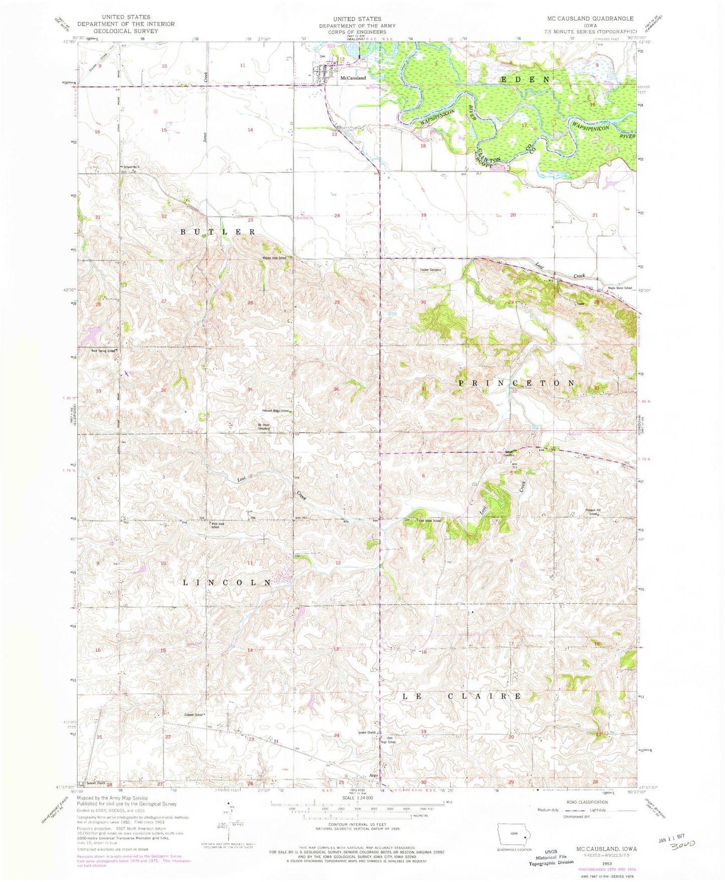
Classic USGS McCausland Iowa 7.5'x7.5' Topo Map
Couldn't load pickup availability
Historical USGS topographic quad map of McCausland in the state of Iowa. Map scale may vary for some years, but is generally around 1:24,000. Print size is approximately 24" x 27"
This quadrangle is in the following counties: Clinton, Scott.
The map contains contour lines, roads, rivers, towns, and lakes. Printed on high-quality waterproof paper with UV fade-resistant inks, and shipped rolled.
Contains the following named places: Argo, Argo Census Designated Place, Argo Post Office, Argo School, Buffalo Bill Cody Homestead, Buffalo Bill Homestead, City of McCausland, Criswell School, Fessler Cemetery, Kerr Post Office, KMJC-FM (Clinton), LeClaire Prairie Cemetery, Lost Grove Lake Wildlife Management Area, Lost Grove School, Maple Glenn School, McCauseland Volunteer Fire Department, McCausland, McCausland Cemetery, McCausland Methodist Church, McCausland Post Office, Mount Union Cemetery, Old Channel Lost Creek, Pleasant Hill School, Pleasant Ridge School, Quiet Valley Heliport, Rock Spring School, Salem Cemetery, South Fork Lost Creek, Summit Church, Summitt Cemetery, Township of Butler, Township of Princeton, United Church, Wapsie View School, West View School, ZIP Codes: 52753, 52758, 52768