MyTopo
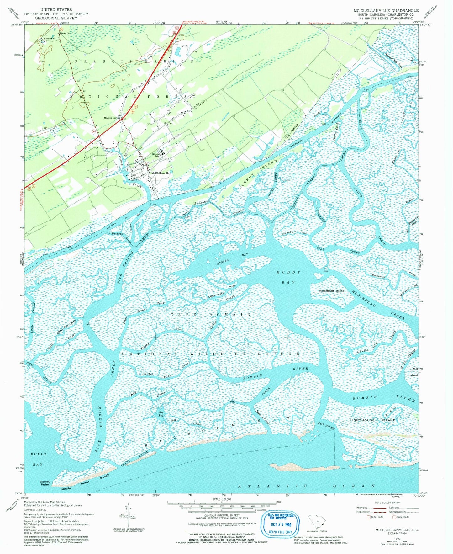
Classic USGS McClellanville South Carolina 7.5'x7.5' Topo Map
Couldn't load pickup availability
Historical USGS topographic quad map of McClellanville in the state of South Carolina. Map scale may vary for some years, but is generally around 1:24,000. Print size is approximately 24" x 27"
This quadrangle is in the following counties: Charleston.
The map contains contour lines, roads, rivers, towns, and lakes. Printed on high-quality waterproof paper with UV fade-resistant inks, and shipped rolled.
Contains the following named places: Awendaw Fire Department Station 5, Awendaw Fire District Station 4, Bay Creek, Bull River, Cape Romain Wilderness, Casino Creek, Chain Gang Camp Number 5, Charleston County Public Library McClellanville Branch, Charleston County Sheriff's Office Substation, Clark Creek, Clubhouse Creek, Congaree Boat Creek, Devils Den Creek, Dupre Creek, DuPre Creek, Five Fathom Creek, Horsehead Creek, Horsehead Island, Island Cut, Jeremy Creek, Jeremy Island, Joe and Ben Creek, Key Bay, Key Creek, Key Inlet, Lighthouse Island, Lincoln High School, Little Papas Creek, Little Sett Creek, Mathews Creek, Mathews Cut, McClellanville, McClellanville Historic District, McClellanville Lookout Tower, McClellanville Magistrate Office, McClellanville Middle School, Mill Creek, Mill Den Creek, Moores Corner, Muddy Bay, Needles Eye Creek, Nellie Creek, Ormand Hall Creek, Oyster Bay, Papas Creek, Raccoon Creek, Raccoon Key, Ramhorn Creek, Rhems Church, Saint Peters Church, Sall Creek, Sandy Point, Sandy Point Beach, Santee Path Creek, Sett Creek, Silver Hill Plantation, Skrine Creek, Slack Reach, South Creek, The Beach, The Village Museum, Town Creek, Town of McClellanville, United States Forest Service Wambaugh, Wambaw District Ranger Office, ZIP Code: 29458